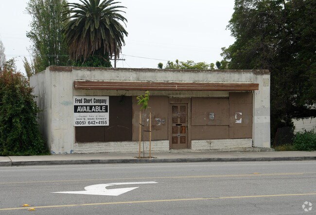
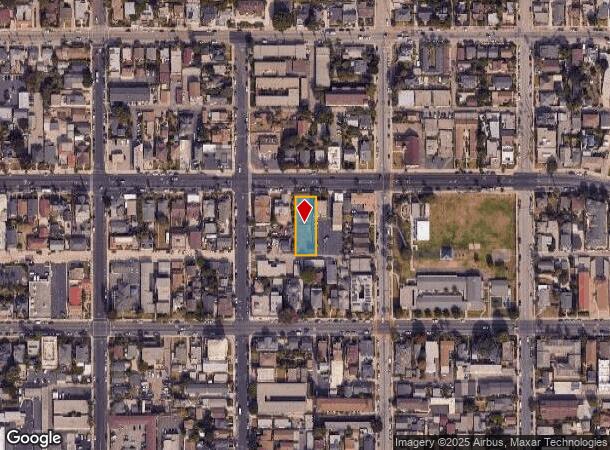
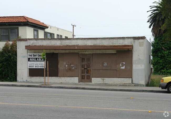
Property Record
1042 E Main St, Ventura, CA 93001

NEARBY LISTINGS FOR SALE OR LEASE
Property Detail
1042 E Main St
Oxnard-Thousand Oaks-Ventura, CA
Adams & Mcelrea Tract
073-0-058-030
LOT: 3 REF: 002MR 125
Commercialacreage
Ventura
X
California
06111C0743F
3
2024
0.28 AC
2025
Ventura
002400
Los Angeles
DEMOGRAPHICS near 1042 E Main St
1 Mile
3 Mile
5 Mile
2024 Total Population
11,950
45,476
77,314
2029 Population
11,914
45,383
77,138
Pop Growth 2024-2029
(0.30%)
(0.20%)
(0.23%)
Average Age
42
42
42
2024 Total Households
5,375
18,247
30,454
HH Growth 2024-2029
(0.17%)
(0.15%)
(0.21%)
Median Household Inc
$71,686
$81,973
$83,611
Avg Household Size
2.10
2.40
2.40
2024 Avg HH Vehicles
2.00
2.00
2.00
Median Home Value
$846,545
$772,898
$726,558
Median Year Built
1960
1962
1969
Nearby Places
Map Layers
Map Styles
 Street
 Aerial
- Restaurants
- Banks
- Shops
- Fitness
- Groceries
PUBLIC TRANSPORTATION
COMMUTER RAIL
Ventura Amtrak (Metrolink Ventura County Line - Amtrak, Pacific Surfliner - Amtrak)
DRIVE
WALK
Distance
Ventura Amtrak (Metrolink Ventura County Line - Amtrak, Pacific Surfliner - Amtrak)
5 min
20 min
1.0 mi
East Ventura Metrolink Station (Metrolink Ventura County Line - Metrolink Trains)
DRIVE
WALK
Distance
East Ventura Metrolink Station (Metrolink Ventura County Line - Metrolink Trains)
10 min
6.7 mi
Freight Ports
The Port of Hueneme
DRIVE
WALK
Distance
The Port of Hueneme
22 min
12.6 mi
Nearby Properties
Address
Land Use
TOTAL SIZE
Lot Size
Zoning
Address
Land Use
TOTAL SIZE
Lot Size
Zoning
1.99 AC
Address
Land Use
TOTAL SIZE
Lot Size
Zoning
4.19 AC
H
Address
Land Use
TOTAL SIZE
Lot Size
Zoning
Address
Land Use
TOTAL SIZE
Lot Size
Zoning
49,296 SF
11.08 AC
Address
Land Use
TOTAL SIZE
Lot Size
Zoning
7,280 SF
5.38 AC
C-T-O
Address
Land Use
TOTAL SIZE
Lot Size
Zoning
6.81 AC
C-T-O
Address
Land Use
TOTAL SIZE
Lot Size
Zoning
2.89 AC
C-T-O
Address
Land Use
TOTAL SIZE
Lot Size
Zoning
13,530 SF
10.85 AC
Address
Land Use
TOTAL SIZE
Lot Size
Zoning
25,401 SF
2.74 AC
C1AD
Address
Land Use
TOTAL SIZE
Lot Size
Zoning
639.79 AC
Address
Land Use
TOTAL SIZE
Lot Size
Zoning
107,360 SF
5.96 AC
RPD15
Address
Land Use
TOTAL SIZE
Lot Size
Zoning
7,993 SF
3.71 AC
C-T-O
Address
Land Use
TOTAL SIZE
Lot Size
Zoning
7,233 SF
7.39 AC
C1
Address
Land Use
TOTAL SIZE
Lot Size
Zoning
13,996 SF
1.09 AC
Address
Land Use
TOTAL SIZE
Lot Size
Zoning
62,306 SF
1.33 AC
Address
Land Use
TOTAL SIZE
Lot Size
Zoning
11,444 SF
6.57 AC
Address
Land Use
TOTAL SIZE
Lot Size
Zoning
42,655 SF
0.94 AC
Address
Land Use
TOTAL SIZE
Lot Size
Zoning
732 SF
0.51 AC
DR
Address
Land Use
TOTAL SIZE
Lot Size
Zoning
0.84 AC
Address
Land Use
TOTAL SIZE
Lot Size
Zoning
56,561 SF
14.56 AC
MPD
Address
Land Use
TOTAL SIZE
Lot Size
Zoning
57,554 SF
0.58 AC
Address
Land Use
TOTAL SIZE
Lot Size
Zoning
0.82 AC
POD
Address
Land Use
TOTAL SIZE
Lot Size
Zoning
Address
Land Use
TOTAL SIZE
Lot Size
Zoning
24,904 SF
1.13 AC
R3-2
Address
Land Use
TOTAL SIZE
Lot Size
Zoning
295.55 AC
AEC-A
Address
Land Use
TOTAL SIZE
Lot Size
Zoning
62,354 SF
5.34 AC
Address
Land Use
TOTAL SIZE
Lot Size
Zoning
43,498 SF
1.67 AC
R33
Address
Land Use
TOTAL SIZE
Lot Size
Zoning
19,709 SF
0.14 AC
DC
Address
Land Use
TOTAL SIZE
Lot Size
Zoning
31,908 SF
1.11 AC
R3-2D
The World's #1 Commercial Real Estate Marketplace
Connect with us
© 2026 CoStar Group
The information above has been obtained from sources believed reliable. While we do not doubt its accuracy we have not verified it and make no guarantee, warranty or representation about it. It is your responsibility to independently confirm its accuracy and completeness. Any projections, opinions, assumptions, or estimates used are for example only and do not represent the current or future performance of the property. The value of this transaction to you depends on tax and other factors which should be evaluated by your tax, financial, and legal advisors. You and your advisors should conduct a careful, independent investigation of the property to determine to your satisfaction the suitability of the property for your needs.