Property Record
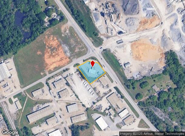
1042 Highway 31 St N, Calera, AL 35040
NEARBY LISTINGS FOR SALE OR LEASE
-
-
View all Calera listings for sale on LoopNet.com
Property Detail
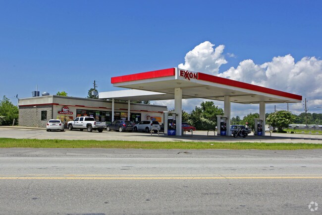
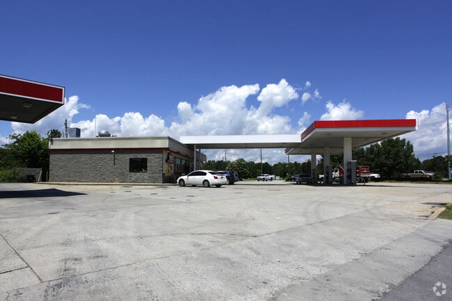
1042 Highway 31 St N
22-4-17-0-000-042-007
COM SW COR SEC N214.04 TO S ROW HWY #87 NE710.1 TO POB; CONT NE130 E110 SE135 SW208.71 NW239 TO POB.
Conveniencestore
Shelby
X
Alabama
01117C0384E
0.98 AC
2024
I-65 Corr/S Shelby County
2024
Birmingham
030504
Birmingham-Hoover, AL
2,800 SF
DEMOGRAPHICS near 1042 Highway 31 St N
1 Mile
3 Mile
5 Mile
2024 Total Population
366
7,708
45,232
2029 Population
398
8,432
49,127
Pop Growth 2024-2029
+ 8.74%
+ 9.39%
+ 8.61%
Average Age
39
39
39
2024 Total Households
133
2,795
16,616
HH Growth 2024-2029
+ 9.02%
+ 9.55%
+ 8.76%
Median Household Inc
$75,446
$82,167
$81,494
Avg Household Size
2.70
2.70
2.70
2024 Avg HH Vehicles
2.00
2.00
2.00
Median Home Value
$259,090
$248,769
$238,856
Median Year Built
1994
2002
1999
Nearby Places
Map Layers
Map Styles
 Street
 Aerial
- Restaurants
- Banks
- Shops
- Fitness
- Groceries
PUBLIC TRANSPORTATION
AIRPORT
Birmingham-Shuttlesworth International
DRIVE
WALK
Distance
Birmingham-Shuttlesworth International
40 min
30.2 mi
Nearby Properties
Address
Land Use
TOTAL SIZE
Lot Size
Zoning
Address
Land Use
TOTAL SIZE
Lot Size
Zoning
416,160 SF
58.85 AC
Address
Land Use
TOTAL SIZE
Lot Size
Zoning
9,444 SF
21.79 AC
Address
Land Use
TOTAL SIZE
Lot Size
Zoning
573,600 SF
19.96 AC
Address
Land Use
TOTAL SIZE
Lot Size
Zoning
500,500 SF
17.45 AC
Address
Land Use
TOTAL SIZE
Lot Size
Zoning
219,975 SF
14.90 AC
Address
Land Use
TOTAL SIZE
Lot Size
Zoning
220,000 SF
21.76 AC
Address
Land Use
TOTAL SIZE
Lot Size
Zoning
62,398 SF
11.51 AC
Address
Land Use
TOTAL SIZE
Lot Size
Zoning
126,897 SF
9.43 AC
Address
Land Use
TOTAL SIZE
Lot Size
Zoning
129,305 SF
50 AC
Address
Land Use
TOTAL SIZE
Lot Size
Zoning
249,500 SF
16.15 AC
Address
Land Use
TOTAL SIZE
Lot Size
Zoning
6,234 SF
33 AC
Address
Land Use
TOTAL SIZE
Lot Size
Zoning
8,416 SF
16.12 AC
Address
Land Use
TOTAL SIZE
Lot Size
Zoning
30,158 SF
8.35 AC
Address
Land Use
TOTAL SIZE
Lot Size
Zoning
137,068 SF
9.08 AC
Address
Land Use
TOTAL SIZE
Lot Size
Zoning
208,000 SF
11.91 AC
Address
Land Use
TOTAL SIZE
Lot Size
Zoning
154,440 SF
12.03 AC
Address
Land Use
TOTAL SIZE
Lot Size
Zoning
9,728 SF
11.01 AC
Address
Land Use
TOTAL SIZE
Lot Size
Zoning
121,500 SF
13.80 AC
Address
Land Use
TOTAL SIZE
Lot Size
Zoning
43,903 SF
10.21 AC
Address
Land Use
TOTAL SIZE
Lot Size
Zoning
50,558 SF
22.76 AC
Address
Land Use
TOTAL SIZE
Lot Size
Zoning
5,000 SF
43 AC
Address
Land Use
TOTAL SIZE
Lot Size
Zoning
139,170 SF
15.30 AC
Address
Land Use
TOTAL SIZE
Lot Size
Zoning
672 SF
7.33 AC
Address
Land Use
TOTAL SIZE
Lot Size
Zoning
241.36 AC
Address
Land Use
TOTAL SIZE
Lot Size
Zoning
46,444 SF
2.70 AC
Address
Land Use
TOTAL SIZE
Lot Size
Zoning
6,275 SF
290 AC
Address
Land Use
TOTAL SIZE
Lot Size
Zoning
14,163 SF
12.78 AC
Address
Land Use
TOTAL SIZE
Lot Size
Zoning
41,852 SF
1.38 AC
The World's #1 Commercial Real Estate Marketplace
Connect with us
© 2025 CoStar Group
The information above has been obtained from sources believed reliable. While we do not doubt its accuracy we have not verified it and make no guarantee, warranty or representation about it. It is your responsibility to independently confirm its accuracy and completeness. Any projections, opinions, assumptions, or estimates used are for example only and do not represent the current or future performance of the property. The value of this transaction to you depends on tax and other factors which should be evaluated by your tax, financial, and legal advisors. You and your advisors should conduct a careful, independent investigation of the property to determine to your satisfaction the suitability of the property for your needs.