Property Record
10424 E 1400 North Rd, Bloomington, IL 61705
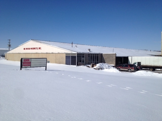

Property Detail
10424 E 1400 North Rd
Bloomington, IL
SEC 35-24-1E COMM SE COR SW; N35.52, W194 TO POB; W356, N806.45, SE535.36, SW256.43 S334.33 TO POB
13-35-300-019
McLean
Commercialnec
Illinois
B and X Area of moderate flood hazard, usually the area between the limits of the 100-year and 500-year floods.
6.24 AC
2022
Bloomington/Normal
2024
Other Market Areas
005201
NEARBY LISTINGS FOR SALE OR LEASE
DEMOGRAPHICS near 10424 E 1400 North Rd
1 mile
3 mile
5 mile
2025 Total Population
499
6,068
66,073
2030 Population
494
6,017
66,689
Pop Growth 2025-2030
(1.00%)
(0.84%)
+ 0.93%
Average Age
45
40
35
2025 Total Households
191
2,444
25,867
HH Growth 2025-2030
(1.05%)
(0.78%)
+ 1.01%
Median Household Inc
$121,428
$80,808
$53,537
Avg Household Size
2.60
2.40
2.20
2025 Avg HH Vehicles
2.00
2.00
2.00
Median Home Value
$280,985
$218,654
$171,162
Median Year Built
1979
1987
1974
Nearby Places
Map Layers
Map Styles
 Street
 Aerial
Layers
 Traffic
 Biking
Places
Listings with unknown addresses are not visible on the map
- Restaurants
- Banks
- Shops
- Fitness
- Groceries
PUBLIC TRANSPORTATION
COMMUTER RAIL
Bloomington-Normal (Lincoln Service - Amtrak, Lincoln Service Missouri River Runner - Amtrak, Texas Eagle - Amtrak)
Drive
Walk
Distance
Bloomington-Normal (Lincoln Service - Amtrak, Lincoln Service Missouri River Runner - Amtrak, Texas Eagle - Amtrak)
11 min
6.0 mi
AIRPORT
Central Il Regional/Bloomington-Normal
Drive
Walk
Distance
Central Il Regional/Bloomington-Normal
21 min
9.0 mi
Freight Ports
Port Milwaukee
Drive
Walk
Distance
Port Milwaukee
246 min
212.0 mi
Nearby Properties
Address
Land Use
TOTAL SIZE
Lot Size
Zoning
Address
Land Use
TOTAL SIZE
Lot Size
Zoning
417.42 AC
Address
Land Use
TOTAL SIZE
Lot Size
Zoning
48,629 SF
39 AC
Address
Land Use
TOTAL SIZE
Lot Size
Zoning
432,093 SF
15 AC
Address
Land Use
TOTAL SIZE
Lot Size
Zoning
422,234 SF
23.17 AC
Address
Land Use
TOTAL SIZE
Lot Size
Zoning
126,428 SF
3.79 AC
Address
Land Use
TOTAL SIZE
Lot Size
Zoning
196,500 SF
5.07 AC
Address
Land Use
TOTAL SIZE
Lot Size
Zoning
335,377 SF
9.78 AC
Address
Land Use
TOTAL SIZE
Lot Size
Zoning
190,476 SF
14.43 AC
M-1
Address
Land Use
TOTAL SIZE
Lot Size
Zoning
128,182 SF
10.65 AC
Address
Land Use
TOTAL SIZE
Lot Size
Zoning
181,476 SF
6.70 AC
Address
Land Use
TOTAL SIZE
Lot Size
Zoning
5,569 SF
9.94 AC
Address
Land Use
TOTAL SIZE
Lot Size
Zoning
98,824 SF
10.13 AC
Address
Land Use
TOTAL SIZE
Lot Size
Zoning
97,000 SF
7 AC
M-2
Address
Land Use
TOTAL SIZE
Lot Size
Zoning
198,016 SF
15.92 AC
Address
Land Use
TOTAL SIZE
Lot Size
Zoning
58,308 SF
8.66 AC
Address
Land Use
TOTAL SIZE
Lot Size
Zoning
8.11 AC
Address
Land Use
TOTAL SIZE
Lot Size
Zoning
197,633 SF
11.91 AC
M-1
Address
Land Use
TOTAL SIZE
Lot Size
Zoning
44,650 SF
4.44 AC
R-3A
Address
Land Use
TOTAL SIZE
Lot Size
Zoning
35.38 AC
Address
Land Use
TOTAL SIZE
Lot Size
Zoning
58,904 SF
2.17 AC
Address
Land Use
TOTAL SIZE
Lot Size
Zoning
56,828 SF
1.82 AC
Address
Land Use
TOTAL SIZE
Lot Size
Zoning
59,071 SF
15.02 AC
Address
Land Use
TOTAL SIZE
Lot Size
Zoning
23.82 AC
Address
Land Use
TOTAL SIZE
Lot Size
Zoning
178,008 SF
13.40 AC
Address
Land Use
TOTAL SIZE
Lot Size
Zoning
73,207 SF
2.41 AC
Address
Land Use
TOTAL SIZE
Lot Size
Zoning
51,648 SF
1.61 AC
Address
Land Use
TOTAL SIZE
Lot Size
Zoning
64,959 SF
1.98 AC
Address
Land Use
TOTAL SIZE
Lot Size
Zoning
9,616 SF
2.14 AC
Address
Land Use
TOTAL SIZE
Lot Size
Zoning
Address
Land Use
TOTAL SIZE
Lot Size
Zoning
277,200 SF
38.10 AC
The World's #1 Commercial Real Estate Marketplace
Connect with us
© 2026 CoStar Group
The information above has been obtained from sources believed reliable. While we do not doubt its accuracy we have not verified it and make no guarantee, warranty or representation about it. It is your responsibility to independently confirm its accuracy and completeness. Any projections, opinions, assumptions, or estimates used are for example only and do not represent the current or future performance of the property. The value of this transaction to you depends on tax and other factors which should be evaluated by your tax, financial, and legal advisors. You and your advisors should conduct a careful, independent investigation of the property to determine to your satisfaction the suitability of the property for your needs.