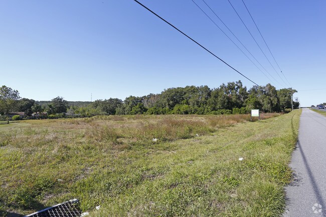
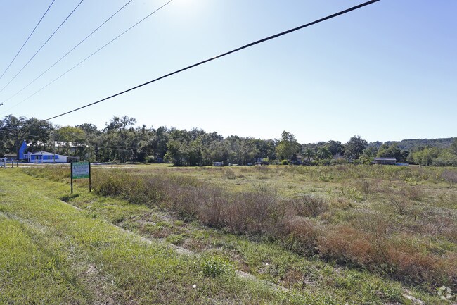
Property Record
10425 Us Highway 301, Dade City, FL 33525

NEARBY LISTINGS FOR SALE OR LEASE
Property Detail
10425 Us Highway 301
15-25-21-0000-02200-0000
Acreage
Commercialacreage
NORTH1/4 OF NE1/4 OF SE1/4 OF SEC 15 INCLUDING THAT PORTION OF VACATED RR THEREIN; EXC R/W FOR U S HWY 301 & EXC WEST 425.41 FT OF EAST 792.21 FT LESS NORTH 35.00 FT THEREOF & LESS SOUTH 35.00 FT OF WEST 132.18 FT OF EAST 366.60 FT THEREOF SUBJECT TO
AE
Pasco
12101C0287F
Florida
2024
7.01 AC
2026
Pasco County
032805
Tampa/St Petersburg
1,361 SF
Tampa-St. Petersburg-Clearwater, FL
DEMOGRAPHICS near 10425 Us Highway 301
1 Mile
3 Mile
5 Mile
2024 Total Population
1,334
14,541
54,931
2029 Population
1,598
17,637
66,552
Pop Growth 2024-2029
+ 19.79%
+ 21.29%
+ 21.16%
Average Age
53
47
45
2024 Total Households
642
6,089
22,530
HH Growth 2024-2029
+ 19.94%
+ 21.17%
+ 21.36%
Median Household Inc
$51,805
$54,469
$51,917
Avg Household Size
2.10
2.30
2.30
2024 Avg HH Vehicles
2.00
2.00
2.00
Median Home Value
$94,019
$177,236
$173,514
Median Year Built
1987
1991
1987
Nearby Places
Map Layers
Map Styles
 Street
 Aerial
- Restaurants
- Banks
- Shops
- Fitness
- Groceries
Nearby Properties
Address
Land Use
TOTAL SIZE
Lot Size
Zoning
Address
Land Use
TOTAL SIZE
Lot Size
Zoning
273,092 SF
12.29 AC
R4
Address
Land Use
TOTAL SIZE
Lot Size
Zoning
127,340 SF
15.04 AC
AC
Address
Land Use
TOTAL SIZE
Lot Size
Zoning
107,232 SF
12.79 AC
MPUD
Address
Land Use
TOTAL SIZE
Lot Size
Zoning
88,782 SF
4.09 AC
M1
Address
Land Use
TOTAL SIZE
Lot Size
Zoning
98,980 SF
5.36 AC
C2
Address
Land Use
TOTAL SIZE
Lot Size
Zoning
216,202 SF
23.77 AC
C2
Address
Land Use
TOTAL SIZE
Lot Size
Zoning
79,605 SF
3.13 AC
C2
Address
Land Use
TOTAL SIZE
Lot Size
Zoning
80,036 SF
12 AC
C2
Address
Land Use
TOTAL SIZE
Lot Size
Zoning
98,666 SF
19.80 AC
RIO
Address
Land Use
TOTAL SIZE
Lot Size
Zoning
54,371 SF
8.09 AC
CH
Address
Land Use
TOTAL SIZE
Lot Size
Zoning
16,994 SF
2.40 AC
CG
Address
Land Use
TOTAL SIZE
Lot Size
Zoning
111,677 SF
10.40 AC
CG
Address
Land Use
TOTAL SIZE
Lot Size
Zoning
123,959 SF
15.18 AC
C2
Address
Land Use
TOTAL SIZE
Lot Size
Zoning
33,580 SF
6.09 AC
RIO
Address
Land Use
TOTAL SIZE
Lot Size
Zoning
88,358 SF
36.68 AC
OUA
Address
Land Use
TOTAL SIZE
Lot Size
Zoning
86,138 SF
6.62 AC
CG
Address
Land Use
TOTAL SIZE
Lot Size
Zoning
37,368 SF
10.82 AC
CG
Address
Land Use
TOTAL SIZE
Lot Size
Zoning
76,818 SF
15 AC
AC
Address
Land Use
TOTAL SIZE
Lot Size
Zoning
26,520 SF
4.42 AC
CG
Address
Land Use
TOTAL SIZE
Lot Size
Zoning
142.77 AC
MPUD
Address
Land Use
TOTAL SIZE
Lot Size
Zoning
95,673 SF
7.51 AC
PDH2
Address
Land Use
TOTAL SIZE
Lot Size
Zoning
36,518 SF
2.77 AC
CG
Address
Land Use
TOTAL SIZE
Lot Size
Zoning
32,530 SF
33 AC
RIO
Address
Land Use
TOTAL SIZE
Lot Size
Zoning
112,952 SF
13.03 AC
MF1
Address
Land Use
TOTAL SIZE
Lot Size
Zoning
16,261 SF
4.35 AC
C2
Address
Land Use
TOTAL SIZE
Lot Size
Zoning
28,109 SF
9.37 AC
AR1
Address
Land Use
TOTAL SIZE
Lot Size
Zoning
54,400 SF
3.03 AC
CG
Address
Land Use
TOTAL SIZE
Lot Size
Zoning
5,103 SF
1.73 AC
MPUD
Address
Land Use
TOTAL SIZE
Lot Size
Zoning
26,350 SF
10.55 AC
AR
Address
Land Use
TOTAL SIZE
Lot Size
Zoning
20,850 SF
5 AC
C2
The World's #1 Commercial Real Estate Marketplace
Connect with us
© 2026 CoStar Group
The information above has been obtained from sources believed reliable. While we do not doubt its accuracy we have not verified it and make no guarantee, warranty or representation about it. It is your responsibility to independently confirm its accuracy and completeness. Any projections, opinions, assumptions, or estimates used are for example only and do not represent the current or future performance of the property. The value of this transaction to you depends on tax and other factors which should be evaluated by your tax, financial, and legal advisors. You and your advisors should conduct a careful, independent investigation of the property to determine to your satisfaction the suitability of the property for your needs.