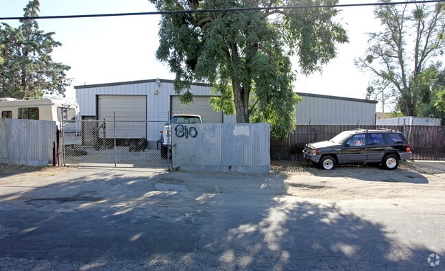
Property Record
1043 Kansas Ave, Modesto, CA 95351


NEARBY LISTINGS FOR SALE OR LEASE
Property Detail
1043 Kansas Ave
029-12-22
Maze Colony
Warehouse
Stanislaus
X
California
06099C0325E
0.60 AC
2025
Modesto
2025
Stockton/Modesto
000602
Modesto, CA
3,673 SF
DEMOGRAPHICS near 1043 Kansas Ave
1 Mile
3 Mile
5 Mile
2024 Total Population
11,437
111,361
251,362
2029 Population
11,484
111,505
251,741
Pop Growth 2024-2029
+ 0.41%
+ 0.13%
+ 0.15%
Average Age
36
37
37
2024 Total Households
3,498
36,343
81,968
HH Growth 2024-2029
+ 0.37%
+ 0.13%
+ 0.14%
Median Household Inc
$71,032
$64,060
$69,366
Avg Household Size
3.10
2.90
3.00
2024 Avg HH Vehicles
2.00
2.00
2.00
Median Home Value
$341,995
$343,410
$377,789
Median Year Built
1969
1967
1976
Nearby Places
Map Layers
Map Styles
 Street
 Aerial
- Restaurants
- Banks
- Shops
- Fitness
- Groceries
PUBLIC TRANSPORTATION
COMMUTER RAIL
DRIVE
WALK
Distance
16 min
7.7 mi
AIRPORT
Stockton Metro
DRIVE
WALK
Distance
Stockton Metro
33 min
24.4 mi
Freight Ports
Port of Stockton
DRIVE
WALK
Distance
Port of Stockton
41 min
32.8 mi
SALE & LEASE HISTORY
LISTING DATE
SALE/LEASE

Feb 27, 2023
For Sale
Nearby Properties
Address
Land Use
TOTAL SIZE
Lot Size
Zoning
Address
Land Use
TOTAL SIZE
Lot Size
Zoning
817,526 SF
17.31 AC
Address
Land Use
TOTAL SIZE
Lot Size
Zoning
373,574 SF
23 AC
Address
Land Use
TOTAL SIZE
Lot Size
Zoning
450,277 SF
15.29 AC
Address
Land Use
TOTAL SIZE
Lot Size
Zoning
308,903 SF
13.21 AC
Address
Land Use
TOTAL SIZE
Lot Size
Zoning
153,937 SF
7.87 AC
Address
Land Use
TOTAL SIZE
Lot Size
Zoning
151,288 SF
6.50 AC
Address
Land Use
TOTAL SIZE
Lot Size
Zoning
138,618 SF
3.99 AC
Address
Land Use
TOTAL SIZE
Lot Size
Zoning
77,382 SF
2.60 AC
Address
Land Use
TOTAL SIZE
Lot Size
Zoning
266,975 SF
1.90 AC
Address
Land Use
TOTAL SIZE
Lot Size
Zoning
189,239 SF
8.75 AC
PD
Address
Land Use
TOTAL SIZE
Lot Size
Zoning
131,958 SF
8.11 AC
Address
Land Use
TOTAL SIZE
Lot Size
Zoning
26,416 SF
18.92 AC
MODPD
Address
Land Use
TOTAL SIZE
Lot Size
Zoning
120,383 SF
5.52 AC
MODCM
Address
Land Use
TOTAL SIZE
Lot Size
Zoning
280,223 SF
23.52 AC
MODC2
Address
Land Use
TOTAL SIZE
Lot Size
Zoning
118,800 SF
0.64 AC
Address
Land Use
TOTAL SIZE
Lot Size
Zoning
206,271 SF
6.94 AC
Address
Land Use
TOTAL SIZE
Lot Size
Zoning
62,280 SF
1.95 AC
Address
Land Use
TOTAL SIZE
Lot Size
Zoning
2.16 AC
Address
Land Use
TOTAL SIZE
Lot Size
Zoning
80,987 SF
4.33 AC
PD
Address
Land Use
TOTAL SIZE
Lot Size
Zoning
94,816 SF
6.78 AC
Address
Land Use
TOTAL SIZE
Lot Size
Zoning
122,944 SF
9.81 AC
Address
Land Use
TOTAL SIZE
Lot Size
Zoning
70,472 SF
3.17 AC
MODPD
Address
Land Use
TOTAL SIZE
Lot Size
Zoning
85,968 SF
2.26 AC
MODCD
Address
Land Use
TOTAL SIZE
Lot Size
Zoning
92,351 SF
3.85 AC
Address
Land Use
TOTAL SIZE
Lot Size
Zoning
73,290 SF
6 AC
MODPD
Address
Land Use
TOTAL SIZE
Lot Size
Zoning
124,645 SF
8.10 AC
Address
Land Use
TOTAL SIZE
Lot Size
Zoning
66,350 SF
9.16 AC
Address
Land Use
TOTAL SIZE
Lot Size
Zoning
75,755 SF
1.28 AC
Address
Land Use
TOTAL SIZE
Lot Size
Zoning
56,869 SF
3.12 AC
Address
Land Use
TOTAL SIZE
Lot Size
Zoning
171,244 SF
5.18 AC
The World's #1 Commercial Real Estate Marketplace
Connect with us
© 2026 CoStar Group
The information above has been obtained from sources believed reliable. While we do not doubt its accuracy we have not verified it and make no guarantee, warranty or representation about it. It is your responsibility to independently confirm its accuracy and completeness. Any projections, opinions, assumptions, or estimates used are for example only and do not represent the current or future performance of the property. The value of this transaction to you depends on tax and other factors which should be evaluated by your tax, financial, and legal advisors. You and your advisors should conduct a careful, independent investigation of the property to determine to your satisfaction the suitability of the property for your needs.