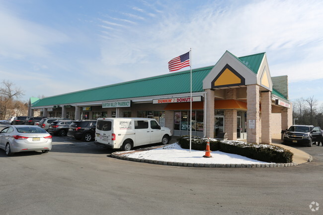
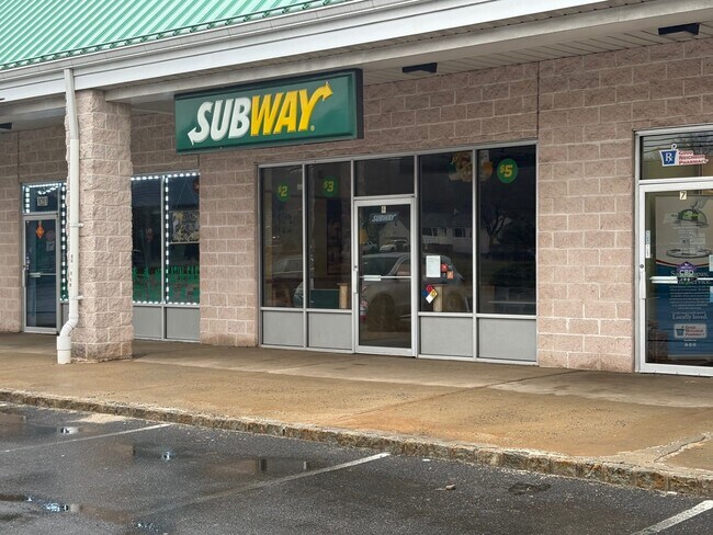
Property Record
1043 Rt 202 N, Somerville, NJ 08876

Save to a Folder
{{folder.Name}}
{{folder.ListingIds.length}} Properties
{{folder.ListingIds.length}} Property
Create a New Folder
Property Detail
1043 Rt 202 N
Lakewood-New Brunswick, NJ
ADDITIONAL LOTS: 31572
05-00057-0000-00014
SOMERSET
Storebuilding
New Jersey
RS2
14
B and X Area of moderate flood hazard, usually the area between the limits of the 100-year and 500-year floods.
4.24 AC
2025
Route 22 West
2026
Northern New Jersey
050600
NEARBY LISTINGS FOR SALE OR LEASE
-
-
View all Somerville listings for lease on LoopNet.com
DEMOGRAPHICS near 1043 Rt 202 N
1 mile
3 mile
5 mile
2025 Total Population
3,277
34,691
95,179
2030 Population
3,405
36,085
99,046
Pop Growth 2025-2030
+ 3.91%
+ 4.02%
+ 4.06%
Average Age
44
42
42
2025 Total Households
1,321
12,590
35,612
HH Growth 2025-2030
+ 3.94%
+ 4.07%
+ 4.23%
Median Household Inc
$145,111
$172,502
$148,815
Avg Household Size
2.40
2.70
2.60
2025 Avg HH Vehicles
2.00
2.00
2.00
Median Home Value
$542,587
$577,166
$555,230
Median Year Built
1987
1987
1982
Nearby Places
Map Layers
Map Styles
 Street
 Aerial
Layers
 Traffic
 Biking
Places
Listings with unknown addresses are not visible on the map
- Restaurants
- Banks
- Shops
- Fitness
- Groceries
PUBLIC TRANSPORTATION
COMMUTER RAIL
North Branch (Raritan Valley Line - NJ Transit Commuter Rail (NJ Transit))
Drive
Walk
Distance
North Branch (Raritan Valley Line - NJ Transit Commuter Rail (NJ Transit))
8 min
2.5 mi
Raritan (Raritan Valley Line - NJ Transit Commuter Rail (NJ Transit))
Drive
Walk
Distance
Raritan (Raritan Valley Line - NJ Transit Commuter Rail (NJ Transit))
6 min
3.6 mi
AIRPORT
Trenton Mercer
Drive
Walk
Distance
Trenton Mercer
47 min
29.4 mi
Newark Liberty International
Drive
Walk
Distance
Newark Liberty International
47 min
37.7 mi
Freight Ports
New York Container Terminal
Drive
Walk
Distance
New York Container Terminal
48 min
36.8 mi
SALE & LEASE HISTORY
LISTING DATE
SALE/LEASE

Nov 02, 2023
For Lease
May 23, 2024
For Lease
Mar 28, 2025
For Lease
Nearby Properties
Address
Land Use
TOTAL SIZE
Lot Size
Zoning
Address
Land Use
TOTAL SIZE
Lot Size
Zoning
63.86 AC
I2
Address
Land Use
TOTAL SIZE
Lot Size
Zoning
108.74 AC
OM-3
Address
Land Use
TOTAL SIZE
Lot Size
Zoning
29.74 AC
I-2
Address
Land Use
TOTAL SIZE
Lot Size
Zoning
47.50 AC
M1
Address
Land Use
TOTAL SIZE
Lot Size
Zoning
4,397 SF
26.86 AC
I-1
Address
Land Use
TOTAL SIZE
Lot Size
Zoning
28.76 AC
I-IP
Address
Land Use
TOTAL SIZE
Lot Size
Zoning
54.31 AC
P2
Address
Land Use
TOTAL SIZE
Lot Size
Zoning
25.70 AC
PACD
Address
Land Use
TOTAL SIZE
Lot Size
Zoning
66.08 AC
M3
Address
Land Use
TOTAL SIZE
Lot Size
Zoning
24.04 AC
RMU
Address
Land Use
TOTAL SIZE
Lot Size
Zoning
34.80 AC
OM-3
Address
Land Use
TOTAL SIZE
Lot Size
Zoning
33.16 AC
M3
Address
Land Use
TOTAL SIZE
Lot Size
Zoning
25 SF
10.43 AC
M2
Address
Land Use
TOTAL SIZE
Lot Size
Zoning
10.33 AC
I-2
Address
Land Use
TOTAL SIZE
Lot Size
Zoning
20 AC
I-1
Address
Land Use
TOTAL SIZE
Lot Size
Zoning
12.58 AC
I-2
Address
Land Use
TOTAL SIZE
Lot Size
Zoning
38.79 AC
I-1
Address
Land Use
TOTAL SIZE
Lot Size
Zoning
23.64 AC
I,IP
Address
Land Use
TOTAL SIZE
Lot Size
Zoning
13.48 AC
I2
Address
Land Use
TOTAL SIZE
Lot Size
Zoning
20.18 AC
I-1
Address
Land Use
TOTAL SIZE
Lot Size
Zoning
25.25 AC
I2
Address
Land Use
TOTAL SIZE
Lot Size
Zoning
14.68 AC
C3
Address
Land Use
TOTAL SIZE
Lot Size
Zoning
25.08 AC
I-1
Address
Land Use
TOTAL SIZE
Lot Size
Zoning
12.05 AC
I-IP
Address
Land Use
TOTAL SIZE
Lot Size
Zoning
10.34 AC
RS-1
Address
Land Use
TOTAL SIZE
Lot Size
Zoning
23.11 AC
I-1
Address
Land Use
TOTAL SIZE
Lot Size
Zoning
5.98 AC
I-IP
Address
Land Use
TOTAL SIZE
Lot Size
Zoning
22.84 AC
I-1
Address
Land Use
TOTAL SIZE
Lot Size
Zoning
12.15 AC
I-2
Address
Land Use
TOTAL SIZE
Lot Size
Zoning
58.72 AC
M1
The World's #1 Commercial Real Estate Marketplace
Connect with us
© 2026 CoStar Group
The information above has been obtained from sources believed reliable. While we do not doubt its accuracy we have not verified it and make no guarantee, warranty or representation about it. It is your responsibility to independently confirm its accuracy and completeness. Any projections, opinions, assumptions, or estimates used are for example only and do not represent the current or future performance of the property. The value of this transaction to you depends on tax and other factors which should be evaluated by your tax, financial, and legal advisors. You and your advisors should conduct a careful, independent investigation of the property to determine to your satisfaction the suitability of the property for your needs.