Property Record
1043 Southbend Ave, Mankato, MN 56001


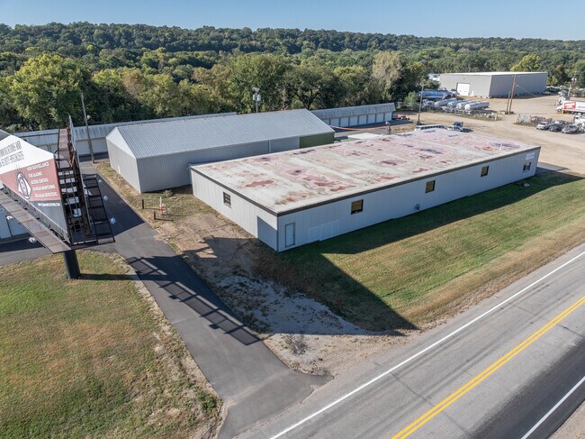

Property Detail
1043 Southbend Ave
Mankato, MN
Lots Eight (8), Nine (9), Ten (10), Eleven (11) and Twelve (12) of Block Fifty (50), South Bend. ABS
R50-08-22-227-003
Blue Earth
Commercialnec
Minnesota
B and X Area of moderate flood hazard, usually the area between the limits of the 100-year and 500-year floods.
8
2025
0.98 AC
2025
West Mankato
170900
Other Market Areas
9,000 SF
NEARBY LISTINGS FOR SALE OR LEASE
DEMOGRAPHICS near 1043 Southbend Ave
1 mile
3 mile
5 mile
2025 Total Population
1,093
29,241
59,256
2030 Population
1,083
29,223
59,651
Pop Growth 2025-2030
(0.91%)
(0.06%)
+ 0.67%
Average Age
44
37
36
2025 Total Households
440
11,087
23,357
HH Growth 2025-2030
(0.68%)
(0.23%)
+ 0.68%
Median Household Inc
$70,746
$69,084
$65,447
Avg Household Size
2.40
2.30
2.30
2025 Avg HH Vehicles
2.00
2.00
2.00
Median Home Value
$279,166
$267,043
$267,407
Median Year Built
1966
1968
1979
Nearby Places
Map Layers
Map Styles
 Street
 Aerial
Layers
 Traffic
 Biking
Places
Listings with unknown addresses are not visible on the map
- Restaurants
- Banks
- Shops
- Fitness
- Groceries
SALE & LEASE HISTORY
LISTING DATE
SALE/LEASE

Sep 25, 2016
For Lease
Sep 23, 2016
For Sale
Sep 12, 2019
For Sale
Oct 21, 2024
For Sale
Jun 26, 2018
For Sale
Jul 17, 2018
For Lease
Feb 24, 2022
For Lease
Dec 23, 2021
For Sale
Nearby Properties
Address
Land Use
TOTAL SIZE
Lot Size
Zoning
Address
Land Use
TOTAL SIZE
Lot Size
Zoning
184,270 SF
79.30 AC
Address
Land Use
TOTAL SIZE
Lot Size
Zoning
616,099 SF
4.06 AC
Address
Land Use
TOTAL SIZE
Lot Size
Zoning
269,842 SF
48.03 AC
Address
Land Use
TOTAL SIZE
Lot Size
Zoning
130,218 SF
39.09 AC
Address
Land Use
TOTAL SIZE
Lot Size
Zoning
219,165 SF
24.49 AC
Address
Land Use
TOTAL SIZE
Lot Size
Zoning
12,400 SF
60.45 AC
Address
Land Use
TOTAL SIZE
Lot Size
Zoning
5.67 AC
Address
Land Use
TOTAL SIZE
Lot Size
Zoning
26,500 SF
3.31 AC
Address
Land Use
TOTAL SIZE
Lot Size
Zoning
58,604 SF
1.19 AC
Address
Land Use
TOTAL SIZE
Lot Size
Zoning
16.15 AC
Address
Land Use
TOTAL SIZE
Lot Size
Zoning
67,200 SF
13.04 AC
Address
Land Use
TOTAL SIZE
Lot Size
Zoning
22,522 SF
2.49 AC
Address
Land Use
TOTAL SIZE
Lot Size
Zoning
13,886 SF
19.50 AC
Address
Land Use
TOTAL SIZE
Lot Size
Zoning
4.28 AC
Address
Land Use
TOTAL SIZE
Lot Size
Zoning
60,000 SF
9.11 AC
Address
Land Use
TOTAL SIZE
Lot Size
Zoning
73,143 SF
0.24 AC
Address
Land Use
TOTAL SIZE
Lot Size
Zoning
272,428 SF
22.09 AC
Address
Land Use
TOTAL SIZE
Lot Size
Zoning
185,200 SF
12.87 AC
Address
Land Use
TOTAL SIZE
Lot Size
Zoning
73,151 SF
0.27 AC
Address
Land Use
TOTAL SIZE
Lot Size
Zoning
213,294 SF
12.56 AC
Address
Land Use
TOTAL SIZE
Lot Size
Zoning
73,749 SF
64.75 AC
Address
Land Use
TOTAL SIZE
Lot Size
Zoning
1.96 AC
Address
Land Use
TOTAL SIZE
Lot Size
Zoning
81,111 SF
4.48 AC
Address
Land Use
TOTAL SIZE
Lot Size
Zoning
64,757 SF
2.46 AC
Address
Land Use
TOTAL SIZE
Lot Size
Zoning
79,762 SF
0.80 AC
Address
Land Use
TOTAL SIZE
Lot Size
Zoning
25,223 SF
2.98 AC
Address
Land Use
TOTAL SIZE
Lot Size
Zoning
57,710 SF
14.10 AC
Address
Land Use
TOTAL SIZE
Lot Size
Zoning
70,656 SF
2.85 AC
Address
Land Use
TOTAL SIZE
Lot Size
Zoning
33,207 SF
0.84 AC
The World's #1 Commercial Real Estate Marketplace
Connect with us
© 2026 CoStar Group
The information above has been obtained from sources believed reliable. While we do not doubt its accuracy we have not verified it and make no guarantee, warranty or representation about it. It is your responsibility to independently confirm its accuracy and completeness. Any projections, opinions, assumptions, or estimates used are for example only and do not represent the current or future performance of the property. The value of this transaction to you depends on tax and other factors which should be evaluated by your tax, financial, and legal advisors. You and your advisors should conduct a careful, independent investigation of the property to determine to your satisfaction the suitability of the property for your needs.