Property Record
1043 Us Highway 280 W, Cordele, GA 31015
NEARBY LISTINGS FOR SALE OR LEASE
Property Detail
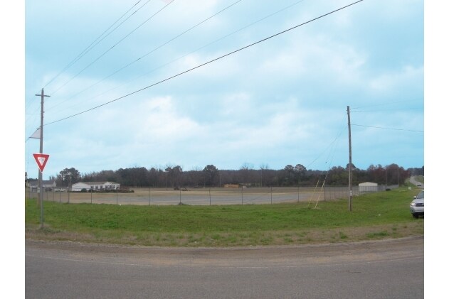
1043 Us Highway 280 W
Cordele, GA
Cnty Comm Exc
019-002A
LL 185 D-10
Commercialnec
Crisp
X
Georgia
13081C0133B
185
2025
5.14 AC
2025
Georgia South Area
010201
Other Market Areas
24,716 SF
DEMOGRAPHICS near 1043 Us Highway 280 W
1 Mile
3 Mile
5 Mile
2024 Total Population
1,401
12,108
13,846
2029 Population
1,382
11,812
13,466
Pop Growth 2024-2029
(1.36%)
(2.44%)
(2.74%)
Average Age
37
39
39
2024 Total Households
546
4,903
5,640
HH Growth 2024-2029
(1.10%)
(2.26%)
(2.57%)
Median Household Inc
$19,378
$34,606
$36,698
Avg Household Size
2.50
2.40
2.40
2024 Avg HH Vehicles
1.00
2.00
2.00
Median Home Value
$56,609
$80,083
$88,748
Median Year Built
1977
1979
1979
Nearby Places
Map Layers
Map Styles
 Street
 Aerial
- Restaurants
- Banks
- Shops
- Fitness
- Groceries
Nearby Properties
Address
Land Use
TOTAL SIZE
Lot Size
Zoning
Address
Land Use
TOTAL SIZE
Lot Size
Zoning
661,934 SF
298.04 AC
INDUSTRIAL
Address
Land Use
TOTAL SIZE
Lot Size
Zoning
145,350 SF
17.34 AC
COMMERCIAL
Address
Land Use
TOTAL SIZE
Lot Size
Zoning
2.94 AC
INDUSTRIAL
Address
Land Use
TOTAL SIZE
Lot Size
Zoning
3,052 SF
4.36 AC
COMMERCIAL
Address
Land Use
TOTAL SIZE
Lot Size
Zoning
9.80 AC
RESIDENTIA
Address
Land Use
TOTAL SIZE
Lot Size
Zoning
49,311 SF
1.72 AC
COMMERCIAL
Address
Land Use
TOTAL SIZE
Lot Size
Zoning
76,646 SF
7.82 AC
COMMERCIAL
Address
Land Use
TOTAL SIZE
Lot Size
Zoning
45,000 SF
0.34 AC
COMMERCIAL
Address
Land Use
TOTAL SIZE
Lot Size
Zoning
11.77 AC
RESIDENTIA
Address
Land Use
TOTAL SIZE
Lot Size
Zoning
26,100 SF
20.59 AC
INDUSTRIAL
Address
Land Use
TOTAL SIZE
Lot Size
Zoning
2,265 SF
6.63 AC
COMMERCIAL
Address
Land Use
TOTAL SIZE
Lot Size
Zoning
15,875 SF
96.92 AC
Address
Land Use
TOTAL SIZE
Lot Size
Zoning
23,084 SF
4.18 AC
RESIDENTIA
Address
Land Use
TOTAL SIZE
Lot Size
Zoning
2,500 SF
44.50 AC
Address
Land Use
TOTAL SIZE
Lot Size
Zoning
10,786 SF
3.75 AC
COMMERCIAL
Address
Land Use
TOTAL SIZE
Lot Size
Zoning
102,700 SF
9.29 AC
RURAL
Address
Land Use
TOTAL SIZE
Lot Size
Zoning
11.11 AC
INDUSTRIAL
Address
Land Use
TOTAL SIZE
Lot Size
Zoning
69,641 SF
7.72 AC
COMMERCIAL
Address
Land Use
TOTAL SIZE
Lot Size
Zoning
625 SF
6.44 AC
RESIDENTIA
Address
Land Use
TOTAL SIZE
Lot Size
Zoning
28,056 SF
4.73 AC
COMMERCIAL
Address
Land Use
TOTAL SIZE
Lot Size
Zoning
16,588 SF
2.63 AC
COMMERCIAL
Address
Land Use
TOTAL SIZE
Lot Size
Zoning
14,466 SF
1.74 AC
COMMERCIAL
Address
Land Use
TOTAL SIZE
Lot Size
Zoning
43,092 SF
0.69 AC
RESIDENTIA
Address
Land Use
TOTAL SIZE
Lot Size
Zoning
167.82 AC
COMMERCIAL
Address
Land Use
TOTAL SIZE
Lot Size
Zoning
37,778 SF
12.23 AC
COMMERCIAL
Address
Land Use
TOTAL SIZE
Lot Size
Zoning
52,605 SF
5.03 AC
COMMERCIAL
Address
Land Use
TOTAL SIZE
Lot Size
Zoning
99.28 AC
RURAL
Address
Land Use
TOTAL SIZE
Lot Size
Zoning
12,064 SF
3.13 AC
COMMERCIAL
Address
Land Use
TOTAL SIZE
Lot Size
Zoning
906 SF
5.12 AC
RESIDENTIA
Address
Land Use
TOTAL SIZE
Lot Size
Zoning
22,782 SF
9.53 AC
COMMERCIAL
The World's #1 Commercial Real Estate Marketplace
Connect with us
© 2026 CoStar Group
The information above has been obtained from sources believed reliable. While we do not doubt its accuracy we have not verified it and make no guarantee, warranty or representation about it. It is your responsibility to independently confirm its accuracy and completeness. Any projections, opinions, assumptions, or estimates used are for example only and do not represent the current or future performance of the property. The value of this transaction to you depends on tax and other factors which should be evaluated by your tax, financial, and legal advisors. You and your advisors should conduct a careful, independent investigation of the property to determine to your satisfaction the suitability of the property for your needs.