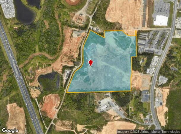
Property Record
1044 Scruggs Rd, Ringgold, GA 30736

NEARBY LISTINGS FOR SALE OR LEASE
Property Detail
1044 Scruggs Rd
Chattanooga, TN-GA
Com- Mack Smith/Scruggs Area
0010B-047
PT LL 1 28/3
Industrialacreage
Catoosa
X
Georgia
47065C0477G
1
2024
14.15 AC
2024
Catoosa County
030402
Chattanooga
592 SF
DEMOGRAPHICS near 1044 Scruggs Rd
1 mile
3 mile
5 mile
2024 Total Population
3,012
42,349
117,015
2029 Population
3,155
44,411
123,158
Pop Growth 2024-2029
+ 4.75%
+ 4.87%
+ 5.25%
Average Age
42
41
41
2024 Total Households
1,230
17,945
48,706
HH Growth 2024-2029
+ 4.88%
+ 4.96%
+ 5.38%
Median Household Inc
$63,997
$55,276
$58,938
Avg Household Size
2.40
2.30
2.30
2024 Avg HH Vehicles
2.00
2.00
2.00
Median Home Value
$245,970
$196,106
$207,032
Median Year Built
1983
1981
1975
Nearby Places
Map Layers
Map Styles
 Street
 Aerial
Transit
 Traffic
 Biking
Places
Listings with unknown addresses are not visible on the map
- Restaurants
- Banks
- Shops
- Fitness
- Groceries
PUBLIC TRANSPORTATION
AIRPORT
Lovell Field
Drive
Walk
Distance
Lovell Field
15 min
6.8 mi
Freight Ports
Georgia Ports - Savannah
Drive
Walk
Distance
Georgia Ports - Savannah
398 min
356.1 mi
SALE & LEASE HISTORY
LISTING DATE
SALE/LEASE

Sep 24, 2016
For Sale
Nearby Properties
Address
Land Use
TOTAL SIZE
Lot Size
Zoning
Address
Land Use
TOTAL SIZE
Lot Size
Zoning
43,488 SF
27.72 AC
R3
Address
Land Use
TOTAL SIZE
Lot Size
Zoning
25,436 SF
21.34 AC
R3
Address
Land Use
TOTAL SIZE
Lot Size
Zoning
20,964 SF
17.72 AC
R1
Address
Land Use
TOTAL SIZE
Lot Size
Zoning
15,808 SF
19.50 AC
R2
Address
Land Use
TOTAL SIZE
Lot Size
Zoning
4,390 SF
36.30 AC
R3
Address
Land Use
TOTAL SIZE
Lot Size
Zoning
790,207 SF
53.84 AC
C2
Address
Land Use
TOTAL SIZE
Lot Size
Zoning
176.54 AC
R1
Address
Land Use
TOTAL SIZE
Lot Size
Zoning
34,862 SF
63.85 AC
A-1
Address
Land Use
TOTAL SIZE
Lot Size
Zoning
233,109 SF
18.99 AC
FOR C-1
Address
Land Use
TOTAL SIZE
Lot Size
Zoning
85,068 SF
9.57 AC
Address
Land Use
TOTAL SIZE
Lot Size
Zoning
27,144 SF
5.62 AC
R3
Address
Land Use
TOTAL SIZE
Lot Size
Zoning
88,285 SF
7 AC
R3
Address
Land Use
TOTAL SIZE
Lot Size
Zoning
209,168 SF
23.28 AC
C2
Address
Land Use
TOTAL SIZE
Lot Size
Zoning
135,954 SF
11.83 AC
R3
Address
Land Use
TOTAL SIZE
Lot Size
Zoning
15,968 SF
9.50 AC
Address
Land Use
TOTAL SIZE
Lot Size
Zoning
66,027 SF
2.84 AC
C2
Address
Land Use
TOTAL SIZE
Lot Size
Zoning
151,314 SF
6.60 AC
Address
Land Use
TOTAL SIZE
Lot Size
Zoning
2,210 SF
11.33 AC
FOR R-5
Address
Land Use
TOTAL SIZE
Lot Size
Zoning
139,638 SF
16.69 AC
FOR C-2
Address
Land Use
TOTAL SIZE
Lot Size
Zoning
7,680 SF
11.06 AC
Address
Land Use
TOTAL SIZE
Lot Size
Zoning
58,911 SF
12.37 AC
FOR C-2
Address
Land Use
TOTAL SIZE
Lot Size
Zoning
109,933 SF
5 AC
Address
Land Use
TOTAL SIZE
Lot Size
Zoning
20,400 SF
13.90 AC
R4
Address
Land Use
TOTAL SIZE
Lot Size
Zoning
130,515 SF
18.78 AC
FOR C-1
Address
Land Use
TOTAL SIZE
Lot Size
Zoning
103,668 SF
5.37 AC
C2
Address
Land Use
TOTAL SIZE
Lot Size
Zoning
83,082 SF
6.25 AC
C2
Address
Land Use
TOTAL SIZE
Lot Size
Zoning
7,678 SF
13.79 AC
R2
Address
Land Use
TOTAL SIZE
Lot Size
Zoning
30,372 SF
3 AC
C2
Address
Land Use
TOTAL SIZE
Lot Size
Zoning
1,903 SF
13.62 AC
FOR R-2
Address
Land Use
TOTAL SIZE
Lot Size
Zoning
210,176 SF
19.38 AC
C2
The World's #1 Commercial Real Estate Marketplace
Connect with us
© 2026 CoStar Group
The information above has been obtained from sources believed reliable. While we do not doubt its accuracy we have not verified it and make no guarantee, warranty or representation about it. It is your responsibility to independently confirm its accuracy and completeness. Any projections, opinions, assumptions, or estimates used are for example only and do not represent the current or future performance of the property. The value of this transaction to you depends on tax and other factors which should be evaluated by your tax, financial, and legal advisors. You and your advisors should conduct a careful, independent investigation of the property to determine to your satisfaction the suitability of the property for your needs.