Property Record
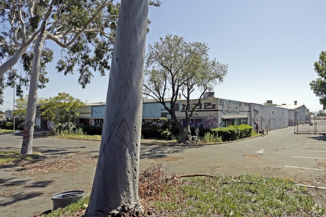
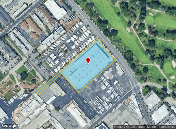
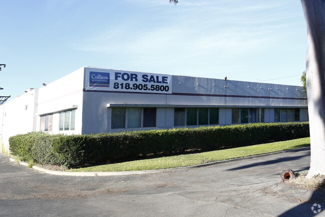
10445 Glenoaks Blvd, Pacoima, CA 91331

NEARBY LISTINGS FOR SALE OR LEASE
Property Detail
10445 Glenoaks Blvd
2537-002-022
Maclay Rancho Ex Mission Of San Fernando
Recreationalentertainmentgeneral
MACLAY RO POR VAC ST ADJ ON NE AND POR OF BLK 169
X
Los Angeles
06037C1069F
California
2024
4.35 AC
2025
East San Ferndo Vlly
104703
Los Angeles
99,301 SF
Los Angeles-Long Beach-Glendale, CA
DEMOGRAPHICS near 10445 Glenoaks Blvd
1 Mile
3 Mile
5 Mile
2024 Total Population
11,348
150,917
498,556
2029 Population
10,863
144,340
481,829
Pop Growth 2024-2029
(4.27%)
(4.36%)
(3.36%)
Average Age
35
38
38
2024 Total Households
2,820
36,758
136,291
HH Growth 2024-2029
(4.50%)
(4.67%)
(3.57%)
Median Household Inc
$55,788
$76,685
$66,602
Avg Household Size
3.80
3.80
3.50
2024 Avg HH Vehicles
2.00
3.00
2.00
Median Home Value
$505,349
$663,487
$681,046
Median Year Built
1976
1958
1965
Nearby Places
Map Layers
Map Styles
 Street
 Aerial
- Restaurants
- Banks
- Shops
- Fitness
- Groceries
PUBLIC TRANSPORTATION
COMMUTER RAIL
Sun Valley (Antelope Valley Line - Southern California Regional Rail Authority (Metrolink))
DRIVE
WALK
Distance
Sun Valley (Antelope Valley Line - Southern California Regional Rail Authority (Metrolink))
7 min
3.6 mi
Sylmar/San Fernando (Antelope Valley Line - Southern California Regional Rail Authority (Metrolink))
DRIVE
WALK
Distance
Sylmar/San Fernando (Antelope Valley Line - Southern California Regional Rail Authority (Metrolink))
10 min
4.7 mi
AIRPORT
Bob Hope
DRIVE
WALK
Distance
Bob Hope
12 min
5.2 mi
Los Angeles International
DRIVE
WALK
Distance
Los Angeles International
42 min
30.3 mi
Long Beach (Daugherty Field)
DRIVE
WALK
Distance
Long Beach (Daugherty Field)
55 min
40.3 mi
Freight Ports
Port of Long Beach
DRIVE
WALK
Distance
Port of Long Beach
58 min
42.2 mi
Nearby Properties
Address
Land Use
TOTAL SIZE
Lot Size
Zoning
Address
Land Use
TOTAL SIZE
Lot Size
Zoning
281,288 SF
34.03 AC
LAM2
Address
Land Use
TOTAL SIZE
Lot Size
Zoning
196,404 SF
10.06 AC
LARD1.5
Address
Land Use
TOTAL SIZE
Lot Size
Zoning
185,568 SF
9.06 AC
LARD1.5
Address
Land Use
TOTAL SIZE
Lot Size
Zoning
144,626 SF
5.15 AC
LAM2
Address
Land Use
TOTAL SIZE
Lot Size
Zoning
193,465 SF
4.67 AC
LAM3
Address
Land Use
TOTAL SIZE
Lot Size
Zoning
248,500 SF
11.01 AC
LAM2
Address
Land Use
TOTAL SIZE
Lot Size
Zoning
257,802 SF
4.52 AC
LARA
Address
Land Use
TOTAL SIZE
Lot Size
Zoning
776,594 SF
16.18 AC
LAC2
Address
Land Use
TOTAL SIZE
Lot Size
Zoning
96,792 SF
5.52 AC
LARD2
Address
Land Use
TOTAL SIZE
Lot Size
Zoning
114,140 SF
4.94 AC
LAA1
Address
Land Use
TOTAL SIZE
Lot Size
Zoning
165,573 SF
60.97 AC
LAM3
Address
Land Use
TOTAL SIZE
Lot Size
Zoning
146,718 SF
7.36 AC
Address
Land Use
TOTAL SIZE
Lot Size
Zoning
146,718 SF
7.11 AC
SFM
Address
Land Use
TOTAL SIZE
Lot Size
Zoning
11,067 SF
3.21 AC
LAM2
Address
Land Use
TOTAL SIZE
Lot Size
Zoning
154,575 SF
12.20 AC
LAM3
Address
Land Use
TOTAL SIZE
Lot Size
Zoning
120,590 SF
9.52 AC
SFM2-C1P*
Address
Land Use
TOTAL SIZE
Lot Size
Zoning
108,012 SF
6.40 AC
LAR3
Address
Land Use
TOTAL SIZE
Lot Size
Zoning
140,411 SF
10.79 AC
LAM3
Address
Land Use
TOTAL SIZE
Lot Size
Zoning
93,635 SF
4.97 AC
LAM2
Address
Land Use
TOTAL SIZE
Lot Size
Zoning
44,480 SF
2.72 AC
LAM2
Address
Land Use
TOTAL SIZE
Lot Size
Zoning
400,169 SF
11.47 AC
LAP
Address
Land Use
TOTAL SIZE
Lot Size
Zoning
250,064 SF
5.97 AC
LAM1
Address
Land Use
TOTAL SIZE
Lot Size
Zoning
170,161 SF
7.76 AC
LAMR2
Address
Land Use
TOTAL SIZE
Lot Size
Zoning
79,778 SF
3.90 AC
LARD1.5
Address
Land Use
TOTAL SIZE
Lot Size
Zoning
99,966 SF
4.53 AC
LAM1
Address
Land Use
TOTAL SIZE
Lot Size
Zoning
122,868 SF
4.96 AC
LAM2
Address
Land Use
TOTAL SIZE
Lot Size
Zoning
138,229 SF
4.67 AC
SFM2*
Address
Land Use
TOTAL SIZE
Lot Size
Zoning
94,760 SF
5.01 AC
LAR3
Address
Land Use
TOTAL SIZE
Lot Size
Zoning
214,067 SF
8.50 AC
SFM2-C1P*
The World's #1 Commercial Real Estate Marketplace
Connect with us
© 2026 CoStar Group
The information above has been obtained from sources believed reliable. While we do not doubt its accuracy we have not verified it and make no guarantee, warranty or representation about it. It is your responsibility to independently confirm its accuracy and completeness. Any projections, opinions, assumptions, or estimates used are for example only and do not represent the current or future performance of the property. The value of this transaction to you depends on tax and other factors which should be evaluated by your tax, financial, and legal advisors. You and your advisors should conduct a careful, independent investigation of the property to determine to your satisfaction the suitability of the property for your needs.