No Photo
Property Record
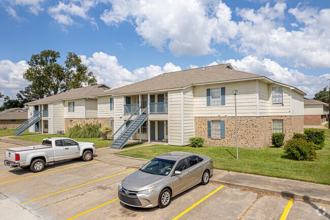
1045 Walters St, Lake Charles, LA 70607

Property Detail
1045 Walters St
Lake Charles, LA
171008-0000-3200003 0000 171008-0000-3200004 0000 171008-0000-3200005 0000 171008-0000-320000601 0000 171008-0000-320000602 0000 -1045 WALTERS ST- -4020 LOUISIANA AVE- -LAUREL OAK VILLAGE- COM 40 FT N AND 30 FT W OF THE SE COR SE SW 17.10.8 TH N ALON
00449172
Calcasieu
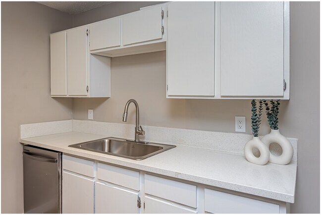
Apartment
Louisiana
C and X Area of minimal flood hazard, usually depicted on FIRMs as above the 500-year flood level.
3-6
2025
11.09 AC
2025
Lake Charles
001100
Other Market Areas
NEARBY LISTINGS FOR SALE OR LEASE
-
-
No Photo
-
View all Lake Charles listings for sale on LoopNet.com
DEMOGRAPHICS near 1045 Walters St
1 mile
3 mile
5 mile
2025 Total Population
9,757
62,257
94,648
2030 Population
9,800
62,650
95,536
Pop Growth 2025-2030
+ 0.44%
+ 0.63%
+ 0.94%
Average Age
37
39
39
2025 Total Households
3,881
25,431
38,132
HH Growth 2025-2030
+ 0.46%
+ 0.65%
+ 0.98%
Median Household Inc
$47,006
$54,609
$56,630
Avg Household Size
2.40
2.30
2.40
2025 Avg HH Vehicles
1.00
2.00
2.00
Median Home Value
$167,216
$211,765
$223,203
Median Year Built
1973
1976
1980
Nearby Places
Map Layers
Map Styles
 Street
 Aerial
Transit
 Traffic
 Biking
Places
Listings with unknown addresses are not visible on the map
- Restaurants
- Banks
- Shops
- Fitness
- Groceries
PUBLIC TRANSPORTATION
COMMUTER RAIL
Drive
Walk
Distance
9 min
4.4 mi
AIRPORT
Lake Charles Regional
Drive
Walk
Distance
Lake Charles Regional
10 min
5.0 mi
Freight Ports
Port of Lake Charles
Drive
Walk
Distance
Port of Lake Charles
9 min
4.5 mi
Nearby Properties
Address
Land Use
TOTAL SIZE
Lot Size
Zoning
Address
Land Use
TOTAL SIZE
Lot Size
Zoning
Address
Land Use
TOTAL SIZE
Lot Size
Zoning
Address
Land Use
TOTAL SIZE
Lot Size
Zoning
64.85 AC
Address
Land Use
TOTAL SIZE
Lot Size
Zoning
Address
Land Use
TOTAL SIZE
Lot Size
Zoning
157.09 AC
Address
Land Use
TOTAL SIZE
Lot Size
Zoning
0.01 AC
Address
Land Use
TOTAL SIZE
Lot Size
Zoning
Address
Land Use
TOTAL SIZE
Lot Size
Zoning
Address
Land Use
TOTAL SIZE
Lot Size
Zoning
27.73 AC
Address
Land Use
TOTAL SIZE
Lot Size
Zoning
Address
Land Use
TOTAL SIZE
Lot Size
Zoning
Address
Land Use
TOTAL SIZE
Lot Size
Zoning
Address
Land Use
TOTAL SIZE
Lot Size
Zoning
Address
Land Use
TOTAL SIZE
Lot Size
Zoning
0.18 AC
Address
Land Use
TOTAL SIZE
Lot Size
Zoning
Address
Land Use
TOTAL SIZE
Lot Size
Zoning
Address
Land Use
TOTAL SIZE
Lot Size
Zoning
15.31 AC
Address
Land Use
TOTAL SIZE
Lot Size
Zoning
Address
Land Use
TOTAL SIZE
Lot Size
Zoning
Address
Land Use
TOTAL SIZE
Lot Size
Zoning
Address
Land Use
TOTAL SIZE
Lot Size
Zoning
23.51 AC
Address
Land Use
TOTAL SIZE
Lot Size
Zoning
Address
Land Use
TOTAL SIZE
Lot Size
Zoning
Address
Land Use
TOTAL SIZE
Lot Size
Zoning
Address
Land Use
TOTAL SIZE
Lot Size
Zoning
2.29 AC
Address
Land Use
TOTAL SIZE
Lot Size
Zoning
Address
Land Use
TOTAL SIZE
Lot Size
Zoning
Address
Land Use
TOTAL SIZE
Lot Size
Zoning
12.78 AC
Address
Land Use
TOTAL SIZE
Lot Size
Zoning
Address
Land Use
TOTAL SIZE
Lot Size
Zoning
20.49 AC
The World's #1 Commercial Real Estate Marketplace
Connect with us
© 2026 CoStar Group
The information above has been obtained from sources believed reliable. While we do not doubt its accuracy we have not verified it and make no guarantee, warranty or representation about it. It is your responsibility to independently confirm its accuracy and completeness. Any projections, opinions, assumptions, or estimates used are for example only and do not represent the current or future performance of the property. The value of this transaction to you depends on tax and other factors which should be evaluated by your tax, financial, and legal advisors. You and your advisors should conduct a careful, independent investigation of the property to determine to your satisfaction the suitability of the property for your needs.