Property Record
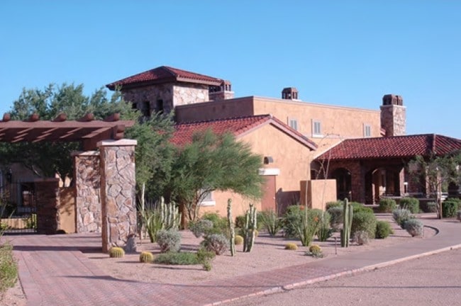
10455 E Pinnacle Peak Pky, Scottsdale, AZ 85255

NEARBY LISTINGS FOR SALE OR LEASE
-
-
View all Scottsdale listings for sale on LoopNet.com
Property Detail
10455 E Pinnacle Peak Pky
217-02-008W
POR NW4 NW4 SEC 4 COM NW COR SD SEC TH S 35F TPOB TH E 109.97F TH E 100.01F TH E RAD 415F ARC 273.56F CB S 70D 59M E TO PT CUR RAD 150F ARC 16.16F CB S 52D 47M W TH S 55D 53M W 89.10F TH S 21D 49M E 263.38F TO PT CUR RAD 895F ARC 733.93F CB S 41D 42M
Hospitalprivate
Maricopa
X
Arizona
04013C1330L
5.84 AC
2025
North Scottsdale
2025
Phoenix
216843
Phoenix-Mesa-Scottsdale, AZ
270,264 SF
DEMOGRAPHICS near 10455 E Pinnacle Peak Pky
1 Mile
3 Mile
5 Mile
2024 Total Population
2,626
15,895
43,027
2029 Population
2,976
17,904
47,846
Pop Growth 2024-2029
+ 13.33%
+ 12.64%
+ 11.20%
Average Age
59
57
52
2024 Total Households
1,265
7,340
18,525
HH Growth 2024-2029
+ 13.36%
+ 12.85%
+ 11.45%
Median Household Inc
$171,098
$163,913
$153,311
Avg Household Size
2.10
2.10
2.30
2024 Avg HH Vehicles
2.00
2.00
2.00
Median Home Value
$1,015,501
$955,829
$898,210
Median Year Built
1999
1999
1999
Nearby Places
Map Layers
Map Styles
 Street
 Aerial
- Restaurants
- Banks
- Shops
- Fitness
- Groceries
PUBLIC TRANSPORTATION
AIRPORT
Phoenix Sky Harbor International
DRIVE
WALK
Distance
Phoenix Sky Harbor International
44 min
29.8 mi
Phoenix-Mesa Gateway
DRIVE
WALK
Distance
Phoenix-Mesa Gateway
66 min
45.1 mi
Nearby Properties
Address
Land Use
TOTAL SIZE
Lot Size
Zoning
Address
Land Use
TOTAL SIZE
Lot Size
Zoning
244,244 SF
23.25 AC
R-4R
Address
Land Use
TOTAL SIZE
Lot Size
Zoning
8.40 AC
Address
Land Use
TOTAL SIZE
Lot Size
Zoning
169,930 SF
656.35 AC
R1130
Address
Land Use
TOTAL SIZE
Lot Size
Zoning
66,317 SF
20.82 AC
R-190
Address
Land Use
TOTAL SIZE
Lot Size
Zoning
100,378 SF
12.29 AC
C-C
Address
Land Use
TOTAL SIZE
Lot Size
Zoning
98,156 SF
15.08 AC
R-4R
Address
Land Use
TOTAL SIZE
Lot Size
Zoning
29,289 SF
24.71 AC
R-190
Address
Land Use
TOTAL SIZE
Lot Size
Zoning
6,569 SF
3.07 AC
R-190
Address
Land Use
TOTAL SIZE
Lot Size
Zoning
4,491 SF
34.11 AC
OS
Address
Land Use
TOTAL SIZE
Lot Size
Zoning
56,495 SF
94.89 AC
R143
Address
Land Use
TOTAL SIZE
Lot Size
Zoning
74,220 SF
1.99 AC
C-C
Address
Land Use
TOTAL SIZE
Lot Size
Zoning
32,508 SF
90.43 AC
O-S
Address
Land Use
TOTAL SIZE
Lot Size
Zoning
45,806 SF
5.68 AC
PAD
Address
Land Use
TOTAL SIZE
Lot Size
Zoning
14,801 SF
85.02 AC
R1-43
Address
Land Use
TOTAL SIZE
Lot Size
Zoning
4.81 AC
R-190
Address
Land Use
TOTAL SIZE
Lot Size
Zoning
58,827 SF
3.82 AC
C-C
Address
Land Use
TOTAL SIZE
Lot Size
Zoning
4.36 AC
R-190
Address
Land Use
TOTAL SIZE
Lot Size
Zoning
32,678 SF
18.01 AC
Address
Land Use
TOTAL SIZE
Lot Size
Zoning
4.85 AC
R-190
Address
Land Use
TOTAL SIZE
Lot Size
Zoning
4.85 AC
R-190
Address
Land Use
TOTAL SIZE
Lot Size
Zoning
4.82 AC
R-190
Address
Land Use
TOTAL SIZE
Lot Size
Zoning
4.55 AC
R-190
Address
Land Use
TOTAL SIZE
Lot Size
Zoning
4.55 AC
R-190
Address
Land Use
TOTAL SIZE
Lot Size
Zoning
156,912 SF
4.21 AC
C-C
Address
Land Use
TOTAL SIZE
Lot Size
Zoning
8,753 SF
5.39 AC
C-C
Address
Land Use
TOTAL SIZE
Lot Size
Zoning
273.28 AC
R135
Address
Land Use
TOTAL SIZE
Lot Size
Zoning
44,666 SF
5.92 AC
C-C
Address
Land Use
TOTAL SIZE
Lot Size
Zoning
15,897 SF
4.10 AC
R-190
The World's #1 Commercial Real Estate Marketplace
Connect with us
© 2025 CoStar Group
The information above has been obtained from sources believed reliable. While we do not doubt its accuracy we have not verified it and make no guarantee, warranty or representation about it. It is your responsibility to independently confirm its accuracy and completeness. Any projections, opinions, assumptions, or estimates used are for example only and do not represent the current or future performance of the property. The value of this transaction to you depends on tax and other factors which should be evaluated by your tax, financial, and legal advisors. You and your advisors should conduct a careful, independent investigation of the property to determine to your satisfaction the suitability of the property for your needs.