Property Record
10459 Chambers Rd, Commerce City, CO 80022
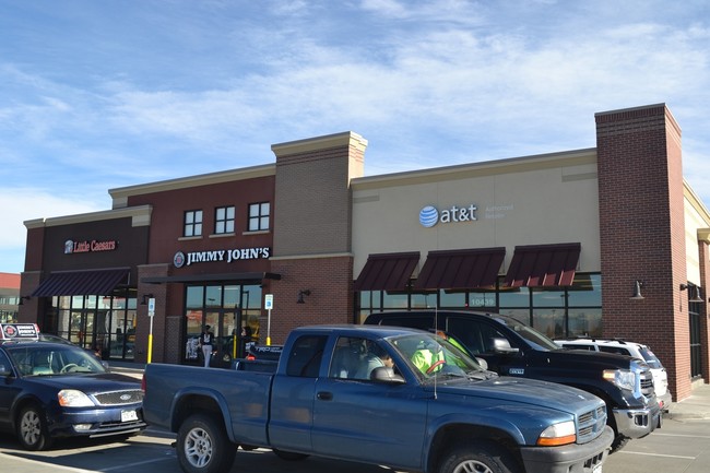

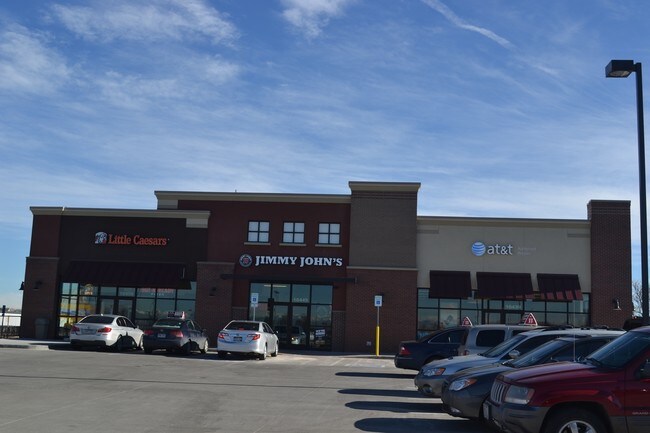
Property Detail
10459 Chambers Rd
Denver-Aurora-Centennial, CO
REUNION FLG NO 32 AMND 1 LOT 5
1723-07-4-01-012
Adams
Storebuilding
Colorado
B and X Area of moderate flood hazard, usually the area between the limits of the 100-year and 500-year floods.
5
2024
0.67 AC
2025
Northeast
008558
Denver
5,170 SF
NEARBY LISTINGS FOR SALE OR LEASE
DEMOGRAPHICS near 10459 Chambers Rd
1 mile
3 mile
5 mile
2024 Total Population
10,667
43,650
50,686
2029 Population
11,334
46,476
53,837
Pop Growth 2024-2029
+ 6.25%
+ 6.47%
+ 6.22%
Average Age
34
34
34
2024 Total Households
3,288
13,456
15,817
HH Growth 2024-2029
+ 6.33%
+ 6.57%
+ 6.30%
Median Household Inc
$114,903
$122,612
$118,883
Avg Household Size
3.20
3.20
3.20
2024 Avg HH Vehicles
2.00
2.00
2.00
Median Home Value
$454,006
$472,121
$471,603
Median Year Built
2008
2009
2008
Nearby Places
Map Layers
Map Styles
 Street
 Aerial
Transit
 Traffic
 Biking
Places
Listings with unknown addresses are not visible on the map
- Restaurants
- Banks
- Shops
- Fitness
- Groceries
PUBLIC TRANSPORTATION
COMMUTER RAIL
Thornton Crossroads - 104Th Station Track 1 (Union Station to Eastlake & 124th Station - Regional Transportation District)
Drive
Walk
Distance
Thornton Crossroads - 104Th Station Track 1 (Union Station to Eastlake & 124th Station - Regional Transportation District)
14 min
7.3 mi
61St & Pena Station Track 2 (Union Station to Denver Airport Station - Regional Transportation District)
Drive
Walk
Distance
61St & Pena Station Track 2 (Union Station to Denver Airport Station - Regional Transportation District)
14 min
8.3 mi
AIRPORT
Denver International
Drive
Walk
Distance
Denver International
18 min
12.3 mi
Freight Ports
Tulsa Port Of Catoosa
Drive
Walk
Distance
Tulsa Port Of Catoosa
725 min
706.5 mi
SALE & LEASE HISTORY
LISTING DATE
SALE/LEASE

Nov 03, 2020
For Lease
Nearby Properties
Address
Land Use
TOTAL SIZE
Lot Size
Zoning
Address
Land Use
TOTAL SIZE
Lot Size
Zoning
279,946 SF
11.55 AC
Address
Land Use
TOTAL SIZE
Lot Size
Zoning
999,780 SF
72.36 AC
Address
Land Use
TOTAL SIZE
Lot Size
Zoning
358,386 SF
76.08 AC
Address
Land Use
TOTAL SIZE
Lot Size
Zoning
276,395 SF
26.43 AC
A3
Address
Land Use
TOTAL SIZE
Lot Size
Zoning
624.02 AC
A3
Address
Land Use
TOTAL SIZE
Lot Size
Zoning
298,200 SF
17.67 AC
Address
Land Use
TOTAL SIZE
Lot Size
Zoning
272,800 SF
16.44 AC
Address
Land Use
TOTAL SIZE
Lot Size
Zoning
64,750 SF
11.91 AC
Address
Land Use
TOTAL SIZE
Lot Size
Zoning
121,103 SF
13.47 AC
Address
Land Use
TOTAL SIZE
Lot Size
Zoning
231,205 SF
10.46 AC
Address
Land Use
TOTAL SIZE
Lot Size
Zoning
Address
Land Use
TOTAL SIZE
Lot Size
Zoning
207,682 SF
7.16 AC
Address
Land Use
TOTAL SIZE
Lot Size
Zoning
64,715 SF
10.38 AC
Address
Land Use
TOTAL SIZE
Lot Size
Zoning
70,573 SF
6.42 AC
Address
Land Use
TOTAL SIZE
Lot Size
Zoning
170,965 SF
15.31 AC
Address
Land Use
TOTAL SIZE
Lot Size
Zoning
122,399 SF
14.29 AC
Address
Land Use
TOTAL SIZE
Lot Size
Zoning
82,239 SF
7.02 AC
Address
Land Use
TOTAL SIZE
Lot Size
Zoning
70,573 SF
14.73 AC
Address
Land Use
TOTAL SIZE
Lot Size
Zoning
79,121 SF
6.39 AC
Address
Land Use
TOTAL SIZE
Lot Size
Zoning
19,341 SF
74.46 AC
Address
Land Use
TOTAL SIZE
Lot Size
Zoning
75,398 SF
8.82 AC
I2
Address
Land Use
TOTAL SIZE
Lot Size
Zoning
102,069 SF
3.26 AC
Address
Land Use
TOTAL SIZE
Lot Size
Zoning
44,215 SF
21.32 AC
Address
Land Use
TOTAL SIZE
Lot Size
Zoning
22,594 SF
19.96 AC
Address
Land Use
TOTAL SIZE
Lot Size
Zoning
24.65 AC
A3
Address
Land Use
TOTAL SIZE
Lot Size
Zoning
88,043 SF
4.39 AC
Address
Land Use
TOTAL SIZE
Lot Size
Zoning
Address
Land Use
TOTAL SIZE
Lot Size
Zoning
24.92 AC
I2
Address
Land Use
TOTAL SIZE
Lot Size
Zoning
12,842 SF
2.17 AC
Address
Land Use
TOTAL SIZE
Lot Size
Zoning
56,000 SF
8.20 AC
The World's #1 Commercial Real Estate Marketplace
Connect with us
© 2026 CoStar Group
The information above has been obtained from sources believed reliable. While we do not doubt its accuracy we have not verified it and make no guarantee, warranty or representation about it. It is your responsibility to independently confirm its accuracy and completeness. Any projections, opinions, assumptions, or estimates used are for example only and do not represent the current or future performance of the property. The value of this transaction to you depends on tax and other factors which should be evaluated by your tax, financial, and legal advisors. You and your advisors should conduct a careful, independent investigation of the property to determine to your satisfaction the suitability of the property for your needs.