Property Record
1046 Cullman Rd, Arab, AL 35016

Save to a Folder
{{folder.Name}}
{{folder.ListingIds.length}} Properties
{{folder.ListingIds.length}} Property
Create a New Folder
Property Detail
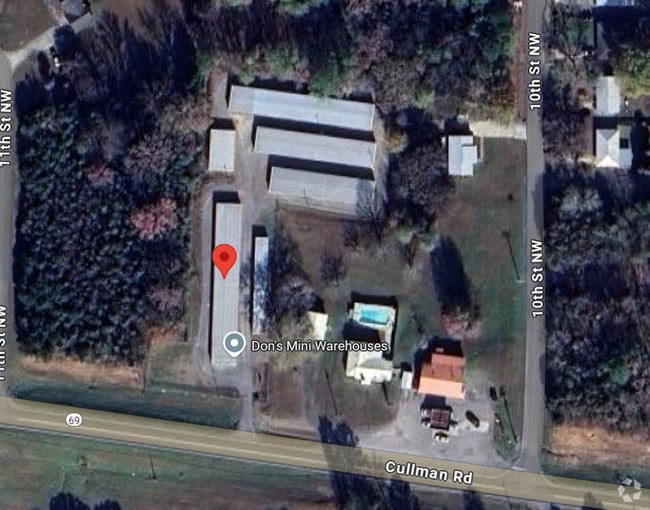
1046 Cullman Rd
130827-1-000-040001
COMM N RW HWY 69 & E R/W 10TH PLACE THN E 230' TO BEG; THN E 100'; N 250'; E 180'; N 30'; E 114'; N 10'; W 155.2'; N 120'; W 270'; S 420' TO BEG 10-17-83 436/315 2.59 AC
Publicstorage
MARSHALL
B and X Area of moderate flood hazard, usually the area between the limits of the 100-year and 500-year floods.
Alabama
2025
1.70 AC
2025
Alabama North Area
030401
Other Market Areas
1,322 SF
Albertville, AL
NEARBY LISTINGS FOR SALE OR LEASE
DEMOGRAPHICS near 1046 Cullman Rd
1 mile
3 mile
5 mile
2025 Total Population
2,242
11,095
18,686
2030 Population
2,324
11,577
19,506
Pop Growth 2025-2030
+ 3.66%
+ 4.34%
+ 4.39%
Average Age
40
41
41
2025 Total Households
988
4,460
7,421
HH Growth 2025-2030
+ 3.24%
+ 4.04%
+ 4.12%
Median Household Inc
$39,098
$57,450
$60,035
Avg Household Size
2.20
2.40
2.40
2025 Avg HH Vehicles
2.00
2.00
2.00
Median Home Value
$167,550
$208,014
$206,409
Median Year Built
1978
1981
1982
Nearby Places
Map Layers
Map Styles
 Street
 Aerial
Layers
 Traffic
 Biking
Places
Listings with unknown addresses are not visible on the map
- Restaurants
- Banks
- Shops
- Fitness
- Groceries
PUBLIC TRANSPORTATION
AIRPORT
Huntsville International-Carl T Jones Field
Drive
Walk
Distance
Huntsville International-Carl T Jones Field
62 min
44.9 mi
Freight Ports
Port of Mobile
Drive
Walk
Distance
Port of Mobile
366 min
327.4 mi
Nearby Properties
Address
Land Use
TOTAL SIZE
Lot Size
Zoning
Address
Land Use
TOTAL SIZE
Lot Size
Zoning
133,635 SF
22 AC
Address
Land Use
TOTAL SIZE
Lot Size
Zoning
137,411 SF
26.93 AC
Address
Land Use
TOTAL SIZE
Lot Size
Zoning
61,691 SF
21 AC
Address
Land Use
TOTAL SIZE
Lot Size
Zoning
82,118 SF
17 AC
Address
Land Use
TOTAL SIZE
Lot Size
Zoning
85,453 SF
11.10 AC
Address
Land Use
TOTAL SIZE
Lot Size
Zoning
80,484 SF
6.80 AC
Address
Land Use
TOTAL SIZE
Lot Size
Zoning
62,666 SF
17 AC
Address
Land Use
TOTAL SIZE
Lot Size
Zoning
48,003 SF
2.13 AC
Address
Land Use
TOTAL SIZE
Lot Size
Zoning
60,000 SF
14 AC
Address
Land Use
TOTAL SIZE
Lot Size
Zoning
80,000 SF
18.50 AC
Address
Land Use
TOTAL SIZE
Lot Size
Zoning
25,686 SF
9.73 AC
Address
Land Use
TOTAL SIZE
Lot Size
Zoning
2,240 SF
13.90 AC
Address
Land Use
TOTAL SIZE
Lot Size
Zoning
81,745 SF
6.35 AC
Address
Land Use
TOTAL SIZE
Lot Size
Zoning
57,000 SF
12.20 AC
Address
Land Use
TOTAL SIZE
Lot Size
Zoning
72,311 SF
7.09 AC
Address
Land Use
TOTAL SIZE
Lot Size
Zoning
44,479 SF
5.70 AC
Address
Land Use
TOTAL SIZE
Lot Size
Zoning
4,784 SF
6.45 AC
Address
Land Use
TOTAL SIZE
Lot Size
Zoning
30,043 SF
5.50 AC
Address
Land Use
TOTAL SIZE
Lot Size
Zoning
77,410 SF
7.80 AC
Address
Land Use
TOTAL SIZE
Lot Size
Zoning
1,144 SF
9.44 AC
Address
Land Use
TOTAL SIZE
Lot Size
Zoning
1,075 SF
8.04 AC
Address
Land Use
TOTAL SIZE
Lot Size
Zoning
26,897 SF
2.02 AC
Address
Land Use
TOTAL SIZE
Lot Size
Zoning
10,072 SF
11.80 AC
Address
Land Use
TOTAL SIZE
Lot Size
Zoning
2,940 SF
5.80 AC
Address
Land Use
TOTAL SIZE
Lot Size
Zoning
15,580 SF
0.94 AC
Address
Land Use
TOTAL SIZE
Lot Size
Zoning
5,712 SF
2.60 AC
Address
Land Use
TOTAL SIZE
Lot Size
Zoning
79,304 SF
18 AC
Address
Land Use
TOTAL SIZE
Lot Size
Zoning
12,650 SF
1.97 AC
Address
Land Use
TOTAL SIZE
Lot Size
Zoning
19,048 SF
1.72 AC
Address
Land Use
TOTAL SIZE
Lot Size
Zoning
20,686 SF
2.26 AC
The World's #1 Commercial Real Estate Marketplace
Connect with us
© 2026 CoStar Group
The information above has been obtained from sources believed reliable. While we do not doubt its accuracy we have not verified it and make no guarantee, warranty or representation about it. It is your responsibility to independently confirm its accuracy and completeness. Any projections, opinions, assumptions, or estimates used are for example only and do not represent the current or future performance of the property. The value of this transaction to you depends on tax and other factors which should be evaluated by your tax, financial, and legal advisors. You and your advisors should conduct a careful, independent investigation of the property to determine to your satisfaction the suitability of the property for your needs.