Property Record
10462 Hickory Hill Rd, Beaverdam, VA 23015
NEARBY LISTINGS FOR SALE OR LEASE
-
-
View all Beaverdam listings for lease on LoopNet.com
Property Detail
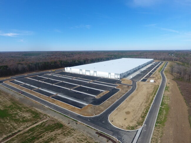
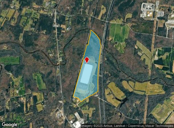
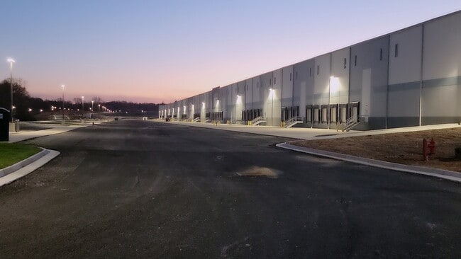
10462 Hickory Hill Rd
Richmond, VA
Graymont Land
7881-29-3011
W/S RT 95ADJ BOURNE
Commercialnec
Hanover
AE
Virginia
51085C0190C
189.83 AC
2025
I-95 North/Ashland
2025
Richmond VA
320100
DEMOGRAPHICS near 10462 Hickory Hill Rd
1 Mile
3 Mile
5 Mile
2024 Total Population
298
6,518
15,727
2029 Population
317
6,997
16,829
Pop Growth 2024-2029
+ 6.38%
+ 7.35%
+ 7.01%
Average Age
37
39
41
2024 Total Households
98
2,288
5,865
HH Growth 2024-2029
+ 6.12%
+ 7.74%
+ 7.23%
Median Household Inc
$70,262
$69,016
$72,163
Avg Household Size
2.50
2.40
2.50
2024 Avg HH Vehicles
2.00
2.00
2.00
Median Home Value
$366,666
$338,656
$341,169
Median Year Built
1984
1986
1984
Nearby Places
Map Layers
Map Styles
 Street
 Aerial
- Restaurants
- Banks
- Shops
- Fitness
- Groceries
PUBLIC TRANSPORTATION
COMMUTER RAIL
Ashland Amtrak (Northeast Regional - Amtrak)
DRIVE
WALK
Distance
Ashland Amtrak (Northeast Regional - Amtrak)
7 min
4.5 mi
AIRPORT
Richmond International
DRIVE
WALK
Distance
Richmond International
35 min
27.4 mi
Freight Ports
Virginia Port Authority - Richmond
DRIVE
WALK
Distance
Virginia Port Authority - Richmond
36 min
27.1 mi
SALE & LEASE HISTORY
LISTING DATE
SALE/LEASE

Oct 20, 2021
For Lease
Nearby Properties
Address
Land Use
TOTAL SIZE
Lot Size
Zoning
Address
Land Use
TOTAL SIZE
Lot Size
Zoning
7,538 SF
600.74 AC
B-3
Address
Land Use
TOTAL SIZE
Lot Size
Zoning
538,610 SF
545.15 AC
M-3
Address
Land Use
TOTAL SIZE
Lot Size
Zoning
194,598 SF
14.50 AC
R-5
Address
Land Use
TOTAL SIZE
Lot Size
Zoning
311,740 SF
43.40 AC
M-1
Address
Land Use
TOTAL SIZE
Lot Size
Zoning
280,900 SF
22.69 AC
M-1
Address
Land Use
TOTAL SIZE
Lot Size
Zoning
24.21 AC
RR-1
Address
Land Use
TOTAL SIZE
Lot Size
Zoning
23.97 AC
RR-1
Address
Land Use
TOTAL SIZE
Lot Size
Zoning
244.60 AC
M-2
Address
Land Use
TOTAL SIZE
Lot Size
Zoning
81,255 SF
13.48 AC
M-1
Address
Land Use
TOTAL SIZE
Lot Size
Zoning
216,700 SF
11.22 AC
M-2
Address
Land Use
TOTAL SIZE
Lot Size
Zoning
318.93 AC
M-1
Address
Land Use
TOTAL SIZE
Lot Size
Zoning
164 AC
M-1
Address
Land Use
TOTAL SIZE
Lot Size
Zoning
263.38 AC
M-1
Address
Land Use
TOTAL SIZE
Lot Size
Zoning
125,400 SF
14.74 AC
M-1
Address
Land Use
TOTAL SIZE
Lot Size
Zoning
105.49 AC
M-1
Address
Land Use
TOTAL SIZE
Lot Size
Zoning
82,732 SF
12.24 AC
M-1
Address
Land Use
TOTAL SIZE
Lot Size
Zoning
111.82 AC
M-2
Address
Land Use
TOTAL SIZE
Lot Size
Zoning
80,236 SF
25.13 AC
B-3
Address
Land Use
TOTAL SIZE
Lot Size
Zoning
114,125 SF
5 AC
M-1
Address
Land Use
TOTAL SIZE
Lot Size
Zoning
89,280 SF
10.50 AC
B-3
Address
Land Use
TOTAL SIZE
Lot Size
Zoning
173.43 AC
M-1
Address
Land Use
TOTAL SIZE
Lot Size
Zoning
698.58 AC
A-1
Address
Land Use
TOTAL SIZE
Lot Size
Zoning
34.26 AC
M-1
Address
Land Use
TOTAL SIZE
Lot Size
Zoning
151.09 AC
M-1
Address
Land Use
TOTAL SIZE
Lot Size
Zoning
11,187 SF
2.43 AC
RR-1
Address
Land Use
TOTAL SIZE
Lot Size
Zoning
216,500 SF
9.28 AC
M-2
Address
Land Use
TOTAL SIZE
Lot Size
Zoning
1,308 SF
19.37 AC
M-2
Address
Land Use
TOTAL SIZE
Lot Size
Zoning
18,255 SF
5.06 AC
B-2
The World's #1 Commercial Real Estate Marketplace
Connect with us
© 2026 CoStar Group
The information above has been obtained from sources believed reliable. While we do not doubt its accuracy we have not verified it and make no guarantee, warranty or representation about it. It is your responsibility to independently confirm its accuracy and completeness. Any projections, opinions, assumptions, or estimates used are for example only and do not represent the current or future performance of the property. The value of this transaction to you depends on tax and other factors which should be evaluated by your tax, financial, and legal advisors. You and your advisors should conduct a careful, independent investigation of the property to determine to your satisfaction the suitability of the property for your needs.