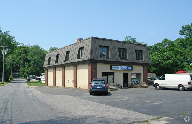
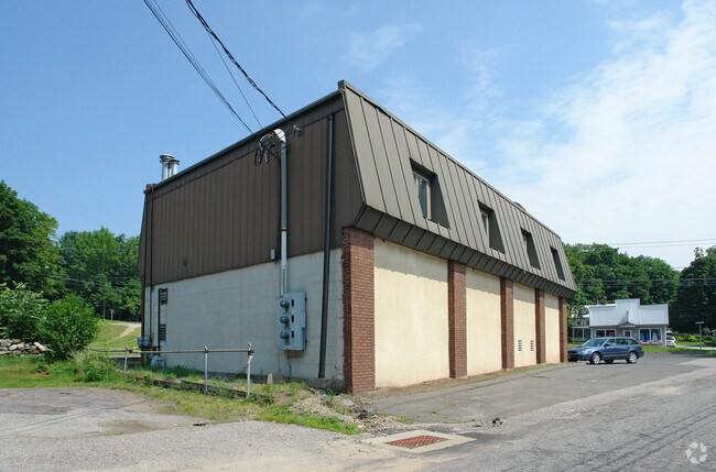
Property Record
1047 Main St, Coventry, CT 06238

NEARBY LISTINGS FOR SALE OR LEASE
-
-
View all Coventry listings for sale on LoopNet.com
Property Detail
1047 Main St
Hartford-West Hartford-East Hartford, CT
Tolland
COVE-000000-N000064-A000000-000000-9A
Connecticut
Commercialbuilding
153
2025
0.26 AC
2025
Tolland County
850200
Hartford
3,720 SF
DEMOGRAPHICS near 1047 Main St
1 mile
3 mile
5 mile
2024 Total Population
1,472
10,862
43,956
2029 Population
1,474
10,926
43,984
Pop Growth 2024-2029
+ 0.14%
+ 0.59%
+ 0.06%
Average Age
45
41
34
2024 Total Households
642
4,138
11,896
HH Growth 2024-2029
+ 0.16%
+ 0.43%
+ 0.07%
Median Household Inc
$75,982
$82,377
$58,409
Avg Household Size
2.20
2.40
2.40
2024 Avg HH Vehicles
2.00
2.00
2.00
Median Home Value
$253,521
$282,795
$278,010
Median Year Built
1955
1963
1973
Nearby Places
Map Layers
Map Styles
 Street
 Aerial
Transit
 Traffic
 Biking
Places
Listings with unknown addresses are not visible on the map
- Restaurants
- Banks
- Shops
- Fitness
- Groceries
PUBLIC TRANSPORTATION
AIRPORT
Bradley International
Drive
Walk
Distance
Bradley International
59 min
36.7 mi
Freight Ports
Port of New Haven
Drive
Walk
Distance
Port of New Haven
78 min
58.8 mi
Nearby Properties
Address
Land Use
TOTAL SIZE
Lot Size
Zoning
Address
Land Use
TOTAL SIZE
Lot Size
Zoning
98 AC
GR40
Address
Land Use
TOTAL SIZE
Lot Size
Zoning
49,319 SF
1 AC
I
Address
Land Use
TOTAL SIZE
Lot Size
Zoning
22.70 AC
RAR90
Address
Land Use
TOTAL SIZE
Lot Size
Zoning
19.60 AC
RAR90
Address
Land Use
TOTAL SIZE
Lot Size
Zoning
Address
Land Use
TOTAL SIZE
Lot Size
Zoning
62,452 SF
20 AC
GR80
Address
Land Use
TOTAL SIZE
Lot Size
Zoning
50,098 SF
16.96 AC
RAR90
Address
Land Use
TOTAL SIZE
Lot Size
Zoning
1,296 SF
9.29 AC
GR40
Address
Land Use
TOTAL SIZE
Lot Size
Zoning
14.09 AC
GR40
Address
Land Use
TOTAL SIZE
Lot Size
Zoning
6 AC
RAR90
Address
Land Use
TOTAL SIZE
Lot Size
Zoning
6.20 AC
VR
Address
Land Use
TOTAL SIZE
Lot Size
Zoning
12,277 SF
15.64 AC
RAR90
Address
Land Use
TOTAL SIZE
Lot Size
Zoning
3,210 SF
1 AC
RAR90
Address
Land Use
TOTAL SIZE
Lot Size
Zoning
22.05 AC
RAR90
Address
Land Use
TOTAL SIZE
Lot Size
Zoning
6,530 SF
0.46 AC
LR
Address
Land Use
TOTAL SIZE
Lot Size
Zoning
44.90 AC
GR80
Address
Land Use
TOTAL SIZE
Lot Size
Zoning
10,984 SF
8.88 AC
GR80
Address
Land Use
TOTAL SIZE
Lot Size
Zoning
7,007 SF
1.99 AC
VC
Address
Land Use
TOTAL SIZE
Lot Size
Zoning
152 AC
Address
Land Use
TOTAL SIZE
Lot Size
Zoning
12,336 SF
1.60 AC
PB5
Address
Land Use
TOTAL SIZE
Lot Size
Zoning
7,622 SF
0.91 AC
VC
Address
Land Use
TOTAL SIZE
Lot Size
Zoning
5,200 SF
7 AC
VR
Address
Land Use
TOTAL SIZE
Lot Size
Zoning
16.39 AC
GR40
Address
Land Use
TOTAL SIZE
Lot Size
Zoning
2,544 SF
22.47 AC
R/A
Address
Land Use
TOTAL SIZE
Lot Size
Zoning
2,788 SF
91.20 AC
GR80
Address
Land Use
TOTAL SIZE
Lot Size
Zoning
6,800 SF
15.90 AC
GR40
Address
Land Use
TOTAL SIZE
Lot Size
Zoning
1.85 AC
VG
Address
Land Use
TOTAL SIZE
Lot Size
Zoning
1.83 AC
RD
Address
Land Use
TOTAL SIZE
Lot Size
Zoning
6,427 SF
1.80 AC
RAR90
Address
Land Use
TOTAL SIZE
Lot Size
Zoning
3,070 SF
2.37 AC
GR80
The World's #1 Commercial Real Estate Marketplace
Connect with us
© 2026 CoStar Group
The information above has been obtained from sources believed reliable. While we do not doubt its accuracy we have not verified it and make no guarantee, warranty or representation about it. It is your responsibility to independently confirm its accuracy and completeness. Any projections, opinions, assumptions, or estimates used are for example only and do not represent the current or future performance of the property. The value of this transaction to you depends on tax and other factors which should be evaluated by your tax, financial, and legal advisors. You and your advisors should conduct a careful, independent investigation of the property to determine to your satisfaction the suitability of the property for your needs.