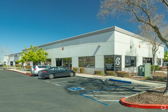
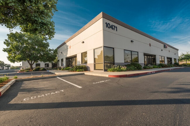
Property Record
10471 Grant Line Rd, Elk Grove, CA 95624

Current Lease Availabilities
NEARBY LISTINGS FOR SALE OR LEASE
-
-
View all Elk Grove listings for lease on LoopNet.com
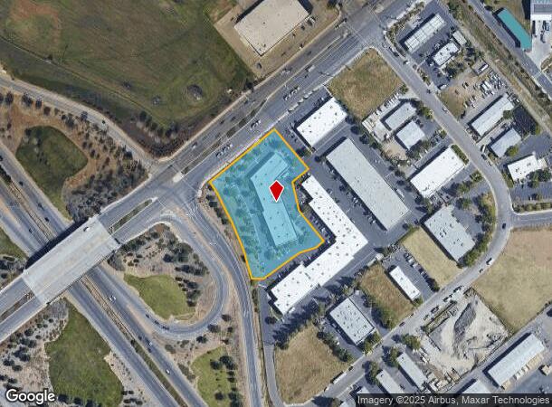
Property Detail
10471 Grant Line Rd
Sacramento--Roseville--Arden-Arcade, CA
Parcel Map
134-0510-035
PARCEL MAP, LOT 2
Multitenantindustrial
Sacramento
X
California
06067C0338H
2
2024
1.97 AC
2025
Elk Grove/Laguna
009336
Sacramento
23,347 SF
DEMOGRAPHICS near 10471 Grant Line Rd
1 Mile
3 Mile
5 Mile
2024 Total Population
2,397
38,617
123,836
2029 Population
2,558
39,452
125,127
Pop Growth 2024-2029
+ 6.72%
+ 2.16%
+ 1.04%
Average Age
35
39
39
2024 Total Households
725
11,951
37,784
HH Growth 2024-2029
+ 6.48%
+ 2.10%
+ 1.01%
Median Household Inc
$116,115
$114,294
$109,328
Avg Household Size
3.30
3.10
3.20
2024 Avg HH Vehicles
2.00
2.00
2.00
Median Home Value
$656,674
$611,392
$582,473
Median Year Built
2010
2000
2001
Nearby Places
- Restaurants
- Banks
- Shops
- Fitness
- Groceries
PUBLIC TRANSPORTATION
AIRPORT
Sacramento International
DRIVE
WALK
Distance
Sacramento International
39 min
28.5 mi
Stockton Metro
DRIVE
WALK
Distance
Stockton Metro
48 min
37.7 mi
Freight Ports
Port of Stockton
DRIVE
WALK
Distance
Port of Stockton
46 min
36.2 mi
Nearby Properties
Address
Land Use
TOTAL SIZE
Lot Size
Zoning
Address
Land Use
TOTAL SIZE
Lot Size
Zoning
43.54 AC
LI
Address
Land Use
TOTAL SIZE
Lot Size
Zoning
7.65 AC
RD-20
Address
Land Use
TOTAL SIZE
Lot Size
Zoning
43.06 AC
LRSPA
Address
Land Use
TOTAL SIZE
Lot Size
Zoning
221,556 SF
20.10 AC
HI
Address
Land Use
TOTAL SIZE
Lot Size
Zoning
9.02 AC
SPASEPA
Address
Land Use
TOTAL SIZE
Lot Size
Zoning
64,579 SF
5.41 AC
LRSPA
Address
Land Use
TOTAL SIZE
Lot Size
Zoning
111,489 SF
4.96 AC
MP
Address
Land Use
TOTAL SIZE
Lot Size
Zoning
102,526 SF
4.06 AC
MP
Address
Land Use
TOTAL SIZE
Lot Size
Zoning
100 SF
50.85 AC
LRSPA
Address
Land Use
TOTAL SIZE
Lot Size
Zoning
5.38 AC
SC
Address
Land Use
TOTAL SIZE
Lot Size
Zoning
63,550 SF
5.53 AC
AC
Address
Land Use
TOTAL SIZE
Lot Size
Zoning
21.18 AC
HI
Address
Land Use
TOTAL SIZE
Lot Size
Zoning
53,949 SF
5.33 AC
AC
Address
Land Use
TOTAL SIZE
Lot Size
Zoning
15.50 AC
LRSPA
Address
Land Use
TOTAL SIZE
Lot Size
Zoning
14.46 AC
LRSPA
Address
Land Use
TOTAL SIZE
Lot Size
Zoning
13.28 AC
LRSPA
Address
Land Use
TOTAL SIZE
Lot Size
Zoning
125,640 SF
10.25 AC
SC
Address
Land Use
TOTAL SIZE
Lot Size
Zoning
150,210 SF
6.25 AC
LI
Address
Land Use
TOTAL SIZE
Lot Size
Zoning
3.71 AC
RD-20
Address
Land Use
TOTAL SIZE
Lot Size
Zoning
56,892 SF
6.18 AC
AC
Address
Land Use
TOTAL SIZE
Lot Size
Zoning
62,002 SF
7.44 AC
AC
Address
Land Use
TOTAL SIZE
Lot Size
Zoning
45,543 SF
8.20 AC
AC
Address
Land Use
TOTAL SIZE
Lot Size
Zoning
128,325 SF
9.71 AC
RD-18 O
Address
Land Use
TOTAL SIZE
Lot Size
Zoning
54,977 SF
3.94 AC
LI
Address
Land Use
TOTAL SIZE
Lot Size
Zoning
485 AC
AG-80
Address
Land Use
TOTAL SIZE
Lot Size
Zoning
62,963 SF
4.94 AC
LC
Address
Land Use
TOTAL SIZE
Lot Size
Zoning
7,704 SF
17.01 AC
HI
Address
Land Use
TOTAL SIZE
Lot Size
Zoning
123,500 SF
5.94 AC
GC
Address
Land Use
TOTAL SIZE
Lot Size
Zoning
137,500 SF
7.44 AC
LI
Address
Land Use
TOTAL SIZE
Lot Size
Zoning
42,426 SF
4.20 AC
LI
The World's #1 Commercial Real Estate Marketplace
Connect with us
© 2025 CoStar Group
The information above has been obtained from sources believed reliable. While we do not doubt its accuracy we have not verified it and make no guarantee, warranty or representation about it. It is your responsibility to independently confirm its accuracy and completeness. Any projections, opinions, assumptions, or estimates used are for example only and do not represent the current or future performance of the property. The value of this transaction to you depends on tax and other factors which should be evaluated by your tax, financial, and legal advisors. You and your advisors should conduct a careful, independent investigation of the property to determine to your satisfaction the suitability of the property for your needs.