Property Record
10476 131St St, Largo, FL 33774
NEARBY LISTINGS FOR SALE OR LEASE
-
-
View all Largo listings for sale on LoopNet.com
Property Detail
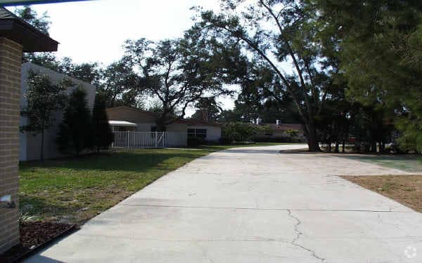
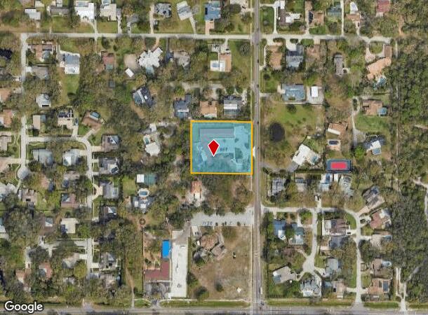
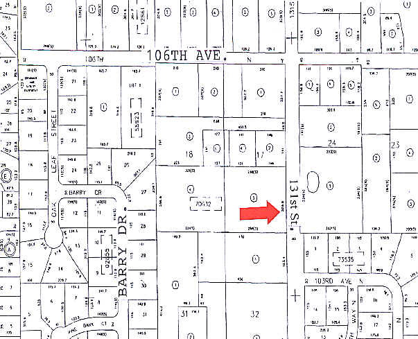
10476 131St St
Tampa-St. Petersburg-Clearwater, FL
Pinellas Groves
17-30-15-70632-300-1703
PINELLAS GROVES SE 1/4, SEC 17-30-15 S 255.81FT OF W 298FT(S) OF LOT 17
Hospitalprivate
Pinellas
X
Florida
12103C0177H
17
2024
1.75 AC
2025
Mid-Pinellas
025119
Tampa/St Petersburg
14,262 SF
DEMOGRAPHICS near 10476 131St St
1 Mile
3 Mile
5 Mile
2024 Total Population
9,326
84,423
171,614
2029 Population
9,250
85,381
173,464
Pop Growth 2024-2029
(0.81%)
+ 1.13%
+ 1.08%
Average Age
46
49
49
2024 Total Households
3,753
39,387
80,654
HH Growth 2024-2029
(0.96%)
+ 1.30%
+ 1.10%
Median Household Inc
$90,444
$68,720
$65,986
Avg Household Size
2.40
2.10
2.10
2024 Avg HH Vehicles
2.00
2.00
2.00
Median Home Value
$381,097
$325,929
$306,778
Median Year Built
1975
1975
1975
Nearby Places
Map Layers
Map Styles
 Street
 Aerial
- Restaurants
- Banks
- Shops
- Fitness
- Groceries
PUBLIC TRANSPORTATION
AIRPORT
St Pete-Clearwater International
DRIVE
WALK
Distance
St Pete-Clearwater International
27 min
12.3 mi
Tampa International
DRIVE
WALK
Distance
Tampa International
39 min
23.8 mi
Freight Ports
Port Manatee
DRIVE
WALK
Distance
Port Manatee
59 min
37.3 mi
Nearby Properties
Address
Land Use
TOTAL SIZE
Lot Size
Zoning
Address
Land Use
TOTAL SIZE
Lot Size
Zoning
537,958 SF
41.61 AC
C2
Address
Land Use
TOTAL SIZE
Lot Size
Zoning
372,952 SF
31.56 AC
Address
Land Use
TOTAL SIZE
Lot Size
Zoning
367,081 SF
13.80 AC
Address
Land Use
TOTAL SIZE
Lot Size
Zoning
223,748 SF
100.32 AC
R3
Address
Land Use
TOTAL SIZE
Lot Size
Zoning
333,425 SF
33.66 AC
Address
Land Use
TOTAL SIZE
Lot Size
Zoning
318,185 SF
38.78 AC
C2
Address
Land Use
TOTAL SIZE
Lot Size
Zoning
227,858 SF
64.31 AC
AE
Address
Land Use
TOTAL SIZE
Lot Size
Zoning
294,101 SF
22.55 AC
Address
Land Use
TOTAL SIZE
Lot Size
Zoning
10,474 SF
660.47 AC
R3
Address
Land Use
TOTAL SIZE
Lot Size
Zoning
261,486 SF
30.21 AC
RPD20
Address
Land Use
TOTAL SIZE
Lot Size
Zoning
129,600 SF
7.09 AC
Address
Land Use
TOTAL SIZE
Lot Size
Zoning
267,730 SF
35.84 AC
AE
Address
Land Use
TOTAL SIZE
Lot Size
Zoning
6,098 SF
374.66 AC
AE
Address
Land Use
TOTAL SIZE
Lot Size
Zoning
186,391 SF
11.86 AC
Address
Land Use
TOTAL SIZE
Lot Size
Zoning
5,647 SF
187.56 AC
AE
Address
Land Use
TOTAL SIZE
Lot Size
Zoning
157,769 SF
4.47 AC
Address
Land Use
TOTAL SIZE
Lot Size
Zoning
159,667 SF
20 AC
AE
Address
Land Use
TOTAL SIZE
Lot Size
Zoning
236,240 SF
12.38 AC
RPD15
Address
Land Use
TOTAL SIZE
Lot Size
Zoning
222,888 SF
11.83 AC
RPD15
Address
Land Use
TOTAL SIZE
Lot Size
Zoning
152,088 SF
92.28 AC
PC
Address
Land Use
TOTAL SIZE
Lot Size
Zoning
385,858 SF
8.83 AC
Address
Land Use
TOTAL SIZE
Lot Size
Zoning
133,440 SF
6.85 AC
RM15
Address
Land Use
TOTAL SIZE
Lot Size
Zoning
440 SF
3.47 AC
Address
Land Use
TOTAL SIZE
Lot Size
Zoning
102,073 SF
9.07 AC
Address
Land Use
TOTAL SIZE
Lot Size
Zoning
160,134 SF
18.61 AC
R2
Address
Land Use
TOTAL SIZE
Lot Size
Zoning
160,616 SF
11.88 AC
Address
Land Use
TOTAL SIZE
Lot Size
Zoning
147,755 SF
6.86 AC
Address
Land Use
TOTAL SIZE
Lot Size
Zoning
95,997 SF
13.61 AC
RM15
Address
Land Use
TOTAL SIZE
Lot Size
Zoning
167,424 SF
17.30 AC
RM1
Address
Land Use
TOTAL SIZE
Lot Size
Zoning
110,192 SF
4.58 AC
The World's #1 Commercial Real Estate Marketplace
Connect with us
© 2025 CoStar Group
The information above has been obtained from sources believed reliable. While we do not doubt its accuracy we have not verified it and make no guarantee, warranty or representation about it. It is your responsibility to independently confirm its accuracy and completeness. Any projections, opinions, assumptions, or estimates used are for example only and do not represent the current or future performance of the property. The value of this transaction to you depends on tax and other factors which should be evaluated by your tax, financial, and legal advisors. You and your advisors should conduct a careful, independent investigation of the property to determine to your satisfaction the suitability of the property for your needs.