Property Record
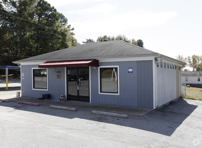
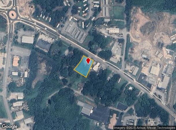
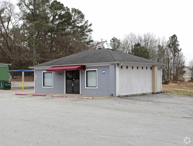
1048 Alabama St, Carrollton, GA 30117
NEARBY LISTINGS FOR SALE OR LEASE
Property Detail
1048 Alabama St
C08-0370031
LAUDROMAT/LOT ALABAMA ST C54
Restaurantbuilding
Carroll
X
Georgia
13045C0253D
0.64 AC
2025
W Carroll County
2025
Atlanta
910502
Atlanta-Sandy Springs-Roswell, GA
875 SF
DEMOGRAPHICS near 1048 Alabama St
1 Mile
3 Mile
5 Mile
2024 Total Population
7,629
29,752
45,490
2029 Population
8,431
33,004
50,477
Pop Growth 2024-2029
+ 10.51%
+ 10.93%
+ 10.96%
Average Age
29
35
36
2024 Total Households
2,270
10,745
16,437
HH Growth 2024-2029
+ 11.06%
+ 11.21%
+ 11.18%
Median Household Inc
$25,922
$43,086
$48,279
Avg Household Size
2.50
2.50
2.60
2024 Avg HH Vehicles
2.00
2.00
2.00
Median Home Value
$141,616
$214,926
$220,730
Median Year Built
1991
1984
1985
Nearby Places
Map Layers
Map Styles
 Street
 Aerial
- Restaurants
- Banks
- Shops
- Fitness
- Groceries
Nearby Properties
Address
Land Use
TOTAL SIZE
Lot Size
Zoning
Address
Land Use
TOTAL SIZE
Lot Size
Zoning
53.04 AC
OI
Address
Land Use
TOTAL SIZE
Lot Size
Zoning
50,000 SF
28.63 AC
HS
Address
Land Use
TOTAL SIZE
Lot Size
Zoning
106,769 SF
11.26 AC
HS
Address
Land Use
TOTAL SIZE
Lot Size
Zoning
1,542,912 SF
118.16 AC
M2
Address
Land Use
TOTAL SIZE
Lot Size
Zoning
452,050 SF
34 AC
M2
Address
Land Use
TOTAL SIZE
Lot Size
Zoning
261,905 SF
64.74 AC
R2
Address
Land Use
TOTAL SIZE
Lot Size
Zoning
820,922 SF
84.15 AC
M2
Address
Land Use
TOTAL SIZE
Lot Size
Zoning
351,903 SF
30.04 AC
C2
Address
Land Use
TOTAL SIZE
Lot Size
Zoning
39,268 SF
12.05 AC
RM-10
Address
Land Use
TOTAL SIZE
Lot Size
Zoning
134,113 SF
2.80 AC
OI
Address
Land Use
TOTAL SIZE
Lot Size
Zoning
32,778 SF
3.89 AC
OI
Address
Land Use
TOTAL SIZE
Lot Size
Zoning
35.33 AC
OI
Address
Land Use
TOTAL SIZE
Lot Size
Zoning
354,354 SF
51.15 AC
I
Address
Land Use
TOTAL SIZE
Lot Size
Zoning
159,860 SF
20.74 AC
C2
Address
Land Use
TOTAL SIZE
Lot Size
Zoning
73,900 SF
10.57 AC
C2
Address
Land Use
TOTAL SIZE
Lot Size
Zoning
142,740 SF
8.13 AC
C2
Address
Land Use
TOTAL SIZE
Lot Size
Zoning
44,708 SF
9.92 AC
RESIDENTIA
Address
Land Use
TOTAL SIZE
Lot Size
Zoning
162,506 SF
23.32 AC
M2
Address
Land Use
TOTAL SIZE
Lot Size
Zoning
13,585 SF
14.93 AC
R3
Address
Land Use
TOTAL SIZE
Lot Size
Zoning
56,458 SF
21.87 AC
R3
Address
Land Use
TOTAL SIZE
Lot Size
Zoning
12,752 SF
15.63 AC
R3
Address
Land Use
TOTAL SIZE
Lot Size
Zoning
23,801 SF
14.78 AC
PD/R-M
Address
Land Use
TOTAL SIZE
Lot Size
Zoning
162,219 SF
31 AC
M2
Address
Land Use
TOTAL SIZE
Lot Size
Zoning
13,185 SF
26.29 AC
R4
Address
Land Use
TOTAL SIZE
Lot Size
Zoning
83,421 SF
4.28 AC
C2
Address
Land Use
TOTAL SIZE
Lot Size
Zoning
19,960 SF
0.53 AC
HS
Address
Land Use
TOTAL SIZE
Lot Size
Zoning
97,509 SF
15.50 AC
001
Address
Land Use
TOTAL SIZE
Lot Size
Zoning
7,700 SF
7.08 AC
R3
Address
Land Use
TOTAL SIZE
Lot Size
Zoning
17,102 SF
33.57 AC
R3
Address
Land Use
TOTAL SIZE
Lot Size
Zoning
17,000 SF
13.52 AC
R3
The World's #1 Commercial Real Estate Marketplace
Connect with us
© 2025 CoStar Group
The information above has been obtained from sources believed reliable. While we do not doubt its accuracy we have not verified it and make no guarantee, warranty or representation about it. It is your responsibility to independently confirm its accuracy and completeness. Any projections, opinions, assumptions, or estimates used are for example only and do not represent the current or future performance of the property. The value of this transaction to you depends on tax and other factors which should be evaluated by your tax, financial, and legal advisors. You and your advisors should conduct a careful, independent investigation of the property to determine to your satisfaction the suitability of the property for your needs.