Property Record
1048 Industrial Ct, Suwanee, GA 30024
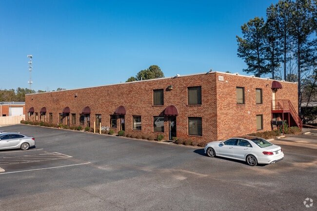
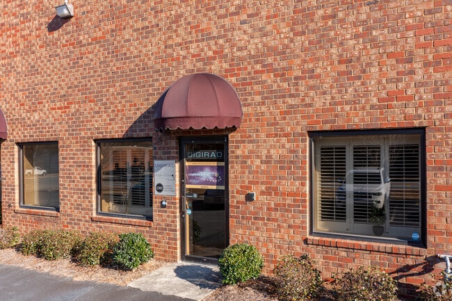
Property Detail
1048 Industrial Ct
7-209-120
L5.9 BA SUWANEE CRK IN SUITE F
Warehouse
Gwinnett
M1
Georgia
B and X Area of moderate flood hazard, usually the area between the limits of the 100-year and 500-year floods.
5
2025
0.03 AC
2025
Duluth/Suwanee/Buford
050223
Atlanta
1,500 SF
Atlanta-Sandy Springs-Roswell, GA
NEARBY LISTINGS FOR SALE OR LEASE
-
-
View all Suwanee listings for sale on LoopNet.com
DEMOGRAPHICS near 1048 Industrial Ct
1 mile
3 mile
5 mile
2024 Total Population
10,088
60,521
182,167
2029 Population
10,737
63,775
191,055
Pop Growth 2024-2029
+ 6.43%
+ 5.38%
+ 4.88%
Average Age
38
39
39
2024 Total Households
3,992
20,839
61,267
HH Growth 2024-2029
+ 6.46%
+ 5.56%
+ 4.97%
Median Household Inc
$86,074
$113,551
$114,479
Avg Household Size
2.50
2.90
2.90
2024 Avg HH Vehicles
2.00
2.00
2.00
Median Home Value
$417,888
$485,437
$480,619
Median Year Built
2000
2000
1998
Nearby Places
Map Layers
Map Styles
 Street
 Aerial
Transit
 Traffic
 Biking
Places
Listings with unknown addresses are not visible on the map
- Restaurants
- Banks
- Shops
- Fitness
- Groceries
Nearby Properties
Address
Land Use
TOTAL SIZE
Lot Size
Zoning
Address
Land Use
TOTAL SIZE
Lot Size
Zoning
482,658 SF
17.05 AC
MUR
Address
Land Use
TOTAL SIZE
Lot Size
Zoning
509,302 SF
55.13 AC
RM8
Address
Land Use
TOTAL SIZE
Lot Size
Zoning
534,578 SF
44.21 AC
RM8
Address
Land Use
TOTAL SIZE
Lot Size
Zoning
393,939 SF
42.21 AC
RM8
Address
Land Use
TOTAL SIZE
Lot Size
Zoning
404,176 SF
32.67 AC
M2
Address
Land Use
TOTAL SIZE
Lot Size
Zoning
280,454 SF
19.97 AC
MUR
Address
Land Use
TOTAL SIZE
Lot Size
Zoning
359,241 SF
21.02 AC
PMUD
Address
Land Use
TOTAL SIZE
Lot Size
Zoning
471,807 SF
69.50 AC
R100
Address
Land Use
TOTAL SIZE
Lot Size
Zoning
379,183 SF
6.09 AC
PMUD
Address
Land Use
TOTAL SIZE
Lot Size
Zoning
334,841 SF
28.14 AC
RM13
Address
Land Use
TOTAL SIZE
Lot Size
Zoning
304,276 SF
14.90 AC
MUR
Address
Land Use
TOTAL SIZE
Lot Size
Zoning
428,329 SF
18.44 AC
RM24
Address
Land Use
TOTAL SIZE
Lot Size
Zoning
372,904 SF
11.64 AC
PUD
Address
Land Use
TOTAL SIZE
Lot Size
Zoning
253,169 SF
8.74 AC
RM24
Address
Land Use
TOTAL SIZE
Lot Size
Zoning
234,420 SF
10.35 AC
PMUD
Address
Land Use
TOTAL SIZE
Lot Size
Zoning
220,779 SF
7.32 AC
PMUD
Address
Land Use
TOTAL SIZE
Lot Size
Zoning
287,187 SF
9.96 AC
RM24
Address
Land Use
TOTAL SIZE
Lot Size
Zoning
248,400 SF
13.92 AC
MUO
Address
Land Use
TOTAL SIZE
Lot Size
Zoning
385,167 SF
49.55 AC
M1
Address
Land Use
TOTAL SIZE
Lot Size
Zoning
503,650 SF
34.37 AC
M1
Address
Land Use
TOTAL SIZE
Lot Size
Zoning
332,011 SF
8.84 AC
PMUD
Address
Land Use
TOTAL SIZE
Lot Size
Zoning
6,552 SF
235.95 AC
R140
Address
Land Use
TOTAL SIZE
Lot Size
Zoning
327,360 SF
26.42 AC
M1
Address
Land Use
TOTAL SIZE
Lot Size
Zoning
553,941 SF
32.82 AC
M1
Address
Land Use
TOTAL SIZE
Lot Size
Zoning
184,890 SF
3 AC
PMUD
Address
Land Use
TOTAL SIZE
Lot Size
Zoning
595,760 SF
39.11 AC
M1
Address
Land Use
TOTAL SIZE
Lot Size
Zoning
185,524 SF
12.61 AC
M1
Address
Land Use
TOTAL SIZE
Lot Size
Zoning
160,021 SF
14.27 AC
PMUD
Address
Land Use
TOTAL SIZE
Lot Size
Zoning
201,040 SF
26.40 AC
R100
Address
Land Use
TOTAL SIZE
Lot Size
Zoning
235,807 SF
1.90 AC
M1
The World's #1 Commercial Real Estate Marketplace
Connect with us
© 2026 CoStar Group
The information above has been obtained from sources believed reliable. While we do not doubt its accuracy we have not verified it and make no guarantee, warranty or representation about it. It is your responsibility to independently confirm its accuracy and completeness. Any projections, opinions, assumptions, or estimates used are for example only and do not represent the current or future performance of the property. The value of this transaction to you depends on tax and other factors which should be evaluated by your tax, financial, and legal advisors. You and your advisors should conduct a careful, independent investigation of the property to determine to your satisfaction the suitability of the property for your needs.