Property Record
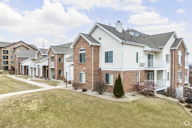
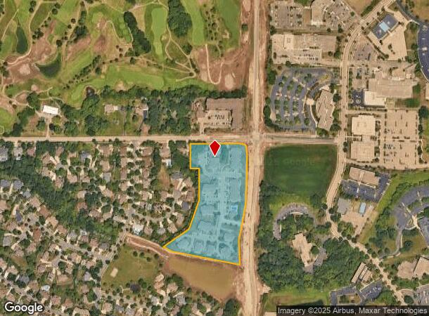
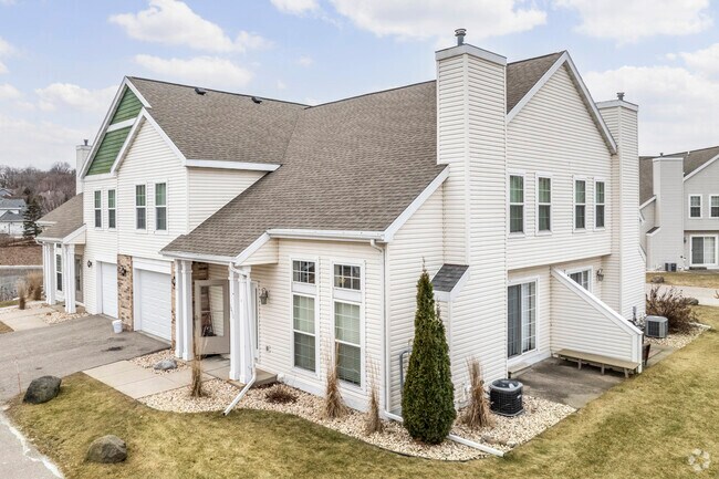
1048 N Pleasant View Rd, Middleton, WI 53562
NEARBY LISTINGS FOR SALE OR LEASE
Property Detail
1048 N Pleasant View Rd
Madison, WI
First Addition To Blackhawk Subdivision
0708-153-0817-1
FIRST ADDITION TO BLACKHAWK SUBDIVISION, LOT 57 & THIRD ADDITION TO BLACKHAWK SU BDIVISION, LOT 143; EXCEPT LANDS CONVEYED FOR ROW PER DOC #5808880.
Commercialnec
Dane
X
Wisconsin
55025C0383G
57
2024
9.53 AC
2024
Outer Middleton
011101
Milwaukee/Madison
213,857 SF
DEMOGRAPHICS near 1048 N Pleasant View Rd
1 Mile
3 Mile
5 Mile
2024 Total Population
8,303
55,342
121,505
2029 Population
8,547
57,812
126,391
Pop Growth 2024-2029
+ 2.94%
+ 4.46%
+ 4.02%
Average Age
40
41
40
2024 Total Households
3,974
25,536
55,065
HH Growth 2024-2029
+ 2.77%
+ 4.53%
+ 4.12%
Median Household Inc
$103,258
$92,804
$89,332
Avg Household Size
2.10
2.10
2.20
2024 Avg HH Vehicles
2.00
2.00
2.00
Median Home Value
$509,685
$431,660
$393,892
Median Year Built
1998
1993
1988
Nearby Places
Map Layers
Map Styles
 Street
 Aerial
- Restaurants
- Banks
- Shops
- Fitness
- Groceries
PUBLIC TRANSPORTATION
AIRPORT
Dane County Regional/Truax Field
DRIVE
WALK
Distance
Dane County Regional/Truax Field
27 min
15.7 mi
Freight Ports
Port Milwaukee
DRIVE
WALK
Distance
Port Milwaukee
113 min
92.8 mi
Nearby Properties
Address
Land Use
TOTAL SIZE
Lot Size
Zoning
Address
Land Use
TOTAL SIZE
Lot Size
Zoning
354,461 SF
37.40 AC
RMX
Address
Land Use
TOTAL SIZE
Lot Size
Zoning
15.61 AC
Address
Land Use
TOTAL SIZE
Lot Size
Zoning
700,496 SF
23.94 AC
SR-V2
Address
Land Use
TOTAL SIZE
Lot Size
Zoning
37,909 SF
10.27 AC
SEC
Address
Land Use
TOTAL SIZE
Lot Size
Zoning
203,672 SF
7.34 AC
PD
Address
Land Use
TOTAL SIZE
Lot Size
Zoning
8.48 AC
Address
Land Use
TOTAL SIZE
Lot Size
Zoning
169,563 SF
19.82 AC
SEC
Address
Land Use
TOTAL SIZE
Lot Size
Zoning
10.12 AC
Address
Land Use
TOTAL SIZE
Lot Size
Zoning
5.95 AC
Address
Land Use
TOTAL SIZE
Lot Size
Zoning
11.09 AC
Address
Land Use
TOTAL SIZE
Lot Size
Zoning
161,767 SF
4.58 AC
CC-T
Address
Land Use
TOTAL SIZE
Lot Size
Zoning
2.91 AC
SE
Address
Land Use
TOTAL SIZE
Lot Size
Zoning
4.05 AC
CC-T
Address
Land Use
TOTAL SIZE
Lot Size
Zoning
326,724 SF
4.23 AC
PD
Address
Land Use
TOTAL SIZE
Lot Size
Zoning
254,922 SF
11.97 AC
PD
Address
Land Use
TOTAL SIZE
Lot Size
Zoning
159,686 SF
7.39 AC
SEC
Address
Land Use
TOTAL SIZE
Lot Size
Zoning
4.37 AC
Address
Land Use
TOTAL SIZE
Lot Size
Zoning
Address
Land Use
TOTAL SIZE
Lot Size
Zoning
320,074 SF
9.28 AC
SR-V2
Address
Land Use
TOTAL SIZE
Lot Size
Zoning
229,381 SF
7.35 AC
PD
Address
Land Use
TOTAL SIZE
Lot Size
Zoning
37,909 SF
10.27 AC
SEC
Address
Land Use
TOTAL SIZE
Lot Size
Zoning
6.57 AC
SR-V2
Address
Land Use
TOTAL SIZE
Lot Size
Zoning
2.98 AC
TR-U2
Address
Land Use
TOTAL SIZE
Lot Size
Zoning
Address
Land Use
TOTAL SIZE
Lot Size
Zoning
10.01 AC
Address
Land Use
TOTAL SIZE
Lot Size
Zoning
34,457 SF
9.04 AC
PD
Address
Land Use
TOTAL SIZE
Lot Size
Zoning
125,786 SF
5.62 AC
A
Address
Land Use
TOTAL SIZE
Lot Size
Zoning
264,603 SF
10.32 AC
PD
Address
Land Use
TOTAL SIZE
Lot Size
Zoning
119,297 SF
4.19 AC
TR-P
Address
Land Use
TOTAL SIZE
Lot Size
Zoning
2.03 AC
TR-P
The World's #1 Commercial Real Estate Marketplace
Connect with us
© 2026 CoStar Group
The information above has been obtained from sources believed reliable. While we do not doubt its accuracy we have not verified it and make no guarantee, warranty or representation about it. It is your responsibility to independently confirm its accuracy and completeness. Any projections, opinions, assumptions, or estimates used are for example only and do not represent the current or future performance of the property. The value of this transaction to you depends on tax and other factors which should be evaluated by your tax, financial, and legal advisors. You and your advisors should conduct a careful, independent investigation of the property to determine to your satisfaction the suitability of the property for your needs.