Property Record
1049 Baltimore St, Hanover, PA 17331
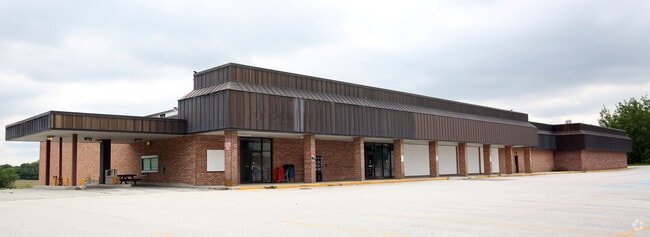

Property Detail
1049 Baltimore St
Publicstorage
YORK
CM
Pennsylvania
B and X Area of moderate flood hazard, usually the area between the limits of the 100-year and 500-year floods.
5.79 AC
2026
York County
2026
Philadelphia
022000
York-Hanover, PA
46,696 SF
44-000-CD-0061.H0-00000
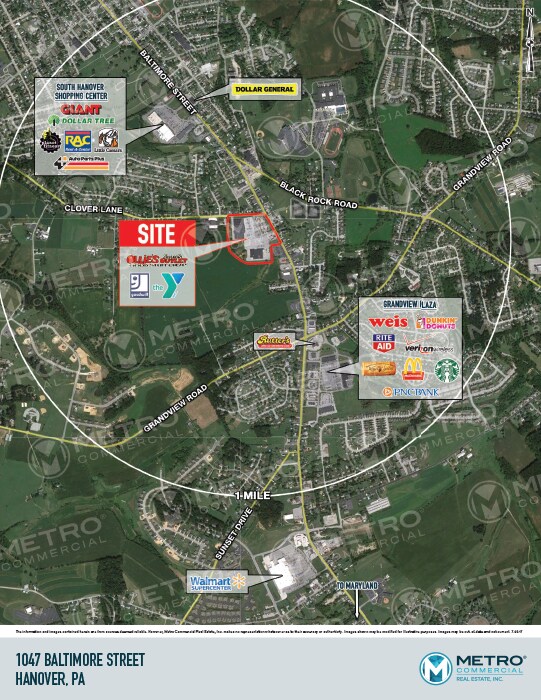
NEARBY LISTINGS FOR SALE OR LEASE
DEMOGRAPHICS near 1049 Baltimore St
1 mile
3 mile
5 mile
2025 Total Population
7,972
44,726
62,573
2030 Population
8,320
46,395
64,685
Pop Growth 2025-2030
+ 4.37%
+ 3.73%
+ 3.38%
Average Age
41
42
42
2025 Total Households
3,038
17,863
24,911
HH Growth 2025-2030
+ 4.41%
+ 3.81%
+ 3.48%
Median Household Inc
$83,593
$73,085
$76,538
Avg Household Size
2.50
2.40
2.40
2025 Avg HH Vehicles
2.00
2.00
2.00
Median Home Value
$243,672
$239,428
$252,595
Median Year Built
1987
1975
1978
Nearby Places
Map Layers
Map Styles
 Street
 Aerial
Layers
 Traffic
 Biking
Places
Listings with unknown addresses are not visible on the map
- Restaurants
- Banks
- Shops
- Fitness
- Groceries
SALE & LEASE HISTORY
LISTING DATE
SALE/LEASE

Dec 01, 2021
For Sale
Aug 03, 2017
For Lease
Nearby Properties
Address
Land Use
TOTAL SIZE
Lot Size
Zoning
Address
Land Use
TOTAL SIZE
Lot Size
Zoning
65,738 SF
89.96 AC
RS
Address
Land Use
TOTAL SIZE
Lot Size
Zoning
2,331 SF
104.05 AC
CI
Address
Land Use
TOTAL SIZE
Lot Size
Zoning
19.01 AC
Address
Land Use
TOTAL SIZE
Lot Size
Zoning
59,212 SF
38.80 AC
RS
Address
Land Use
TOTAL SIZE
Lot Size
Zoning
15.58 AC
SC
Address
Land Use
TOTAL SIZE
Lot Size
Zoning
190,175 SF
20.98 AC
ID
Address
Land Use
TOTAL SIZE
Lot Size
Zoning
307,500 SF
23.24 AC
ID
Address
Land Use
TOTAL SIZE
Lot Size
Zoning
360,608 SF
46.91 AC
ID
Address
Land Use
TOTAL SIZE
Lot Size
Zoning
49,736 SF
20.73 AC
CM
Address
Land Use
TOTAL SIZE
Lot Size
Zoning
6.16 AC
CI
Address
Land Use
TOTAL SIZE
Lot Size
Zoning
386,528 SF
2.35 AC
ID
Address
Land Use
TOTAL SIZE
Lot Size
Zoning
13.32 AC
CI
Address
Land Use
TOTAL SIZE
Lot Size
Zoning
376,800 SF
26.23 AC
ID
Address
Land Use
TOTAL SIZE
Lot Size
Zoning
Address
Land Use
TOTAL SIZE
Lot Size
Zoning
291,626 SF
39.16 AC
ID
Address
Land Use
TOTAL SIZE
Lot Size
Zoning
183,195 SF
22.71 AC
CI
Address
Land Use
TOTAL SIZE
Lot Size
Zoning
Address
Land Use
TOTAL SIZE
Lot Size
Zoning
38,712 SF
7.63 AC
CM
Address
Land Use
TOTAL SIZE
Lot Size
Zoning
369,686 SF
13.75 AC
ID
Address
Land Use
TOTAL SIZE
Lot Size
Zoning
1,704 SF
7.93 AC
SR
Address
Land Use
TOTAL SIZE
Lot Size
Zoning
9.68 AC
ID
Address
Land Use
TOTAL SIZE
Lot Size
Zoning
49.06 AC
ID
Address
Land Use
TOTAL SIZE
Lot Size
Zoning
1,560 SF
255.36 AC
RS
Address
Land Use
TOTAL SIZE
Lot Size
Zoning
53,432 SF
9.34 AC
RS
Address
Land Use
TOTAL SIZE
Lot Size
Zoning
33,120 SF
6.95 AC
RS
Address
Land Use
TOTAL SIZE
Lot Size
Zoning
18.48 AC
CI
Address
Land Use
TOTAL SIZE
Lot Size
Zoning
141,100 SF
8.63 AC
ID
Address
Land Use
TOTAL SIZE
Lot Size
Zoning
51,520 SF
4.31 AC
RS
Address
Land Use
TOTAL SIZE
Lot Size
Zoning
54,288 SF
5.30 AC
CM
The World's #1 Commercial Real Estate Marketplace
Connect with us
© 2026 CoStar Group
The information above has been obtained from sources believed reliable. While we do not doubt its accuracy we have not verified it and make no guarantee, warranty or representation about it. It is your responsibility to independently confirm its accuracy and completeness. Any projections, opinions, assumptions, or estimates used are for example only and do not represent the current or future performance of the property. The value of this transaction to you depends on tax and other factors which should be evaluated by your tax, financial, and legal advisors. You and your advisors should conduct a careful, independent investigation of the property to determine to your satisfaction the suitability of the property for your needs.