Property Record
1049 Durham Rd, Roxboro, NC 27573

Property Detail
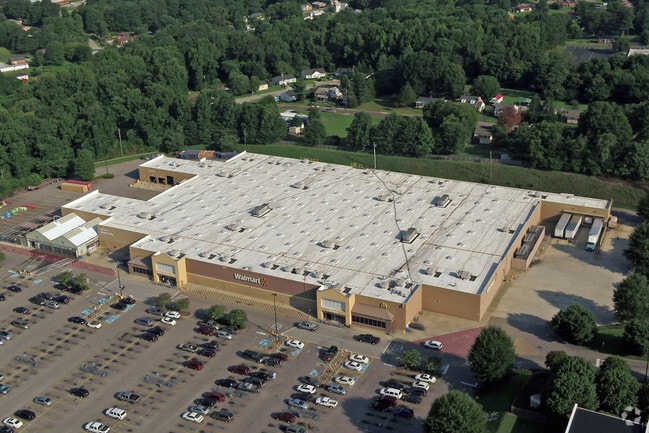
1049 Durham Rd
Durham-Chapel Hill, NC
WALMART/LT1/19&76AC
111-1
PERSON
Autorepair
North Carolina
AE The base floodplain where base flood elevations are provided. AE Zones are now used on new format FIRMs instead of A1-A30 Zones.
1
2025
19.76 AC
2025
Person County
920601
Raleigh/Durham
153,823 SF
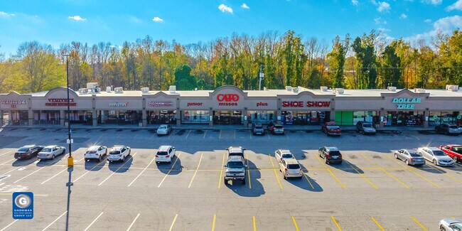
NEARBY LISTINGS FOR SALE OR LEASE
DEMOGRAPHICS near 1049 Durham Rd
1 mile
3 mile
5 mile
2025 Total Population
2,305
11,329
19,800
2030 Population
2,418
11,731
20,411
Pop Growth 2025-2030
+ 4.90%
+ 3.55%
+ 3.09%
Average Age
42
42
42
2025 Total Households
998
4,858
8,280
HH Growth 2025-2030
+ 4.81%
+ 3.58%
+ 3.13%
Median Household Inc
$53,901
$46,892
$51,741
Avg Household Size
2.10
2.30
2.30
2025 Avg HH Vehicles
2.00
2.00
2.00
Median Home Value
$156,666
$172,297
$178,923
Median Year Built
1972
1976
1980
Nearby Places
Map Layers
Map Styles
 Street
 Aerial
Transit
 Traffic
 Biking
Places
Listings with unknown addresses are not visible on the map
- Restaurants
- Banks
- Shops
- Fitness
- Groceries
SALE & LEASE HISTORY
LISTING DATE
SALE/LEASE

Dec 02, 2024
For Sale
Nearby Properties
Address
Land Use
TOTAL SIZE
Lot Size
Zoning
Address
Land Use
TOTAL SIZE
Lot Size
Zoning
54,132 SF
42.03 AC
Address
Land Use
TOTAL SIZE
Lot Size
Zoning
112,896 SF
8.82 AC
Address
Land Use
TOTAL SIZE
Lot Size
Zoning
23,040 SF
173 AC
Address
Land Use
TOTAL SIZE
Lot Size
Zoning
7,305 SF
4.41 AC
Address
Land Use
TOTAL SIZE
Lot Size
Zoning
105,170 SF
17.68 AC
Address
Land Use
TOTAL SIZE
Lot Size
Zoning
968 SF
10 AC
Address
Land Use
TOTAL SIZE
Lot Size
Zoning
43,101 SF
20.63 AC
Address
Land Use
TOTAL SIZE
Lot Size
Zoning
71,339 SF
7.96 AC
RC
Address
Land Use
TOTAL SIZE
Lot Size
Zoning
70,797 SF
34.92 AC
Address
Land Use
TOTAL SIZE
Lot Size
Zoning
289,445 SF
40.62 AC
Address
Land Use
TOTAL SIZE
Lot Size
Zoning
22,292 SF
4.97 AC
Address
Land Use
TOTAL SIZE
Lot Size
Zoning
96,784 SF
11.53 AC
Address
Land Use
TOTAL SIZE
Lot Size
Zoning
62,596 SF
40 AC
Address
Land Use
TOTAL SIZE
Lot Size
Zoning
1,590 SF
8 AC
Address
Land Use
TOTAL SIZE
Lot Size
Zoning
24,872 SF
20 AC
Address
Land Use
TOTAL SIZE
Lot Size
Zoning
63,360 SF
8.05 AC
Address
Land Use
TOTAL SIZE
Lot Size
Zoning
33,613 SF
4.77 AC
Address
Land Use
TOTAL SIZE
Lot Size
Zoning
7,698 SF
5.08 AC
Address
Land Use
TOTAL SIZE
Lot Size
Zoning
9,464 SF
2.70 AC
Address
Land Use
TOTAL SIZE
Lot Size
Zoning
8,056 SF
2.64 AC
Address
Land Use
TOTAL SIZE
Lot Size
Zoning
2,131 SF
10 AC
Address
Land Use
TOTAL SIZE
Lot Size
Zoning
4,760 SF
14.89 AC
Address
Land Use
TOTAL SIZE
Lot Size
Zoning
15,460 SF
3.31 AC
Address
Land Use
TOTAL SIZE
Lot Size
Zoning
42,733 SF
3.99 AC
Address
Land Use
TOTAL SIZE
Lot Size
Zoning
32,808 SF
4.48 AC
Address
Land Use
TOTAL SIZE
Lot Size
Zoning
40,784 SF
0.97 AC
Address
Land Use
TOTAL SIZE
Lot Size
Zoning
32,728 SF
5.85 AC
Address
Land Use
TOTAL SIZE
Lot Size
Zoning
31,600 SF
11.50 AC
Address
Land Use
TOTAL SIZE
Lot Size
Zoning
75,000 SF
8.48 AC
The World's #1 Commercial Real Estate Marketplace
Connect with us
© 2026 CoStar Group
The information above has been obtained from sources believed reliable. While we do not doubt its accuracy we have not verified it and make no guarantee, warranty or representation about it. It is your responsibility to independently confirm its accuracy and completeness. Any projections, opinions, assumptions, or estimates used are for example only and do not represent the current or future performance of the property. The value of this transaction to you depends on tax and other factors which should be evaluated by your tax, financial, and legal advisors. You and your advisors should conduct a careful, independent investigation of the property to determine to your satisfaction the suitability of the property for your needs.