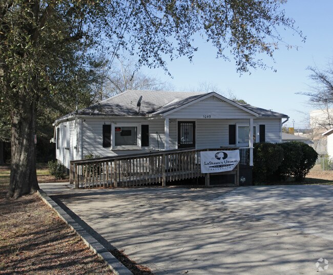
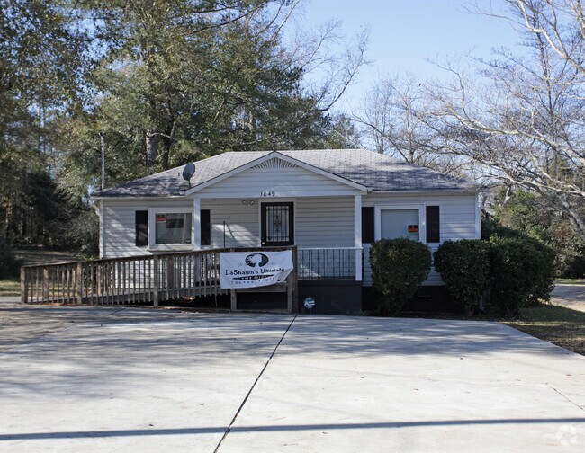
Property Record
1049 Mcbride Dr, Columbus, GA 31907

Property Detail
1049 Mcbride Dr
087-022-039
PT 25 L D GINN
Commercialnec
Muscogee
B and X Area of moderate flood hazard, usually the area between the limits of the 100-year and 500-year floods.
Georgia
2025
0.18 AC
2025
Greater Columbus
010701
Columbus GA
725 SF
Columbus, GA-AL
NEARBY LISTINGS FOR SALE OR LEASE
DEMOGRAPHICS near 1049 Mcbride Dr
1 mile
3 mile
5 mile
2025 Total Population
8,562
66,154
134,706
2030 Population
8,096
64,141
132,622
Pop Growth 2025-2030
(5.44%)
(3.04%)
(1.55%)
Average Age
39
39
38
2025 Total Households
3,255
26,479
54,359
HH Growth 2025-2030
(5.25%)
(2.69%)
(1.57%)
Median Household Inc
$46,027
$44,300
$44,395
Avg Household Size
2.60
2.40
2.40
2025 Avg HH Vehicles
2.00
2.00
2.00
Median Home Value
$97,456
$155,408
$160,811
Median Year Built
1968
1972
1972
Nearby Places
Map Layers
Map Styles
 Street
 Aerial
Layers
 Traffic
 Biking
Places
Listings with unknown addresses are not visible on the map
- Restaurants
- Banks
- Shops
- Fitness
- Groceries
PUBLIC TRANSPORTATION
AIRPORT
Columbus
Drive
Walk
Distance
Columbus
11 min
6.3 mi
Freight Ports
Port of Panama City
Drive
Walk
Distance
Port of Panama City
241 min
188.6 mi
SALE & LEASE HISTORY
LISTING DATE
SALE/LEASE

Sep 23, 2016
For Sale
Nov 21, 2016
For Lease
Nearby Properties
Address
Land Use
TOTAL SIZE
Lot Size
Zoning
Address
Land Use
TOTAL SIZE
Lot Size
Zoning
55,900 SF
27.05 AC
Address
Land Use
TOTAL SIZE
Lot Size
Zoning
210,532 SF
57.21 AC
Address
Land Use
TOTAL SIZE
Lot Size
Zoning
Address
Land Use
TOTAL SIZE
Lot Size
Zoning
56,095 SF
25.91 AC
Address
Land Use
TOTAL SIZE
Lot Size
Zoning
360 SF
106.65 AC
Address
Land Use
TOTAL SIZE
Lot Size
Zoning
4,802 SF
22.77 AC
Address
Land Use
TOTAL SIZE
Lot Size
Zoning
133,276 SF
36.76 AC
Address
Land Use
TOTAL SIZE
Lot Size
Zoning
45,932 SF
29 AC
Address
Land Use
TOTAL SIZE
Lot Size
Zoning
78,948 SF
6 AC
Address
Land Use
TOTAL SIZE
Lot Size
Zoning
53.77 AC
Address
Land Use
TOTAL SIZE
Lot Size
Zoning
90.59 AC
Address
Land Use
TOTAL SIZE
Lot Size
Zoning
140,739 SF
32.87 AC
Address
Land Use
TOTAL SIZE
Lot Size
Zoning
5,686 SF
17.64 AC
Address
Land Use
TOTAL SIZE
Lot Size
Zoning
48,100 SF
9 AC
Address
Land Use
TOTAL SIZE
Lot Size
Zoning
5,414 SF
17.11 AC
Address
Land Use
TOTAL SIZE
Lot Size
Zoning
271,364 SF
71.66 AC
Address
Land Use
TOTAL SIZE
Lot Size
Zoning
5,514 SF
15.28 AC
Address
Land Use
TOTAL SIZE
Lot Size
Zoning
32,202 SF
8.42 AC
Address
Land Use
TOTAL SIZE
Lot Size
Zoning
30,375 SF
33.14 AC
Address
Land Use
TOTAL SIZE
Lot Size
Zoning
134.35 AC
Address
Land Use
TOTAL SIZE
Lot Size
Zoning
137.48 AC
Address
Land Use
TOTAL SIZE
Lot Size
Zoning
13,440 SF
16.32 AC
Address
Land Use
TOTAL SIZE
Lot Size
Zoning
14,223 SF
6.80 AC
Address
Land Use
TOTAL SIZE
Lot Size
Zoning
104,778 SF
13.66 AC
Address
Land Use
TOTAL SIZE
Lot Size
Zoning
144,992 SF
50.91 AC
Address
Land Use
TOTAL SIZE
Lot Size
Zoning
117,740 SF
22.77 AC
Address
Land Use
TOTAL SIZE
Lot Size
Zoning
58,831 SF
12.18 AC
Address
Land Use
TOTAL SIZE
Lot Size
Zoning
4,386 SF
18 AC
Address
Land Use
TOTAL SIZE
Lot Size
Zoning
64.31 AC
Address
Land Use
TOTAL SIZE
Lot Size
Zoning
288,635 SF
32.01 AC
The World's #1 Commercial Real Estate Marketplace
Connect with us
© 2026 CoStar Group
The information above has been obtained from sources believed reliable. While we do not doubt its accuracy we have not verified it and make no guarantee, warranty or representation about it. It is your responsibility to independently confirm its accuracy and completeness. Any projections, opinions, assumptions, or estimates used are for example only and do not represent the current or future performance of the property. The value of this transaction to you depends on tax and other factors which should be evaluated by your tax, financial, and legal advisors. You and your advisors should conduct a careful, independent investigation of the property to determine to your satisfaction the suitability of the property for your needs.