Property Record
1049 Springmill St, Mansfield, OH 44906


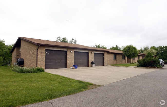
Property Detail
1049 Springmill St
Mansfield, OH
SE A 17.46 LT 18 PT SUBJ HWY EASE
027-04-292-30-000
Richland
Apartment
Ohio
B and X Area of moderate flood hazard, usually the area between the limits of the 100-year and 500-year floods.
18
2024
17.46 AC
2025
Mansfield
001500
Cleveland
15,168 SF
NEARBY LISTINGS FOR SALE OR LEASE
DEMOGRAPHICS near 1049 Springmill St
1 mile
3 mile
5 mile
2025 Total Population
3,535
25,177
63,194
2030 Population
3,569
25,303
63,091
Pop Growth 2025-2030
+ 0.96%
+ 0.50%
(0.16%)
Average Age
43
41
42
2025 Total Households
1,472
10,792
25,373
HH Growth 2025-2030
+ 0.95%
+ 0.46%
(0.22%)
Median Household Inc
$45,607
$44,831
$47,493
Avg Household Size
2.20
2.20
2.20
2025 Avg HH Vehicles
2.00
2.00
2.00
Median Home Value
$82,513
$127,635
$141,596
Median Year Built
1963
1958
1959
Nearby Places
Map Layers
Map Styles
 Street
 Aerial
Layers
 Traffic
 Biking
Places
Listings with unknown addresses are not visible on the map
- Restaurants
- Banks
- Shops
- Fitness
- Groceries
Nearby Properties
Address
Land Use
TOTAL SIZE
Lot Size
Zoning
Address
Land Use
TOTAL SIZE
Lot Size
Zoning
456.50 AC
Address
Land Use
TOTAL SIZE
Lot Size
Zoning
492,672 SF
6.83 AC
Address
Land Use
TOTAL SIZE
Lot Size
Zoning
6,400 SF
137.67 AC
Address
Land Use
TOTAL SIZE
Lot Size
Zoning
354,710 SF
7.07 AC
Address
Land Use
TOTAL SIZE
Lot Size
Zoning
139,809 SF
0.99 AC
Address
Land Use
TOTAL SIZE
Lot Size
Zoning
172,938 SF
16.05 AC
Address
Land Use
TOTAL SIZE
Lot Size
Zoning
136,951 SF
35.76 AC
Address
Land Use
TOTAL SIZE
Lot Size
Zoning
148,135 SF
6.89 AC
Address
Land Use
TOTAL SIZE
Lot Size
Zoning
263,840 SF
16 AC
Address
Land Use
TOTAL SIZE
Lot Size
Zoning
221,864 SF
20 AC
Address
Land Use
TOTAL SIZE
Lot Size
Zoning
36,708 SF
12.56 AC
Address
Land Use
TOTAL SIZE
Lot Size
Zoning
318,366 SF
26.16 AC
Address
Land Use
TOTAL SIZE
Lot Size
Zoning
204,882 SF
32.98 AC
Address
Land Use
TOTAL SIZE
Lot Size
Zoning
458,316 SF
27.90 AC
Address
Land Use
TOTAL SIZE
Lot Size
Zoning
217,680 SF
22.86 AC
Address
Land Use
TOTAL SIZE
Lot Size
Zoning
131,816 SF
17.69 AC
Address
Land Use
TOTAL SIZE
Lot Size
Zoning
15,490 SF
89.80 AC
Address
Land Use
TOTAL SIZE
Lot Size
Zoning
58,960 SF
2.30 AC
Address
Land Use
TOTAL SIZE
Lot Size
Zoning
125,778 SF
11.63 AC
Address
Land Use
TOTAL SIZE
Lot Size
Zoning
27,501 SF
16.40 AC
Address
Land Use
TOTAL SIZE
Lot Size
Zoning
134,984 SF
17.98 AC
Address
Land Use
TOTAL SIZE
Lot Size
Zoning
179,262 SF
22.54 AC
Address
Land Use
TOTAL SIZE
Lot Size
Zoning
161,800 SF
15.87 AC
Address
Land Use
TOTAL SIZE
Lot Size
Zoning
47.90 AC
Address
Land Use
TOTAL SIZE
Lot Size
Zoning
26,616 SF
1.10 AC
Address
Land Use
TOTAL SIZE
Lot Size
Zoning
63,442 SF
5.51 AC
Address
Land Use
TOTAL SIZE
Lot Size
Zoning
121,887 SF
12.68 AC
Address
Land Use
TOTAL SIZE
Lot Size
Zoning
161,297 SF
8.12 AC
Address
Land Use
TOTAL SIZE
Lot Size
Zoning
106,361 SF
5.06 AC
Address
Land Use
TOTAL SIZE
Lot Size
Zoning
88,556 SF
12.32 AC
The World's #1 Commercial Real Estate Marketplace
Connect with us
© 2026 CoStar Group
The information above has been obtained from sources believed reliable. While we do not doubt its accuracy we have not verified it and make no guarantee, warranty or representation about it. It is your responsibility to independently confirm its accuracy and completeness. Any projections, opinions, assumptions, or estimates used are for example only and do not represent the current or future performance of the property. The value of this transaction to you depends on tax and other factors which should be evaluated by your tax, financial, and legal advisors. You and your advisors should conduct a careful, independent investigation of the property to determine to your satisfaction the suitability of the property for your needs.