Property Record
1049 W Ridge Rd, Rochester, NY 14615
NEARBY LISTINGS FOR SALE OR LEASE
Property Detail
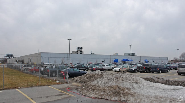
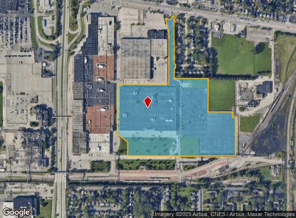
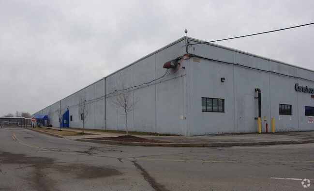
1049 W Ridge Rd
Rochester, NY
Monroe
261400 090.23-1-9.003
New York
Manufacturinglight
9.003
2025
25.92 AC
2024
Greater Rochester
001800
Rochester
343,399 SF
DEMOGRAPHICS near 1049 W Ridge Rd
1 Mile
3 Mile
5 Mile
2024 Total Population
14,285
115,514
299,471
2029 Population
14,160
113,673
295,072
Pop Growth 2024-2029
(0.88%)
(1.59%)
(1.47%)
Average Age
37
39
39
2024 Total Households
6,374
48,788
128,598
HH Growth 2024-2029
(0.85%)
(1.63%)
(1.48%)
Median Household Inc
$44,873
$47,945
$51,278
Avg Household Size
2.20
2.30
2.20
2024 Avg HH Vehicles
1.00
1.00
1.00
Median Home Value
$88,168
$121,788
$136,875
Median Year Built
1956
1955
1955
Nearby Places
Map Layers
Map Styles
 Street
 Aerial
- Restaurants
- Banks
- Shops
- Fitness
- Groceries
PUBLIC TRANSPORTATION
COMMUTER RAIL
Rochester (Empire Service - VIA Rail, Lake Shore Limited - VIA Rail, Maple Leaf - VIA Rail, Toronto - New York - VIA Rail)
DRIVE
WALK
Distance
Rochester (Empire Service - VIA Rail, Lake Shore Limited - VIA Rail, Maple Leaf - VIA Rail, Toronto - New York - VIA Rail)
9 min
4.9 mi
AIRPORT
Frederick Douglass/Greater Rochester International
DRIVE
WALK
Distance
Frederick Douglass/Greater Rochester International
14 min
8.9 mi
Freight Ports
Albany, NY Port
DRIVE
WALK
Distance
Albany, NY Port
275 min
232.6 mi
Nearby Properties
Address
Land Use
TOTAL SIZE
Lot Size
Zoning
Address
Land Use
TOTAL SIZE
Lot Size
Zoning
181,500 SF
57.85 AC
Address
Land Use
TOTAL SIZE
Lot Size
Zoning
64,041 SF
42.66 AC
Address
Land Use
TOTAL SIZE
Lot Size
Zoning
57,550 SF
46.61 AC
05 - COMME
Address
Land Use
TOTAL SIZE
Lot Size
Zoning
18,831 SF
70.63 AC
Address
Land Use
TOTAL SIZE
Lot Size
Zoning
Address
Land Use
TOTAL SIZE
Lot Size
Zoning
13.10 AC
Address
Land Use
TOTAL SIZE
Lot Size
Zoning
0.01 AC
Address
Land Use
TOTAL SIZE
Lot Size
Zoning
37,487 SF
47.63 AC
Address
Land Use
TOTAL SIZE
Lot Size
Zoning
491,375 SF
5.90 AC
Address
Land Use
TOTAL SIZE
Lot Size
Zoning
410,400 SF
2.88 AC
Address
Land Use
TOTAL SIZE
Lot Size
Zoning
225,793 SF
32.60 AC
Address
Land Use
TOTAL SIZE
Lot Size
Zoning
227,808 SF
69.10 AC
Address
Land Use
TOTAL SIZE
Lot Size
Zoning
1.06 AC
Address
Land Use
TOTAL SIZE
Lot Size
Zoning
2.63 AC
Address
Land Use
TOTAL SIZE
Lot Size
Zoning
273,663 SF
80.37 AC
Address
Land Use
TOTAL SIZE
Lot Size
Zoning
274,700 SF
24.79 AC
Address
Land Use
TOTAL SIZE
Lot Size
Zoning
6,617 SF
275.73 AC
Address
Land Use
TOTAL SIZE
Lot Size
Zoning
3,281 SF
17.99 AC
Address
Land Use
TOTAL SIZE
Lot Size
Zoning
3,710 SF
30.20 AC
05 - COMME
Address
Land Use
TOTAL SIZE
Lot Size
Zoning
215,405 SF
10.56 AC
Address
Land Use
TOTAL SIZE
Lot Size
Zoning
119,777 SF
14.38 AC
06 - INDUS
Address
Land Use
TOTAL SIZE
Lot Size
Zoning
391,478 SF
29.27 AC
Address
Land Use
TOTAL SIZE
Lot Size
Zoning
250,500 SF
18 AC
Address
Land Use
TOTAL SIZE
Lot Size
Zoning
119,983 SF
17.80 AC
03 - MULTI
Address
Land Use
TOTAL SIZE
Lot Size
Zoning
1,899,594 SF
87.90 AC
Address
Land Use
TOTAL SIZE
Lot Size
Zoning
205,616 SF
3.10 AC
Address
Land Use
TOTAL SIZE
Lot Size
Zoning
Address
Land Use
TOTAL SIZE
Lot Size
Zoning
2,855 SF
243.50 AC
Address
Land Use
TOTAL SIZE
Lot Size
Zoning
179,837 SF
8.01 AC
Address
Land Use
TOTAL SIZE
Lot Size
Zoning
149,541 SF
6.10 AC
03 - MULTI
The World's #1 Commercial Real Estate Marketplace
Connect with us
© 2025 CoStar Group
The information above has been obtained from sources believed reliable. While we do not doubt its accuracy we have not verified it and make no guarantee, warranty or representation about it. It is your responsibility to independently confirm its accuracy and completeness. Any projections, opinions, assumptions, or estimates used are for example only and do not represent the current or future performance of the property. The value of this transaction to you depends on tax and other factors which should be evaluated by your tax, financial, and legal advisors. You and your advisors should conduct a careful, independent investigation of the property to determine to your satisfaction the suitability of the property for your needs.