Property Record
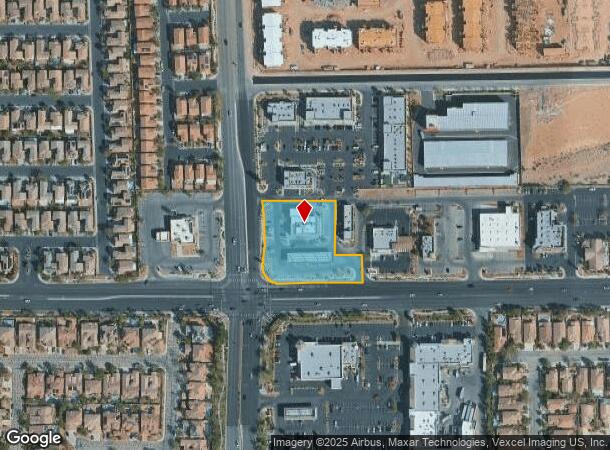
10490 S Decatur Blvd, Las Vegas, NV 89141


NEARBY LISTINGS FOR SALE OR LEASE
Property Detail
10490 S Decatur Blvd
Las Vegas-Henderson-Paradise, NV
N E C Decatur & Cactus
177-30-412-003
N E C DECATUR & CACTUS PLAT BOOK 141 PAGE 39 PT LOT 1 BLOCK 1
Servicestation
Clark
X
Nevada
32003C2925D
1
2025
1.51 AC
2025
Southwest Las Vegas
005834
Las Vegas
5,768 SF
DEMOGRAPHICS near 10490 S Decatur Blvd
1 Mile
3 Mile
5 Mile
2024 Total Population
18,492
106,888
271,425
2029 Population
20,245
116,907
294,528
Pop Growth 2024-2029
+ 9.48%
+ 9.37%
+ 8.51%
Average Age
39
38
38
2024 Total Households
6,387
38,305
99,065
HH Growth 2024-2029
+ 9.33%
+ 9.27%
+ 8.39%
Median Household Inc
$103,757
$93,330
$84,841
Avg Household Size
2.90
2.70
2.70
2024 Avg HH Vehicles
2.00
2.00
2.00
Median Home Value
$460,174
$426,541
$410,193
Median Year Built
2007
2007
2005
Nearby Places
Map Layers
Map Styles
 Street
 Aerial
- Restaurants
- Banks
- Shops
- Fitness
- Groceries
PUBLIC TRANSPORTATION
AIRPORT
Harry Reid International
DRIVE
WALK
Distance
Harry Reid International
15 min
9.0 mi
Boulder City Municipal
DRIVE
WALK
Distance
Boulder City Municipal
37 min
24.3 mi
Freight Ports
Port of Long Beach
DRIVE
WALK
Distance
Port of Long Beach
305 min
272.8 mi
Nearby Properties
Address
Land Use
TOTAL SIZE
Lot Size
Zoning
Address
Land Use
TOTAL SIZE
Lot Size
Zoning
2,340,130 SF
56.10 AC
H1
Address
Land Use
TOTAL SIZE
Lot Size
Zoning
14,422 SF
30.79 AC
Address
Land Use
TOTAL SIZE
Lot Size
Zoning
60 AC
PF
Address
Land Use
TOTAL SIZE
Lot Size
Zoning
5,271 SF
22.88 AC
Address
Land Use
TOTAL SIZE
Lot Size
Zoning
7,370 SF
18.03 AC
Address
Land Use
TOTAL SIZE
Lot Size
Zoning
4,924 SF
16.14 AC
C:R-3
Address
Land Use
TOTAL SIZE
Lot Size
Zoning
4,405 SF
19.79 AC
Address
Land Use
TOTAL SIZE
Lot Size
Zoning
4,444 SF
18.11 AC
Address
Land Use
TOTAL SIZE
Lot Size
Zoning
117.50 AC
Address
Land Use
TOTAL SIZE
Lot Size
Zoning
4,830 SF
15.84 AC
Address
Land Use
TOTAL SIZE
Lot Size
Zoning
5,921 SF
17.62 AC
RE
Address
Land Use
TOTAL SIZE
Lot Size
Zoning
22,180 SF
5.89 AC
Address
Land Use
TOTAL SIZE
Lot Size
Zoning
3,148 SF
18.80 AC
R3
Address
Land Use
TOTAL SIZE
Lot Size
Zoning
Address
Land Use
TOTAL SIZE
Lot Size
Zoning
14.65 AC
RE
Address
Land Use
TOTAL SIZE
Lot Size
Zoning
4,393 SF
14.25 AC
Address
Land Use
TOTAL SIZE
Lot Size
Zoning
18.03 AC
PF
Address
Land Use
TOTAL SIZE
Lot Size
Zoning
13 AC
RE
Address
Land Use
TOTAL SIZE
Lot Size
Zoning
53,331 SF
77.50 AC
Address
Land Use
TOTAL SIZE
Lot Size
Zoning
192,814 SF
20.27 AC
Address
Land Use
TOTAL SIZE
Lot Size
Zoning
6,095 SF
13.82 AC
Address
Land Use
TOTAL SIZE
Lot Size
Zoning
494,886 SF
26.61 AC
M1
Address
Land Use
TOTAL SIZE
Lot Size
Zoning
4,169 SF
19.06 AC
R3
Address
Land Use
TOTAL SIZE
Lot Size
Zoning
346,416 SF
11.84 AC
Address
Land Use
TOTAL SIZE
Lot Size
Zoning
186,421 SF
19.06 AC
Address
Land Use
TOTAL SIZE
Lot Size
Zoning
242,151 SF
14.08 AC
R3
Address
Land Use
TOTAL SIZE
Lot Size
Zoning
22.48 AC
Address
Land Use
TOTAL SIZE
Lot Size
Zoning
72.81 AC
PF
The World's #1 Commercial Real Estate Marketplace
Connect with us
© 2025 CoStar Group
The information above has been obtained from sources believed reliable. While we do not doubt its accuracy we have not verified it and make no guarantee, warranty or representation about it. It is your responsibility to independently confirm its accuracy and completeness. Any projections, opinions, assumptions, or estimates used are for example only and do not represent the current or future performance of the property. The value of this transaction to you depends on tax and other factors which should be evaluated by your tax, financial, and legal advisors. You and your advisors should conduct a careful, independent investigation of the property to determine to your satisfaction the suitability of the property for your needs.