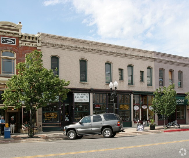
Property Record
105 25Th St, Ogden, UT 84401

Property Detail
105 25Th St
Ogden, UT
THE WEST 1/2 OF LOT 22, AMENDED PLAT, BEN LOMOND HEIGHTS, SOUTH OGDEN CITY, WEBER COUNTY, UTAH. EXCEPTING, HOWEVER, THE NORTH
01-018-0017
Weber
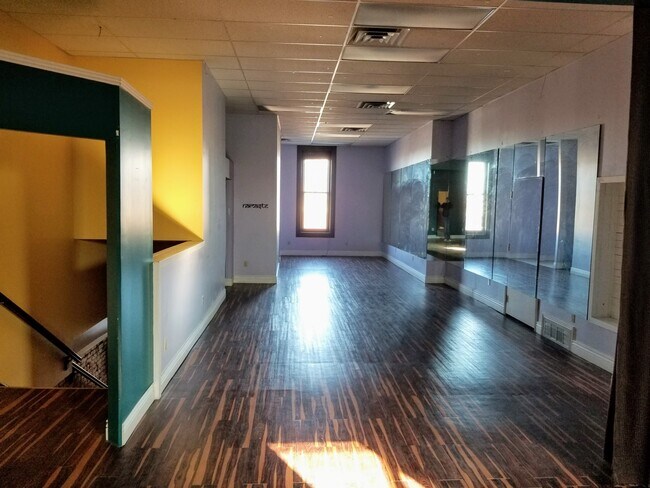
Storebuilding
Utah
B and X Area of moderate flood hazard, usually the area between the limits of the 100-year and 500-year floods.
22
2025
0.21 AC
2025
Davis/Weber Counties
210900
Salt Lake City
6,832 SF
NEARBY LISTINGS FOR SALE OR LEASE
DEMOGRAPHICS near 105 25Th St
1 mile
3 mile
5 mile
2025 Total Population
12,198
87,210
167,239
2030 Population
12,790
90,224
173,359
Pop Growth 2025-2030
+ 4.85%
+ 3.46%
+ 3.66%
Average Age
36
36
36
2025 Total Households
5,177
32,551
60,292
HH Growth 2025-2030
+ 5.04%
+ 3.75%
+ 3.93%
Median Household Inc
$44,379
$68,995
$78,108
Avg Household Size
2.20
2.60
2.70
2025 Avg HH Vehicles
1.00
2.00
2.00
Median Home Value
$311,254
$362,255
$394,646
Median Year Built
1967
1963
1977
Nearby Places
Map Layers
Map Styles
 Street
 Aerial
Layers
 Traffic
 Biking
Places
Listings with unknown addresses are not visible on the map
- Restaurants
- Banks
- Shops
- Fitness
- Groceries
PUBLIC TRANSPORTATION
COMMUTER RAIL
Ogden (FrontRunner North - Utah Transit Authority (UTA))
Drive
Walk
Distance
Ogden (FrontRunner North - Utah Transit Authority (UTA))
2 min
8 min
0.5 mi
Roy (FrontRunner North - Utah Transit Authority (UTA))
Drive
Walk
Distance
Roy (FrontRunner North - Utah Transit Authority (UTA))
9 min
4.7 mi
AIRPORT
Salt Lake City International
Drive
Walk
Distance
Salt Lake City International
47 min
38.9 mi
Freight Ports
Port of Stockton
Drive
Walk
Distance
Port of Stockton
748 min
729.3 mi
SALE & LEASE HISTORY
LISTING DATE
SALE/LEASE

Nov 16, 2018
For Lease
Mar 05, 2020
For Lease
Jun 06, 2023
For Lease
Jan 13, 2021
For Lease
Nearby Properties
Address
Land Use
TOTAL SIZE
Lot Size
Zoning
Address
Land Use
TOTAL SIZE
Lot Size
Zoning
790,525 SF
57.26 AC
Address
Land Use
TOTAL SIZE
Lot Size
Zoning
841,756 SF
45.79 AC
Address
Land Use
TOTAL SIZE
Lot Size
Zoning
111,832 SF
24.92 AC
Address
Land Use
TOTAL SIZE
Lot Size
Zoning
128,867 SF
3.36 AC
Address
Land Use
TOTAL SIZE
Lot Size
Zoning
97,932 SF
3.07 AC
Address
Land Use
TOTAL SIZE
Lot Size
Zoning
52,200 SF
9.95 AC
Address
Land Use
TOTAL SIZE
Lot Size
Zoning
305,444 SF
1.58 AC
Address
Land Use
TOTAL SIZE
Lot Size
Zoning
152,877 SF
4.96 AC
Address
Land Use
TOTAL SIZE
Lot Size
Zoning
9,464 SF
6.82 AC
Address
Land Use
TOTAL SIZE
Lot Size
Zoning
21,684 SF
8.38 AC
Address
Land Use
TOTAL SIZE
Lot Size
Zoning
48,177 SF
5.54 AC
Address
Land Use
TOTAL SIZE
Lot Size
Zoning
98,660 SF
3.18 AC
Address
Land Use
TOTAL SIZE
Lot Size
Zoning
106,752 SF
10.35 AC
Address
Land Use
TOTAL SIZE
Lot Size
Zoning
22,227 SF
10.81 AC
Address
Land Use
TOTAL SIZE
Lot Size
Zoning
8,580 SF
6.40 AC
Address
Land Use
TOTAL SIZE
Lot Size
Zoning
66,896 SF
7.50 AC
Address
Land Use
TOTAL SIZE
Lot Size
Zoning
101,191 SF
4.14 AC
Address
Land Use
TOTAL SIZE
Lot Size
Zoning
119,043 SF
2.05 AC
Address
Land Use
TOTAL SIZE
Lot Size
Zoning
95,949 SF
3.29 AC
Address
Land Use
TOTAL SIZE
Lot Size
Zoning
149,400 SF
26.88 AC
The World's #1 Commercial Real Estate Marketplace
Connect with us
© 2026 CoStar Group
The information above has been obtained from sources believed reliable. While we do not doubt its accuracy we have not verified it and make no guarantee, warranty or representation about it. It is your responsibility to independently confirm its accuracy and completeness. Any projections, opinions, assumptions, or estimates used are for example only and do not represent the current or future performance of the property. The value of this transaction to you depends on tax and other factors which should be evaluated by your tax, financial, and legal advisors. You and your advisors should conduct a careful, independent investigation of the property to determine to your satisfaction the suitability of the property for your needs.