Property Record
105 E Oak St, Ponchatoula, LA 70454

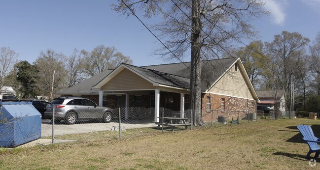
Property Detail
105 E Oak St
Hammond, LA
W 156 FT OF LOTS 15 16 SQ 51 PONCHATOULA MEAS 100 X 150 FT B328 P90 B1117 P13 B1341 P232 MAP 1338900
01554018
Tangipahoa
Commercialnec
Louisiana
B and X Area of moderate flood hazard, usually the area between the limits of the 100-year and 500-year floods.
15
2025
0.34 AC
2025
Louisiana South Area
954800
Other Market Areas
3,975 SF
NEARBY LISTINGS FOR SALE OR LEASE
-
-
View all Ponchatoula listings for sale on LoopNet.com
DEMOGRAPHICS near 105 E Oak St
1 mile
3 mile
5 mile
2025 Total Population
6,194
18,837
48,079
2030 Population
6,431
19,546
49,945
Pop Growth 2025-2030
+ 3.83%
+ 3.76%
+ 3.88%
Average Age
40
39
39
2025 Total Households
2,499
7,454
18,909
HH Growth 2025-2030
+ 4.00%
+ 3.90%
+ 4.07%
Median Household Inc
$59,678
$64,337
$59,806
Avg Household Size
2.40
2.50
2.50
2025 Avg HH Vehicles
2.00
2.00
2.00
Median Home Value
$233,544
$235,111
$239,811
Median Year Built
1989
2001
1999
Nearby Places
Map Layers
Map Styles
 Street
 Aerial
Layers
 Traffic
 Biking
Places
Listings with unknown addresses are not visible on the map
- Restaurants
- Banks
- Shops
- Fitness
- Groceries
PUBLIC TRANSPORTATION
COMMUTER RAIL
Hammond Amtrak Station (City of New Orleans - Amtrak)
Drive
Walk
Distance
Hammond Amtrak Station (City of New Orleans - Amtrak)
9 min
5.9 mi
Freight Ports
Port of New Orleans
Drive
Walk
Distance
Port of New Orleans
67 min
53.1 mi
Nearby Properties
Address
Land Use
TOTAL SIZE
Lot Size
Zoning
Address
Land Use
TOTAL SIZE
Lot Size
Zoning
22.56 AC
Address
Land Use
TOTAL SIZE
Lot Size
Zoning
327,625 SF
14.78 AC
Address
Land Use
TOTAL SIZE
Lot Size
Zoning
152,841 SF
20.69 AC
Address
Land Use
TOTAL SIZE
Lot Size
Zoning
84,000 SF
8.32 AC
Address
Land Use
TOTAL SIZE
Lot Size
Zoning
82,860 SF
11.42 AC
Address
Land Use
TOTAL SIZE
Lot Size
Zoning
24,823 SF
3 AC
Address
Land Use
TOTAL SIZE
Lot Size
Zoning
36,593 SF
1.54 AC
Address
Land Use
TOTAL SIZE
Lot Size
Zoning
27,215 SF
7.58 AC
Address
Land Use
TOTAL SIZE
Lot Size
Zoning
96,064 SF
5.03 AC
Address
Land Use
TOTAL SIZE
Lot Size
Zoning
20,128 SF
20.77 AC
Address
Land Use
TOTAL SIZE
Lot Size
Zoning
22,507 SF
0.63 AC
Address
Land Use
TOTAL SIZE
Lot Size
Zoning
120,800 SF
10 AC
Address
Land Use
TOTAL SIZE
Lot Size
Zoning
10,753 SF
1.57 AC
Address
Land Use
TOTAL SIZE
Lot Size
Zoning
24,040 SF
2.08 AC
Address
Land Use
TOTAL SIZE
Lot Size
Zoning
80,000 SF
11.02 AC
Address
Land Use
TOTAL SIZE
Lot Size
Zoning
57,587 SF
7.98 AC
Address
Land Use
TOTAL SIZE
Lot Size
Zoning
10,944 SF
2.16 AC
Address
Land Use
TOTAL SIZE
Lot Size
Zoning
16,780 SF
8.41 AC
Address
Land Use
TOTAL SIZE
Lot Size
Zoning
12,074 SF
45.70 AC
Address
Land Use
TOTAL SIZE
Lot Size
Zoning
236,540 SF
36.01 AC
Address
Land Use
TOTAL SIZE
Lot Size
Zoning
13,288 SF
15.07 AC
Address
Land Use
TOTAL SIZE
Lot Size
Zoning
67,728 SF
6.78 AC
Address
Land Use
TOTAL SIZE
Lot Size
Zoning
96,000 SF
7.29 AC
Address
Land Use
TOTAL SIZE
Lot Size
Zoning
12,021 SF
1.15 AC
Address
Land Use
TOTAL SIZE
Lot Size
Zoning
10,692 SF
5.49 AC
Address
Land Use
TOTAL SIZE
Lot Size
Zoning
31,750 SF
3.53 AC
Address
Land Use
TOTAL SIZE
Lot Size
Zoning
51,390 SF
16 AC
Address
Land Use
TOTAL SIZE
Lot Size
Zoning
8,700 SF
1.75 AC
Address
Land Use
TOTAL SIZE
Lot Size
Zoning
14,850 SF
6.91 AC
Address
Land Use
TOTAL SIZE
Lot Size
Zoning
39,389 SF
2.30 AC
The World's #1 Commercial Real Estate Marketplace
Connect with us
© 2026 CoStar Group
The information above has been obtained from sources believed reliable. While we do not doubt its accuracy we have not verified it and make no guarantee, warranty or representation about it. It is your responsibility to independently confirm its accuracy and completeness. Any projections, opinions, assumptions, or estimates used are for example only and do not represent the current or future performance of the property. The value of this transaction to you depends on tax and other factors which should be evaluated by your tax, financial, and legal advisors. You and your advisors should conduct a careful, independent investigation of the property to determine to your satisfaction the suitability of the property for your needs.