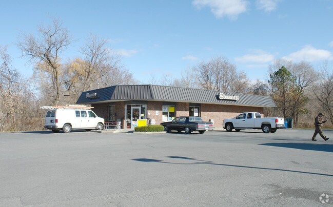
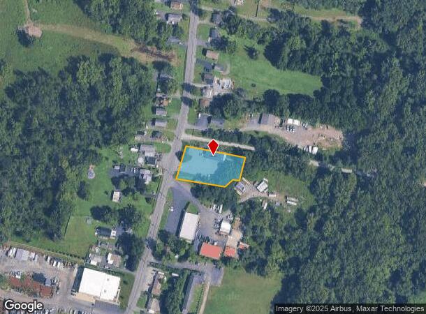
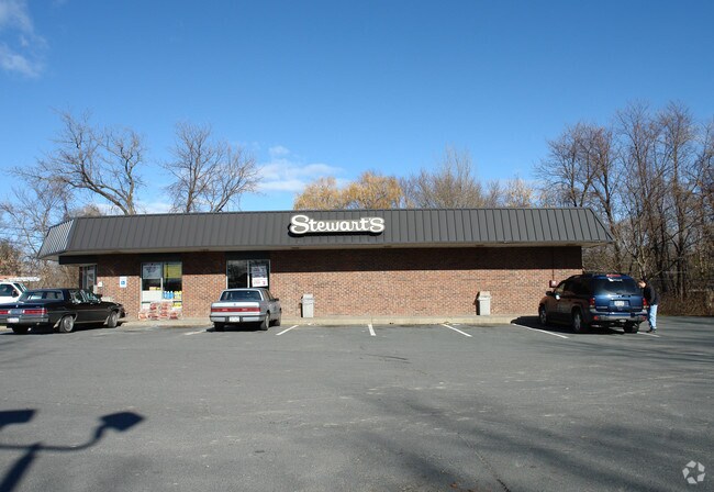
Property Record
105 Hudson River Rd, Waterford, NY 12188
NEARBY LISTINGS FOR SALE OR LEASE
Property Detail
105 Hudson River Rd
Albany-Schenectady-Troy, NY
Saratoga
415489-291-007-0001-030-000-0000
New York
Servicestationmarket
30.000
2025
0.76 AC
2024
Saratoga County
062700
Albany/Schenectady/Troy
2,392 SF
DEMOGRAPHICS near 105 Hudson River Rd
1 Mile
3 Mile
5 Mile
2024 Total Population
2,645
30,278
80,724
2029 Population
2,634
29,785
80,062
Pop Growth 2024-2029
(0.42%)
(1.63%)
(0.82%)
Average Age
44
42
41
2024 Total Households
1,090
13,902
35,467
HH Growth 2024-2029
(0.37%)
(1.83%)
(0.92%)
Median Household Inc
$78,314
$59,301
$64,519
Avg Household Size
2.30
2.10
2.20
2024 Avg HH Vehicles
2.00
1.00
2.00
Median Home Value
$195,372
$194,928
$221,906
Median Year Built
1957
1951
1962
Nearby Places
- Restaurants
- Banks
- Shops
- Fitness
- Groceries
PUBLIC TRANSPORTATION
AIRPORT
Albany International
DRIVE
WALK
Distance
Albany International
21 min
11.6 mi
Freight Ports
Albany, NY Port
DRIVE
WALK
Distance
Albany, NY Port
26 min
14.3 mi
Nearby Properties
Address
Land Use
TOTAL SIZE
Lot Size
Zoning
Address
Land Use
TOTAL SIZE
Lot Size
Zoning
173.09 AC
Address
Land Use
TOTAL SIZE
Lot Size
Zoning
5,000 SF
48.44 AC
CR
Address
Land Use
TOTAL SIZE
Lot Size
Zoning
150,000 SF
45.60 AC
07 - MIXED
Address
Land Use
TOTAL SIZE
Lot Size
Zoning
39.06 AC
Address
Land Use
TOTAL SIZE
Lot Size
Zoning
77,193 SF
28.41 AC
SF
Address
Land Use
TOTAL SIZE
Lot Size
Zoning
Address
Land Use
TOTAL SIZE
Lot Size
Zoning
16,698 SF
46.45 AC
MF
Address
Land Use
TOTAL SIZE
Lot Size
Zoning
193,144 SF
41.18 AC
Address
Land Use
TOTAL SIZE
Lot Size
Zoning
346,727 SF
15.06 AC
03 - MULTI
Address
Land Use
TOTAL SIZE
Lot Size
Zoning
4,680 SF
26.74 AC
Address
Land Use
TOTAL SIZE
Lot Size
Zoning
1.30 AC
Address
Land Use
TOTAL SIZE
Lot Size
Zoning
210,415 SF
1.69 AC
MF
Address
Land Use
TOTAL SIZE
Lot Size
Zoning
723,643 SF
27.56 AC
Address
Land Use
TOTAL SIZE
Lot Size
Zoning
5,500 SF
15.31 AC
MU2
Address
Land Use
TOTAL SIZE
Lot Size
Zoning
3,844 SF
3.18 AC
Address
Land Use
TOTAL SIZE
Lot Size
Zoning
Address
Land Use
TOTAL SIZE
Lot Size
Zoning
95,466 SF
7.64 AC
MF
Address
Land Use
TOTAL SIZE
Lot Size
Zoning
52 AC
CR
Address
Land Use
TOTAL SIZE
Lot Size
Zoning
70,069 SF
4.47 AC
03
Address
Land Use
TOTAL SIZE
Lot Size
Zoning
212,672 SF
3.90 AC
07 - MIXED
Address
Land Use
TOTAL SIZE
Lot Size
Zoning
86,904 SF
150.22 AC
Address
Land Use
TOTAL SIZE
Lot Size
Zoning
101,016 SF
2.30 AC
07 - MIXED
Address
Land Use
TOTAL SIZE
Lot Size
Zoning
528 SF
5.90 AC
02 - SINGL
Address
Land Use
TOTAL SIZE
Lot Size
Zoning
2,560 SF
9.30 AC
A3
Address
Land Use
TOTAL SIZE
Lot Size
Zoning
95,800 SF
23.50 AC
Address
Land Use
TOTAL SIZE
Lot Size
Zoning
75,872 SF
8.26 AC
SF
Address
Land Use
TOTAL SIZE
Lot Size
Zoning
15,562 SF
1.91 AC
WMU
Address
Land Use
TOTAL SIZE
Lot Size
Zoning
88.48 AC
Address
Land Use
TOTAL SIZE
Lot Size
Zoning
14.90 AC
Address
Land Use
TOTAL SIZE
Lot Size
Zoning
93,008 SF
3.90 AC
07 - MIXED
The World's #1 Commercial Real Estate Marketplace
Connect with us
© 2025 CoStar Group
The information above has been obtained from sources believed reliable. While we do not doubt its accuracy we have not verified it and make no guarantee, warranty or representation about it. It is your responsibility to independently confirm its accuracy and completeness. Any projections, opinions, assumptions, or estimates used are for example only and do not represent the current or future performance of the property. The value of this transaction to you depends on tax and other factors which should be evaluated by your tax, financial, and legal advisors. You and your advisors should conduct a careful, independent investigation of the property to determine to your satisfaction the suitability of the property for your needs.