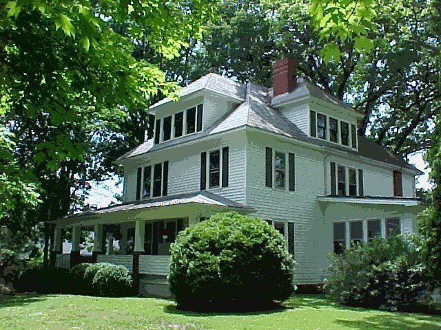
Property Record
105 N Main St, Mars Hill, NC 28754

Save to a Folder
{{folder.Name}}
{{folder.ListingIds.length}} Properties
{{folder.ListingIds.length}} Property
Create a New Folder
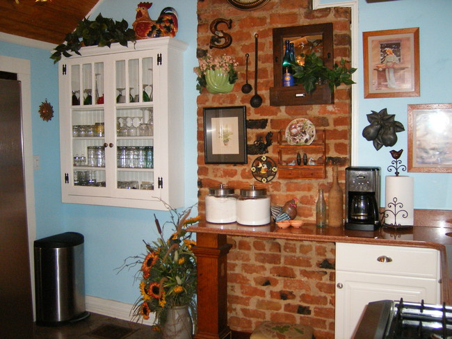
Property Detail
105 N Main St
Financialbuilding
Madison
R-A
North Carolina
B and X Area of moderate flood hazard, usually the area between the limits of the 100-year and 500-year floods.
1.16 AC
2025
Madison County
2025
Asheville
010601
Asheville, NC
4,046 SF
9747-85-2221
NEARBY LISTINGS FOR SALE OR LEASE
-
-
View all Mars Hill listings for sale on LoopNet.com
DEMOGRAPHICS near 105 N Main St
1 mile
3 mile
5 mile
2025 Total Population
1,961
5,589
12,892
2030 Population
2,025
5,761
13,329
Pop Growth 2025-2030
+ 3.26%
+ 3.08%
+ 3.39%
Average Age
42
42
43
2025 Total Households
703
2,068
4,974
HH Growth 2025-2030
+ 2.84%
+ 2.76%
+ 3.16%
Median Household Inc
$67,346
$69,769
$70,766
Avg Household Size
2.30
2.30
2.40
2025 Avg HH Vehicles
2.00
2.00
2.00
Median Home Value
$319,091
$330,529
$335,682
Median Year Built
1983
1987
1990
Nearby Places
Map Layers
Map Styles
 Street
 Aerial
Layers
 Traffic
 Biking
Places
Listings with unknown addresses are not visible on the map
- Restaurants
- Banks
- Shops
- Fitness
- Groceries
PUBLIC TRANSPORTATION
AIRPORT
Asheville Regional
Drive
Walk
Distance
Asheville Regional
42 min
31.5 mi
Freight Ports
North Charleston Terminal
Drive
Walk
Distance
North Charleston Terminal
313 min
275.2 mi
Nearby Properties
Address
Land Use
TOTAL SIZE
Lot Size
Zoning
Address
Land Use
TOTAL SIZE
Lot Size
Zoning
23,100 SF
6 AC
R-A
Address
Land Use
TOTAL SIZE
Lot Size
Zoning
1,536 SF
27.44 AC
R-A
Address
Land Use
TOTAL SIZE
Lot Size
Zoning
86,223 SF
10.20 AC
R-A
Address
Land Use
TOTAL SIZE
Lot Size
Zoning
36,069 SF
0.50 AC
R-1
Address
Land Use
TOTAL SIZE
Lot Size
Zoning
30,170 SF
1.09 AC
R-1
Address
Land Use
TOTAL SIZE
Lot Size
Zoning
6,848 SF
2.26 AC
R-A
Address
Land Use
TOTAL SIZE
Lot Size
Zoning
29,968 SF
6.94 AC
R-A
Address
Land Use
TOTAL SIZE
Lot Size
Zoning
28,642 SF
1.29 AC
R-A
Address
Land Use
TOTAL SIZE
Lot Size
Zoning
6,381 SF
5.20 AC
R-A
Address
Land Use
TOTAL SIZE
Lot Size
Zoning
16,078 SF
1.03 AC
R-A
Address
Land Use
TOTAL SIZE
Lot Size
Zoning
4,330 SF
2.16 AC
R-A
Address
Land Use
TOTAL SIZE
Lot Size
Zoning
242 SF
7.12 AC
R-A
Address
Land Use
TOTAL SIZE
Lot Size
Zoning
14,916 SF
0.96 AC
R-A
Address
Land Use
TOTAL SIZE
Lot Size
Zoning
13,466 SF
4 AC
R-A
Address
Land Use
TOTAL SIZE
Lot Size
Zoning
22,863 SF
0.80 AC
R-A
Address
Land Use
TOTAL SIZE
Lot Size
Zoning
6,955 SF
0.74 AC
R-A
Address
Land Use
TOTAL SIZE
Lot Size
Zoning
5,376 SF
2.14 AC
R-A
Address
Land Use
TOTAL SIZE
Lot Size
Zoning
1,421 SF
4.08 AC
R-1
Address
Land Use
TOTAL SIZE
Lot Size
Zoning
920 SF
18.24 AC
R-1
Address
Land Use
TOTAL SIZE
Lot Size
Zoning
9,000 SF
1.69 AC
R-A
Address
Land Use
TOTAL SIZE
Lot Size
Zoning
1,860 SF
3.05 AC
R-A
Address
Land Use
TOTAL SIZE
Lot Size
Zoning
4,044 SF
3.96 AC
R-A
Address
Land Use
TOTAL SIZE
Lot Size
Zoning
15,171 SF
0.25 AC
R-A
Address
Land Use
TOTAL SIZE
Lot Size
Zoning
104,725 SF
9.38 AC
R-1
Address
Land Use
TOTAL SIZE
Lot Size
Zoning
11,000 SF
6.51 AC
R-A
Address
Land Use
TOTAL SIZE
Lot Size
Zoning
5,008 SF
5.25 AC
R-A
Address
Land Use
TOTAL SIZE
Lot Size
Zoning
10,200 SF
3.83 AC
R-1
Address
Land Use
TOTAL SIZE
Lot Size
Zoning
4,398 SF
1.37 AC
R-A
Address
Land Use
TOTAL SIZE
Lot Size
Zoning
19.15 AC
R-A
Address
Land Use
TOTAL SIZE
Lot Size
Zoning
10,000 SF
20.78 AC
OU
The World's #1 Commercial Real Estate Marketplace
Connect with us
© 2026 CoStar Group
The information above has been obtained from sources believed reliable. While we do not doubt its accuracy we have not verified it and make no guarantee, warranty or representation about it. It is your responsibility to independently confirm its accuracy and completeness. Any projections, opinions, assumptions, or estimates used are for example only and do not represent the current or future performance of the property. The value of this transaction to you depends on tax and other factors which should be evaluated by your tax, financial, and legal advisors. You and your advisors should conduct a careful, independent investigation of the property to determine to your satisfaction the suitability of the property for your needs.