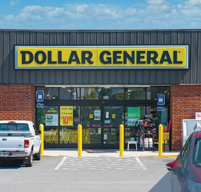
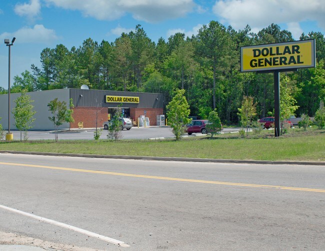
Property Record
105 Redds Branch Rd, Aiken, SC 29801

Save to a Folder
{{folder.Name}}
{{folder.ListingIds.length}} Properties
{{folder.ListingIds.length}} Property
Create a New Folder
Property Detail
105 Redds Branch Rd
Augusta-Richmond County, GA-SC
HWY 215 AT HWY 218
137-15-04-001
Aiken
Storebuilding
South Carolina
B and X Area of moderate flood hazard, usually the area between the limits of the 100-year and 500-year floods.
008
2025
0.94 AC
2025
Outlying Aiken County
021601
Augusta/Richmond County
9,217 SF
NEARBY LISTINGS FOR SALE OR LEASE
-
-
View all Aiken listings for sale on LoopNet.com
DEMOGRAPHICS near 105 Redds Branch Rd
1 mile
3 mile
5 mile
2025 Total Population
1,056
15,519
41,161
2030 Population
1,134
16,481
43,520
Pop Growth 2025-2030
+ 7.39%
+ 6.20%
+ 5.73%
Average Age
41
41
43
2025 Total Households
433
6,491
17,813
HH Growth 2025-2030
+ 7.39%
+ 6.27%
+ 5.71%
Median Household Inc
$74,736
$64,453
$68,605
Avg Household Size
2.30
2.30
2.20
2025 Avg HH Vehicles
2.00
2.00
2.00
Median Home Value
$194,949
$221,494
$240,655
Median Year Built
1993
1981
1985
Nearby Places
Map Layers
Map Styles
 Street
 Aerial
Layers
 Traffic
 Biking
Places
Listings with unknown addresses are not visible on the map
- Restaurants
- Banks
- Shops
- Fitness
- Groceries
PUBLIC TRANSPORTATION
AIRPORT
Augusta Regional at Bush Field
Drive
Walk
Distance
Augusta Regional at Bush Field
47 min
30.3 mi
SALE & LEASE HISTORY
LISTING DATE
SALE/LEASE

May 30, 2017
For Sale
Aug 01, 2017
For Sale
Nearby Properties
Address
Land Use
TOTAL SIZE
Lot Size
Zoning
Address
Land Use
TOTAL SIZE
Lot Size
Zoning
310,500 SF
24.39 AC
Address
Land Use
TOTAL SIZE
Lot Size
Zoning
30.20 AC
Address
Land Use
TOTAL SIZE
Lot Size
Zoning
49.46 AC
Address
Land Use
TOTAL SIZE
Lot Size
Zoning
179,120 SF
20 AC
Address
Land Use
TOTAL SIZE
Lot Size
Zoning
44,216 SF
10.69 AC
Address
Land Use
TOTAL SIZE
Lot Size
Zoning
355,597 SF
45.72 AC
Address
Land Use
TOTAL SIZE
Lot Size
Zoning
1,009,629 SF
72.21 AC
Address
Land Use
TOTAL SIZE
Lot Size
Zoning
21,747 SF
10 AC
Address
Land Use
TOTAL SIZE
Lot Size
Zoning
32,936 SF
198.34 AC
Address
Land Use
TOTAL SIZE
Lot Size
Zoning
27,163 SF
4 AC
Address
Land Use
TOTAL SIZE
Lot Size
Zoning
208,972 SF
48.92 AC
Address
Land Use
TOTAL SIZE
Lot Size
Zoning
Address
Land Use
TOTAL SIZE
Lot Size
Zoning
0.33 AC
Address
Land Use
TOTAL SIZE
Lot Size
Zoning
102,656 SF
10 AC
Address
Land Use
TOTAL SIZE
Lot Size
Zoning
12,240 SF
2 AC
Address
Land Use
TOTAL SIZE
Lot Size
Zoning
13,476 SF
0.62 AC
Address
Land Use
TOTAL SIZE
Lot Size
Zoning
800 SF
140.80 AC
Address
Land Use
TOTAL SIZE
Lot Size
Zoning
14,328 SF
51.76 AC
Address
Land Use
TOTAL SIZE
Lot Size
Zoning
19,375 SF
5 AC
Address
Land Use
TOTAL SIZE
Lot Size
Zoning
8,726 SF
10.30 AC
Address
Land Use
TOTAL SIZE
Lot Size
Zoning
11.61 AC
Address
Land Use
TOTAL SIZE
Lot Size
Zoning
7.30 AC
Address
Land Use
TOTAL SIZE
Lot Size
Zoning
1,656 SF
6.64 AC
Address
Land Use
TOTAL SIZE
Lot Size
Zoning
11,000 SF
4.16 AC
Address
Land Use
TOTAL SIZE
Lot Size
Zoning
228,775 SF
21 AC
Address
Land Use
TOTAL SIZE
Lot Size
Zoning
912 SF
4.13 AC
Address
Land Use
TOTAL SIZE
Lot Size
Zoning
17,220 SF
1.95 AC
Address
Land Use
TOTAL SIZE
Lot Size
Zoning
Address
Land Use
TOTAL SIZE
Lot Size
Zoning
20.32 AC
Address
Land Use
TOTAL SIZE
Lot Size
Zoning
9,299 SF
8.92 AC
The World's #1 Commercial Real Estate Marketplace
Connect with us
© 2026 CoStar Group
The information above has been obtained from sources believed reliable. While we do not doubt its accuracy we have not verified it and make no guarantee, warranty or representation about it. It is your responsibility to independently confirm its accuracy and completeness. Any projections, opinions, assumptions, or estimates used are for example only and do not represent the current or future performance of the property. The value of this transaction to you depends on tax and other factors which should be evaluated by your tax, financial, and legal advisors. You and your advisors should conduct a careful, independent investigation of the property to determine to your satisfaction the suitability of the property for your needs.