Property Record
105 Seaview Ave, Staten Island, NY 10304
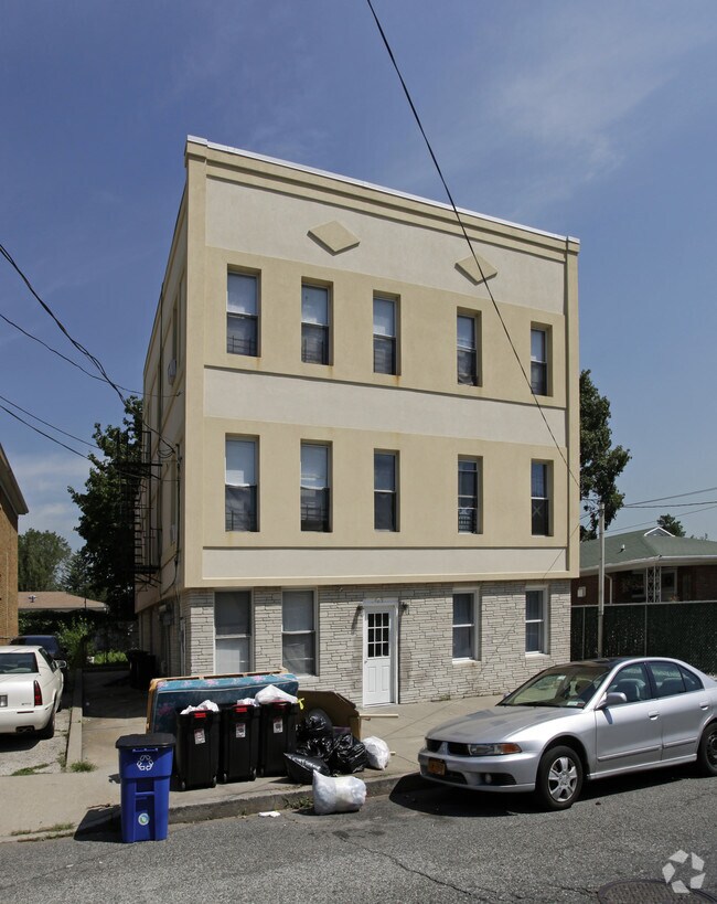

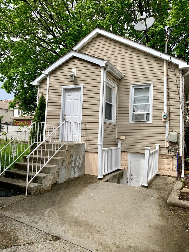

Property Detail
105 Seaview Ave
03320-0060
Richmond
Multifamilydwelling
New York
R3X
60
B and X Area of moderate flood hazard, usually the area between the limits of the 100-year and 500-year floods.
0.10 AC
2025
South Beach-Old Town
2026
Long Island (New York)
009602
New York-Jersey City-White Plains, NY-NJ
5,760 SF
NEARBY LISTINGS FOR SALE OR LEASE
DEMOGRAPHICS near 105 Seaview Ave
1 mile
3 mile
5 mile
2025 Total Population
31,474
219,678
535,705
2030 Population
31,855
222,273
537,464
Pop Growth 2025-2030
+ 1.21%
+ 1.18%
+ 0.33%
Average Age
43
42
41
2025 Total Households
11,342
76,304
192,453
HH Growth 2025-2030
+ 1.15%
+ 1.14%
+ 0.25%
Median Household Inc
$97,815
$93,861
$91,782
Avg Household Size
2.70
2.80
2.70
2025 Avg HH Vehicles
2.00
1.00
1.00
Median Home Value
$748,444
$738,957
$732,143
Median Year Built
1967
1968
1963
Nearby Places
Map Layers
Map Styles
 Street
 Aerial
Layers
 Traffic
 Biking
Places
Listings with unknown addresses are not visible on the map
- Restaurants
- Banks
- Shops
- Fitness
- Groceries
PUBLIC TRANSPORTATION
TRANSIT/SUBWAY
Dongan Hills (Staten Island Railway - New York MTA Subway (The Subway))
Drive
Walk
Distance
Dongan Hills (Staten Island Railway - New York MTA Subway (The Subway))
1 min
4 min
0.2 mi
Jefferson Avenue (Staten Island Railway - New York MTA Subway (The Subway))
Drive
Walk
Distance
Jefferson Avenue (Staten Island Railway - New York MTA Subway (The Subway))
2 min
10 min
0.5 mi
Old Town (Staten Island Railway - New York MTA Subway (The Subway))
Drive
Walk
Distance
Old Town (Staten Island Railway - New York MTA Subway (The Subway))
6 min
19 min
1.0 mi
Grant City (Staten Island Railway - New York MTA Subway (The Subway))
Drive
Walk
Distance
Grant City (Staten Island Railway - New York MTA Subway (The Subway))
5 min
19 min
1.0 mi
COMMUTER RAIL
Dongan Hills (Staten Island Railway - New York MTA Subway (The Subway))
Drive
Walk
Distance
Dongan Hills (Staten Island Railway - New York MTA Subway (The Subway))
1 min
4 min
0.2 mi
Jefferson Avenue (Staten Island Railway - New York MTA Subway (The Subway))
Drive
Walk
Distance
Jefferson Avenue (Staten Island Railway - New York MTA Subway (The Subway))
3 min
10 min
0.5 mi
AIRPORT
Newark Liberty International
Drive
Walk
Distance
Newark Liberty International
29 min
15.9 mi
LaGuardia
Drive
Walk
Distance
LaGuardia
39 min
21.9 mi
John F Kennedy International
Drive
Walk
Distance
John F Kennedy International
42 min
24.4 mi
Freight Ports
New York Container Terminal
Drive
Walk
Distance
New York Container Terminal
15 min
6.7 mi
SALE & LEASE HISTORY
LISTING DATE
SALE/LEASE

May 05, 2019
For Sale
Aug 31, 2021
For Sale
Nearby Properties
Address
Land Use
TOTAL SIZE
Lot Size
Zoning
Address
Land Use
TOTAL SIZE
Lot Size
Zoning
3,600 SF
731.18 AC
PARK
Address
Land Use
TOTAL SIZE
Lot Size
Zoning
633,280 SF
202.90 AC
R3-2
Address
Land Use
TOTAL SIZE
Lot Size
Zoning
738,600 SF
189.62 AC
R3-2
Address
Land Use
TOTAL SIZE
Lot Size
Zoning
640,077 SF
19.34 AC
R3-1
Address
Land Use
TOTAL SIZE
Lot Size
Zoning
566,000 SF
103.31 AC
R3-2
Address
Land Use
TOTAL SIZE
Lot Size
Zoning
135,000 SF
117.71 AC
PARK
Address
Land Use
TOTAL SIZE
Lot Size
Zoning
236,591 SF
207.66 AC
R3-2
Address
Land Use
TOTAL SIZE
Lot Size
Zoning
310,560 SF
15.90 AC
C4-1
Address
Land Use
TOTAL SIZE
Lot Size
Zoning
494,840 SF
34.77 AC
R3-2
Address
Land Use
TOTAL SIZE
Lot Size
Zoning
521,405 SF
52.79 AC
R3-1
Address
Land Use
TOTAL SIZE
Lot Size
Zoning
421,275 SF
18.95 AC
R3-2
Address
Land Use
TOTAL SIZE
Lot Size
Zoning
111,000 SF
186.03 AC
PARK
Address
Land Use
TOTAL SIZE
Lot Size
Zoning
294,320 SF
15 AC
R3-2
Address
Land Use
TOTAL SIZE
Lot Size
Zoning
240 SF
47.41 AC
R3-2
Address
Land Use
TOTAL SIZE
Lot Size
Zoning
476,145 SF
50.97 AC
R3-1
Address
Land Use
TOTAL SIZE
Lot Size
Zoning
48,500 SF
61.98 AC
R3-2
Address
Land Use
TOTAL SIZE
Lot Size
Zoning
146,855 SF
16.50 AC
R3-1
Address
Land Use
TOTAL SIZE
Lot Size
Zoning
77,502 SF
1.29 AC
R3-1
Address
Land Use
TOTAL SIZE
Lot Size
Zoning
900 SF
50 AC
R1-1
Address
Land Use
TOTAL SIZE
Lot Size
Zoning
654,030 SF
13.94 AC
R5
Address
Land Use
TOTAL SIZE
Lot Size
Zoning
151,637 SF
7.41 AC
C4-1
Address
Land Use
TOTAL SIZE
Lot Size
Zoning
45,570 SF
206.38 AC
PARKUS
Address
Land Use
TOTAL SIZE
Lot Size
Zoning
7,410 SF
44.60 AC
R1-1
Address
Land Use
TOTAL SIZE
Lot Size
Zoning
151,080 SF
17.59 AC
R1-2
Address
Land Use
TOTAL SIZE
Lot Size
Zoning
37.30 AC
PARK
Address
Land Use
TOTAL SIZE
Lot Size
Zoning
19,102 SF
67.84 AC
PARK
Address
Land Use
TOTAL SIZE
Lot Size
Zoning
26.45 AC
PARK
Address
Land Use
TOTAL SIZE
Lot Size
Zoning
180,000 SF
2.28 AC
R2
Address
Land Use
TOTAL SIZE
Lot Size
Zoning
146,568 SF
26.40 AC
R3-1
Address
Land Use
TOTAL SIZE
Lot Size
Zoning
12,400 SF
47.97 AC
R3-2
The World's #1 Commercial Real Estate Marketplace
Connect with us
© 2026 CoStar Group
The information above has been obtained from sources believed reliable. While we do not doubt its accuracy we have not verified it and make no guarantee, warranty or representation about it. It is your responsibility to independently confirm its accuracy and completeness. Any projections, opinions, assumptions, or estimates used are for example only and do not represent the current or future performance of the property. The value of this transaction to you depends on tax and other factors which should be evaluated by your tax, financial, and legal advisors. You and your advisors should conduct a careful, independent investigation of the property to determine to your satisfaction the suitability of the property for your needs.