Property Record
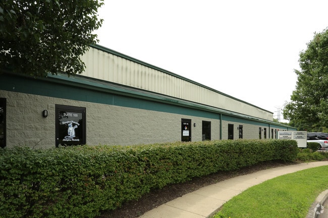
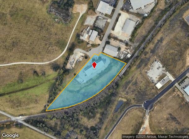
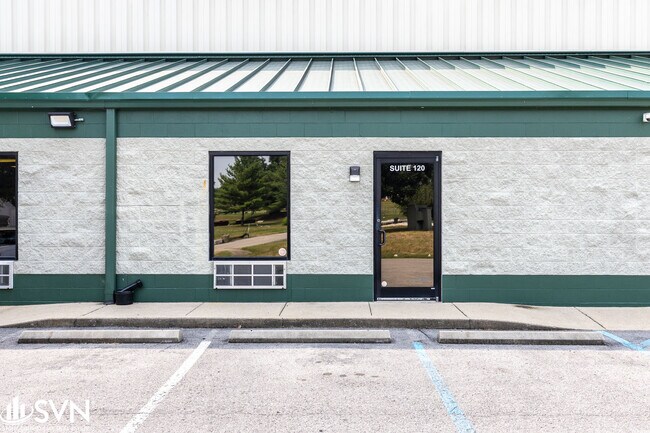
1050 Enterprise Dr, Lexington, KY 40510
NEARBY LISTINGS FOR SALE OR LEASE
Property Detail
1050 Enterprise Dr
Lexington-Fayette, KY
Enterprise Ind Park West
38040660
D-616 WOODLAND LOT 87; BOOK: 3427 PAGE: 9
Multipleuses
Fayette
X
Kentucky
2100670116E
4b
2025
4.39 AC
2025
West Lexington/Fayette
003702
Lexington/Fayette
15,056 SF
DEMOGRAPHICS near 1050 Enterprise Dr
1 Mile
3 Mile
5 Mile
2024 Total Population
6,412
57,455
147,031
2029 Population
6,458
57,824
147,490
Pop Growth 2024-2029
+ 0.72%
+ 0.64%
+ 0.31%
Average Age
36
37
38
2024 Total Households
2,447
24,201
60,408
HH Growth 2024-2029
+ 0.57%
+ 0.56%
+ 0.35%
Median Household Inc
$44,108
$52,657
$56,953
Avg Household Size
2.50
2.30
2.20
2024 Avg HH Vehicles
2.00
2.00
2.00
Median Home Value
$170,031
$209,624
$253,269
Median Year Built
1971
1985
1974
Nearby Places
Map Layers
Map Styles
 Street
 Aerial
- Restaurants
- Banks
- Shops
- Fitness
- Groceries
PUBLIC TRANSPORTATION
AIRPORT
Blue Grass
DRIVE
WALK
Distance
Blue Grass
14 min
7.0 mi
SALE & LEASE HISTORY
LISTING DATE
SALE/LEASE

Sep 13, 2023
For Lease
Oct 19, 2020
For Lease
Jul 30, 2024
For Lease
Nearby Properties
Address
Land Use
TOTAL SIZE
Lot Size
Zoning
Address
Land Use
TOTAL SIZE
Lot Size
Zoning
510,633 SF
15.10 AC
P-1
Address
Land Use
TOTAL SIZE
Lot Size
Zoning
292,730 SF
3.18 AC
R-1C
Address
Land Use
TOTAL SIZE
Lot Size
Zoning
648.54 AC
A-R
Address
Land Use
TOTAL SIZE
Lot Size
Zoning
394,590 SF
14.76 AC
R-4
Address
Land Use
TOTAL SIZE
Lot Size
Zoning
1,344 SF
150.76 AC
A-U
Address
Land Use
TOTAL SIZE
Lot Size
Zoning
599,650 SF
262.66 AC
A-R
Address
Land Use
TOTAL SIZE
Lot Size
Zoning
29,480 SF
4.60 AC
MU-3
Address
Land Use
TOTAL SIZE
Lot Size
Zoning
8,078 SF
10.61 AC
R-5
Address
Land Use
TOTAL SIZE
Lot Size
Zoning
384,037 SF
9.52 AC
P-1
Address
Land Use
TOTAL SIZE
Lot Size
Zoning
2,545 SF
14 AC
R-4
Address
Land Use
TOTAL SIZE
Lot Size
Zoning
Address
Land Use
TOTAL SIZE
Lot Size
Zoning
9,774 SF
798.32 AC
A-R
Address
Land Use
TOTAL SIZE
Lot Size
Zoning
8,880 SF
7.39 AC
R-4
Address
Land Use
TOTAL SIZE
Lot Size
Zoning
63,509 SF
2.24 AC
B-1
Address
Land Use
TOTAL SIZE
Lot Size
Zoning
2,968 SF
14.26 AC
R-3
Address
Land Use
TOTAL SIZE
Lot Size
Zoning
97,729 SF
4.22 AC
P-1
Address
Land Use
TOTAL SIZE
Lot Size
Zoning
14,292 SF
11.32 AC
R-4
Address
Land Use
TOTAL SIZE
Lot Size
Zoning
2,480 SF
9.12 AC
R-3
Address
Land Use
TOTAL SIZE
Lot Size
Zoning
23,042 SF
8.90 AC
R-4
Address
Land Use
TOTAL SIZE
Lot Size
Zoning
210 SF
46.68 AC
M-1P
Address
Land Use
TOTAL SIZE
Lot Size
Zoning
107,473 SF
17 AC
A-U
Address
Land Use
TOTAL SIZE
Lot Size
Zoning
78,675 SF
2.12 AC
P-1
Address
Land Use
TOTAL SIZE
Lot Size
Zoning
206,496 SF
5.57 AC
R-5
Address
Land Use
TOTAL SIZE
Lot Size
Zoning
2,864 SF
7.34 AC
R-3
Address
Land Use
TOTAL SIZE
Lot Size
Zoning
16.93 AC
R-3
Address
Land Use
TOTAL SIZE
Lot Size
Zoning
94,930 SF
15.03 AC
R-1D
Address
Land Use
TOTAL SIZE
Lot Size
Zoning
255,490 SF
55.45 AC
I-1
Address
Land Use
TOTAL SIZE
Lot Size
Zoning
9.05 AC
R-3
Address
Land Use
TOTAL SIZE
Lot Size
Zoning
88,216 SF
15 AC
R-1C
Address
Land Use
TOTAL SIZE
Lot Size
Zoning
85,491 SF
8 AC
R-1D
The World's #1 Commercial Real Estate Marketplace
Connect with us
© 2025 CoStar Group
The information above has been obtained from sources believed reliable. While we do not doubt its accuracy we have not verified it and make no guarantee, warranty or representation about it. It is your responsibility to independently confirm its accuracy and completeness. Any projections, opinions, assumptions, or estimates used are for example only and do not represent the current or future performance of the property. The value of this transaction to you depends on tax and other factors which should be evaluated by your tax, financial, and legal advisors. You and your advisors should conduct a careful, independent investigation of the property to determine to your satisfaction the suitability of the property for your needs.