Property Record
1050 Lake Blvd, Davis, CA 95616


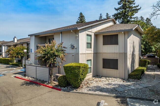
Property Detail
1050 Lake Blvd
Sacramento-Roseville-Folsom, CA
SD2704 STONEGATE #6D PCL 5
036-380-008-000
Yolo
Apartment
California
PD
4a,4b
B and X Area of moderate flood hazard, usually the area between the limits of the 100-year and 500-year floods.
0.56 AC
2024
Stonegate
2025
Sacramento
010513
NEARBY LISTINGS FOR SALE OR LEASE
DEMOGRAPHICS near 1050 Lake Blvd
1 mile
3 mile
5 mile
2025 Total Population
12,420
55,359
82,573
2030 Population
12,637
57,050
84,827
Pop Growth 2025-2030
+ 1.75%
+ 3.05%
+ 2.73%
Average Age
37
32
34
2025 Total Households
4,615
18,518
28,500
HH Growth 2025-2030
+ 1.56%
+ 2.93%
+ 2.69%
Median Household Inc
$92,926
$75,598
$86,016
Avg Household Size
2.40
2.40
2.50
2025 Avg HH Vehicles
2.00
2.00
2.00
Median Home Value
$812,035
$839,008
$820,395
Median Year Built
1985
1980
1983
Nearby Places
Map Layers
Map Styles
 Street
 Aerial
Layers
 Traffic
 Biking
Places
Listings with unknown addresses are not visible on the map
- Restaurants
- Banks
- Shops
- Fitness
- Groceries
PUBLIC TRANSPORTATION
COMMUTER RAIL
Davis (Capitol Corridor - Capitol Corridor Joint Powers Authority)
Drive
Walk
Distance
Davis (Capitol Corridor - Capitol Corridor Joint Powers Authority)
10 min
3.6 mi
AIRPORT
Sacramento International
Drive
Walk
Distance
Sacramento International
30 min
20.4 mi
Freight Ports
Port of Stockton
Drive
Walk
Distance
Port of Stockton
76 min
63.1 mi
Nearby Properties
Address
Land Use
TOTAL SIZE
Lot Size
Zoning
Address
Land Use
TOTAL SIZE
Lot Size
Zoning
11.18 AC
P-D
Address
Land Use
TOTAL SIZE
Lot Size
Zoning
40,000 SF
16.56 AC
A1
Address
Land Use
TOTAL SIZE
Lot Size
Zoning
5.92 AC
P-D
Address
Land Use
TOTAL SIZE
Lot Size
Zoning
185,271 SF
1.01 AC
RHD
Address
Land Use
TOTAL SIZE
Lot Size
Zoning
4.40 AC
PD
Address
Land Use
TOTAL SIZE
Lot Size
Zoning
152,916 SF
0.17 AC
PD
Address
Land Use
TOTAL SIZE
Lot Size
Zoning
13,068 SF
8.25 AC
PD
Address
Land Use
TOTAL SIZE
Lot Size
Zoning
1.93 AC
PD
Address
Land Use
TOTAL SIZE
Lot Size
Zoning
61,829 SF
1.31 AC
CC
Address
Land Use
TOTAL SIZE
Lot Size
Zoning
12,361 SF
0.59 AC
PD
Address
Land Use
TOTAL SIZE
Lot Size
Zoning
59,200 SF
2.34 AC
R3M
Address
Land Use
TOTAL SIZE
Lot Size
Zoning
158,000 SF
0.13 AC
PD
Address
Land Use
TOTAL SIZE
Lot Size
Zoning
61,624 SF
3.66 AC
PD
Address
Land Use
TOTAL SIZE
Lot Size
Zoning
94,720 SF
3.93 AC
R3M
Address
Land Use
TOTAL SIZE
Lot Size
Zoning
56,480 SF
2.15 AC
R3
Address
Land Use
TOTAL SIZE
Lot Size
Zoning
13,243 SF
1.96 AC
A1
Address
Land Use
TOTAL SIZE
Lot Size
Zoning
0.79 AC
PD
Address
Land Use
TOTAL SIZE
Lot Size
Zoning
0.11 AC
Address
Land Use
TOTAL SIZE
Lot Size
Zoning
49,856 SF
2.15 AC
R3
Address
Land Use
TOTAL SIZE
Lot Size
Zoning
133,728 SF
0.24 AC
PD
Address
Land Use
TOTAL SIZE
Lot Size
Zoning
75,472 SF
1.95 AC
RHD
Address
Land Use
TOTAL SIZE
Lot Size
Zoning
48,852 SF
1.86 AC
R3M
Address
Land Use
TOTAL SIZE
Lot Size
Zoning
32.92 AC
Address
Land Use
TOTAL SIZE
Lot Size
Zoning
137,892 SF
0.14 AC
PD
Address
Land Use
TOTAL SIZE
Lot Size
Zoning
95,408 SF
4.01 AC
PD
Address
Land Use
TOTAL SIZE
Lot Size
Zoning
35,018 SF
2.98 AC
PD
Address
Land Use
TOTAL SIZE
Lot Size
Zoning
115,568 SF
0.19 AC
PD
Address
Land Use
TOTAL SIZE
Lot Size
Zoning
34,545 SF
0.47 AC
PD
Address
Land Use
TOTAL SIZE
Lot Size
Zoning
112,000 SF
7.05 AC
R3M
Address
Land Use
TOTAL SIZE
Lot Size
Zoning
90,042 SF
0.33 AC
R3L
The World's #1 Commercial Real Estate Marketplace
Connect with us
© 2026 CoStar Group
The information above has been obtained from sources believed reliable. While we do not doubt its accuracy we have not verified it and make no guarantee, warranty or representation about it. It is your responsibility to independently confirm its accuracy and completeness. Any projections, opinions, assumptions, or estimates used are for example only and do not represent the current or future performance of the property. The value of this transaction to you depends on tax and other factors which should be evaluated by your tax, financial, and legal advisors. You and your advisors should conduct a careful, independent investigation of the property to determine to your satisfaction the suitability of the property for your needs.