Property Record
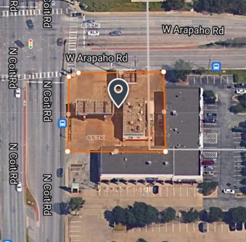
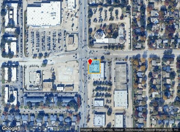
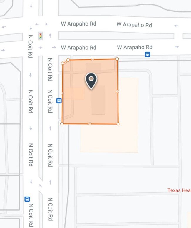
1050 N Coit Rd, Richardson, TX 75080
NEARBY LISTINGS FOR SALE OR LEASE
Property Detail
1050 N Coit Rd
Dallas-Fort Worth-Arlington, TX
Promenade Shopping Center Sec 1
42142700000020000
PROMENADE SHOPPING CENTER SEC 1 TR 2 ACS 0.4444 LESS ROW INT 20070225280 DD05162007 CO-DC 1427000000200 2CR14270000
Servicestationmarket
Dallas
X
Texas
48085C0485K
2
2024
0.44 AC
2025
Richardson
019215
Dallas/Ft Worth
1,901 SF
DEMOGRAPHICS near 1050 N Coit Rd
1 mile
3 mile
5 mile
2024 Total Population
14,337
144,218
392,555
2029 Population
14,128
148,578
416,171
Pop Growth 2024-2029
(1.46%)
+ 3.02%
+ 6.02%
Average Age
38
37
38
2024 Total Households
4,959
58,628
172,182
HH Growth 2024-2029
(1.75%)
+ 3.35%
+ 6.49%
Median Household Inc
$113,011
$68,601
$69,842
Avg Household Size
2.80
2.30
2.20
2024 Avg HH Vehicles
2.00
2.00
2.00
Median Home Value
$400,050
$414,101
$392,275
Median Year Built
1968
1978
1983
Nearby Places
Map Layers
Map Styles
 Street
 Aerial
Transit
 Traffic
 Biking
Places
Listings with unknown addresses are not visible on the map
- Restaurants
- Banks
- Shops
- Fitness
- Groceries
PUBLIC TRANSPORTATION
AIRPORT
Dallas Love Field
Drive
Walk
Distance
Dallas Love Field
23 min
14.4 mi
Dallas-Fort Worth International
Drive
Walk
Distance
Dallas-Fort Worth International
31 min
23.6 mi
Freight Ports
Port of Shreveport
Drive
Walk
Distance
Port of Shreveport
219 min
201.7 mi
Nearby Properties
Address
Land Use
TOTAL SIZE
Lot Size
Zoning
Address
Land Use
TOTAL SIZE
Lot Size
Zoning
7,706,477 SF
245.55 AC
Z116
Address
Land Use
TOTAL SIZE
Lot Size
Zoning
1,614,550 SF
77.76 AC
SFR
Address
Land Use
TOTAL SIZE
Lot Size
Zoning
686,032 SF
9 AC
R2000
Address
Land Use
TOTAL SIZE
Lot Size
Zoning
369,694 SF
Address
Land Use
TOTAL SIZE
Lot Size
Zoning
533,962 SF
29.78 AC
MF-M
Address
Land Use
TOTAL SIZE
Lot Size
Zoning
445,071 SF
107.94 AC
2493-A TO-
Address
Land Use
TOTAL SIZE
Lot Size
Zoning
421,798 SF
9 AC
Z151
Address
Land Use
TOTAL SIZE
Lot Size
Zoning
430,618 SF
11.33 AC
MF-H
Address
Land Use
TOTAL SIZE
Lot Size
Zoning
520,713 SF
8.03 AC
Address
Land Use
TOTAL SIZE
Lot Size
Zoning
393,416 SF
Address
Land Use
TOTAL SIZE
Lot Size
Zoning
706,061 SF
36.76 AC
Z109
Address
Land Use
TOTAL SIZE
Lot Size
Zoning
696,563 SF
19.77 AC
Z239
Address
Land Use
TOTAL SIZE
Lot Size
Zoning
386,448 SF
Address
Land Use
TOTAL SIZE
Lot Size
Zoning
462,916 SF
15.67 AC
Z248
Address
Land Use
TOTAL SIZE
Lot Size
Zoning
595,188 SF
6.16 AC
Z239
Address
Land Use
TOTAL SIZE
Lot Size
Zoning
379,592 SF
12.75 AC
Z248
Address
Land Use
TOTAL SIZE
Lot Size
Zoning
537,928 SF
11.13 AC
Z109
Address
Land Use
TOTAL SIZE
Lot Size
Zoning
488,063 SF
31.19 AC
MF-L
Address
Land Use
TOTAL SIZE
Lot Size
Zoning
787,326 SF
7.39 AC
Z181
Address
Land Use
TOTAL SIZE
Lot Size
Zoning
303,616 SF
12.58 AC
Z163
Address
Land Use
TOTAL SIZE
Lot Size
Zoning
424,666 SF
12.19 AC
Z151
Address
Land Use
TOTAL SIZE
Lot Size
Zoning
211,607 SF
Address
Land Use
TOTAL SIZE
Lot Size
Zoning
316,085 SF
13.73 AC
Z107
Address
Land Use
TOTAL SIZE
Lot Size
Zoning
498,499 SF
6.42 AC
Z149
Address
Land Use
TOTAL SIZE
Lot Size
Zoning
302,594 SF
16.02 AC
TO-M
Address
Land Use
TOTAL SIZE
Lot Size
Zoning
593,252 SF
8.50 AC
Z164
Address
Land Use
TOTAL SIZE
Lot Size
Zoning
424,095 SF
4.74 AC
Z239
Address
Land Use
TOTAL SIZE
Lot Size
Zoning
456,238 SF
20.07 AC
Z239
Address
Land Use
TOTAL SIZE
Lot Size
Zoning
340,812 SF
5.34 AC
R/0-M
The World's #1 Commercial Real Estate Marketplace
Connect with us
© 2026 CoStar Group
The information above has been obtained from sources believed reliable. While we do not doubt its accuracy we have not verified it and make no guarantee, warranty or representation about it. It is your responsibility to independently confirm its accuracy and completeness. Any projections, opinions, assumptions, or estimates used are for example only and do not represent the current or future performance of the property. The value of this transaction to you depends on tax and other factors which should be evaluated by your tax, financial, and legal advisors. You and your advisors should conduct a careful, independent investigation of the property to determine to your satisfaction the suitability of the property for your needs.