Property Record
1050 Williams Rd, Anderson, SC 29625

Save to a Folder
{{folder.Name}}
{{folder.ListingIds.length}} Properties
{{folder.ListingIds.length}} Property
Create a New Folder
Property Detail
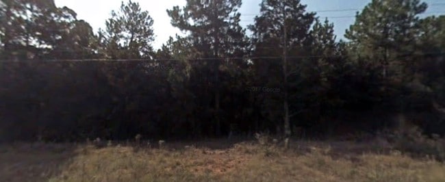
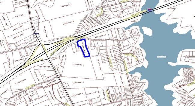
1050 Williams Rd
045-00-06-002
CP S 3201/8 PP S 2555/8 F293 D735 PP S 247/2A WILLIAMS RD 4.64 AC
Commercialnec
ANDERSON
B and X Area of moderate flood hazard, usually the area between the limits of the 100-year and 500-year floods.
South Carolina
2025
4.64 AC
2025
Anderson County
010800
Greenville/Spartanburg
8,750 SF
Greenville-Anderson-Greer, SC
NEARBY LISTINGS FOR SALE OR LEASE
-
-
View all Anderson listings for sale on LoopNet.com
DEMOGRAPHICS near 1050 Williams Rd
1 mile
3 mile
5 mile
2025 Total Population
989
8,575
20,669
2030 Population
1,069
9,198
21,978
Pop Growth 2025-2030
+ 8.09%
+ 7.27%
+ 6.33%
Average Age
45
45
44
2025 Total Households
432
3,607
8,626
HH Growth 2025-2030
+ 8.33%
+ 7.60%
+ 6.69%
Median Household Inc
$100,481
$82,051
$77,639
Avg Household Size
2.30
2.40
2.40
2025 Avg HH Vehicles
2.00
2.00
2.00
Median Home Value
$414,516
$335,970
$291,093
Median Year Built
1997
1995
1993
Nearby Places
Map Layers
Map Styles
 Street
 Aerial
Layers
 Traffic
 Biking
Places
Listings with unknown addresses are not visible on the map
- Restaurants
- Banks
- Shops
- Fitness
- Groceries
SALE & LEASE HISTORY
LISTING DATE
SALE/LEASE

Sep 24, 2016
For Sale
Sep 24, 2016
For Sale
Jun 28, 2017
For Sale
Nearby Properties
Address
Land Use
TOTAL SIZE
Lot Size
Zoning
Address
Land Use
TOTAL SIZE
Lot Size
Zoning
10.51 AC
Address
Land Use
TOTAL SIZE
Lot Size
Zoning
13,100 SF
15.25 AC
Address
Land Use
TOTAL SIZE
Lot Size
Zoning
50.20 AC
Address
Land Use
TOTAL SIZE
Lot Size
Zoning
28,526 SF
1.32 AC
Address
Land Use
TOTAL SIZE
Lot Size
Zoning
360 SF
9.68 AC
Address
Land Use
TOTAL SIZE
Lot Size
Zoning
13,705 SF
4 AC
Address
Land Use
TOTAL SIZE
Lot Size
Zoning
3,341 SF
1.37 AC
Address
Land Use
TOTAL SIZE
Lot Size
Zoning
10,774 SF
1.40 AC
Address
Land Use
TOTAL SIZE
Lot Size
Zoning
8,121 SF
4 AC
Address
Land Use
TOTAL SIZE
Lot Size
Zoning
2,756 SF
39.59 AC
Address
Land Use
TOTAL SIZE
Lot Size
Zoning
49,502 SF
6.94 AC
Address
Land Use
TOTAL SIZE
Lot Size
Zoning
Address
Land Use
TOTAL SIZE
Lot Size
Zoning
10,596 SF
1.76 AC
Address
Land Use
TOTAL SIZE
Lot Size
Zoning
3,087 SF
5.68 AC
Address
Land Use
TOTAL SIZE
Lot Size
Zoning
34,647 SF
5.87 AC
Address
Land Use
TOTAL SIZE
Lot Size
Zoning
3,968 SF
0.92 AC
Address
Land Use
TOTAL SIZE
Lot Size
Zoning
4,008 SF
5.75 AC
Address
Land Use
TOTAL SIZE
Lot Size
Zoning
24.25 AC
Address
Land Use
TOTAL SIZE
Lot Size
Zoning
12,185 SF
3 AC
Address
Land Use
TOTAL SIZE
Lot Size
Zoning
9,141 SF
1.53 AC
Address
Land Use
TOTAL SIZE
Lot Size
Zoning
480 SF
4.66 AC
Address
Land Use
TOTAL SIZE
Lot Size
Zoning
Address
Land Use
TOTAL SIZE
Lot Size
Zoning
2,441 SF
4.32 AC
Address
Land Use
TOTAL SIZE
Lot Size
Zoning
13,710 SF
1.99 AC
Address
Land Use
TOTAL SIZE
Lot Size
Zoning
2.18 AC
Address
Land Use
TOTAL SIZE
Lot Size
Zoning
7,927 SF
6.50 AC
Address
Land Use
TOTAL SIZE
Lot Size
Zoning
25,368 SF
3.08 AC
Address
Land Use
TOTAL SIZE
Lot Size
Zoning
26.82 AC
Address
Land Use
TOTAL SIZE
Lot Size
Zoning
22,752 SF
1.41 AC
Address
Land Use
TOTAL SIZE
Lot Size
Zoning
2,352 SF
0.97 AC
The World's #1 Commercial Real Estate Marketplace
Connect with us
© 2026 CoStar Group
The information above has been obtained from sources believed reliable. While we do not doubt its accuracy we have not verified it and make no guarantee, warranty or representation about it. It is your responsibility to independently confirm its accuracy and completeness. Any projections, opinions, assumptions, or estimates used are for example only and do not represent the current or future performance of the property. The value of this transaction to you depends on tax and other factors which should be evaluated by your tax, financial, and legal advisors. You and your advisors should conduct a careful, independent investigation of the property to determine to your satisfaction the suitability of the property for your needs.