Property Record
10500 Gosling Rd, Spring, TX 77381
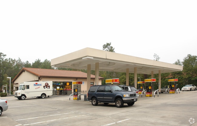


Property Detail
10500 Gosling Rd
9726-98-00190
S972698 - WDLNDS PANTHER CK VIL SQ, REPLAT-SEC 01, RES J, ACRES 1.399, STORE #204.01
Commercialnec
MONTGOMERY
6
Texas
B and X Area of moderate flood hazard, usually the area between the limits of the 100-year and 500-year floods.
1.40 AC
2024
Montgomery County
2025
Houston
691201
Houston-Pasadena-The Woodlands, TX
3,948 SF
NEARBY LISTINGS FOR SALE OR LEASE
DEMOGRAPHICS near 10500 Gosling Rd
1 mile
3 mile
5 mile
2025 Total Population
13,819
77,932
197,060
2030 Population
15,939
88,967
224,702
Pop Growth 2025-2030
+ 15.34%
+ 14.16%
+ 14.03%
Average Age
43
41
40
2025 Total Households
5,763
30,238
74,762
HH Growth 2025-2030
+ 16.02%
+ 15.15%
+ 14.90%
Median Household Inc
$96,603
$126,581
$116,174
Avg Household Size
2.30
2.50
2.60
2025 Avg HH Vehicles
2.00
2.00
2.00
Median Home Value
$400,975
$501,262
$448,202
Median Year Built
1987
1999
2004
Nearby Places
Map Layers
Map Styles
 Street
 Aerial
Transit
 Traffic
 Biking
Places
Listings with unknown addresses are not visible on the map
- Restaurants
- Banks
- Shops
- Fitness
- Groceries
PUBLIC TRANSPORTATION
AIRPORT
George Bush Intcntl/Houston
Drive
Walk
Distance
George Bush Intcntl/Houston
32 min
24.3 mi
Freight Ports
Port of Houston
Drive
Walk
Distance
Port of Houston
55 min
40.0 mi
Nearby Properties
Address
Land Use
TOTAL SIZE
Lot Size
Zoning
Address
Land Use
TOTAL SIZE
Lot Size
Zoning
718,313 SF
33.62 AC
Address
Land Use
TOTAL SIZE
Lot Size
Zoning
709,789 SF
3.04 AC
Address
Land Use
TOTAL SIZE
Lot Size
Zoning
707,184 SF
3.48 AC
Address
Land Use
TOTAL SIZE
Lot Size
Zoning
565,113 SF
4.52 AC
Address
Land Use
TOTAL SIZE
Lot Size
Zoning
469,813 SF
3.16 AC
Address
Land Use
TOTAL SIZE
Lot Size
Zoning
225,149 SF
1.07 AC
Address
Land Use
TOTAL SIZE
Lot Size
Zoning
670,665 SF
6.70 AC
Address
Land Use
TOTAL SIZE
Lot Size
Zoning
571,041 SF
4.82 AC
Address
Land Use
TOTAL SIZE
Lot Size
Zoning
438,062 SF
4.54 AC
Address
Land Use
TOTAL SIZE
Lot Size
Zoning
1,132,062 SF
3.31 AC
Address
Land Use
TOTAL SIZE
Lot Size
Zoning
410,156 SF
18.68 AC
Address
Land Use
TOTAL SIZE
Lot Size
Zoning
327,377 SF
24.02 AC
6
Address
Land Use
TOTAL SIZE
Lot Size
Zoning
473,060 SF
10.07 AC
Address
Land Use
TOTAL SIZE
Lot Size
Zoning
327,018 SF
21.91 AC
6
Address
Land Use
TOTAL SIZE
Lot Size
Zoning
392,960 SF
20.01 AC
6
Address
Land Use
TOTAL SIZE
Lot Size
Zoning
514,121 SF
2.01 AC
Address
Land Use
TOTAL SIZE
Lot Size
Zoning
289,737 SF
13.83 AC
Address
Land Use
TOTAL SIZE
Lot Size
Zoning
279,413 SF
12.45 AC
6
Address
Land Use
TOTAL SIZE
Lot Size
Zoning
336,730 SF
2.41 AC
Address
Land Use
TOTAL SIZE
Lot Size
Zoning
383,484 SF
4.67 AC
Address
Land Use
TOTAL SIZE
Lot Size
Zoning
246,719 SF
1.25 AC
Address
Land Use
TOTAL SIZE
Lot Size
Zoning
162,976 SF
1.04 AC
Address
Land Use
TOTAL SIZE
Lot Size
Zoning
246,043 SF
1.88 AC
Address
Land Use
TOTAL SIZE
Lot Size
Zoning
323,119 SF
14.37 AC
Address
Land Use
TOTAL SIZE
Lot Size
Zoning
170,955 SF
21.98 AC
Address
Land Use
TOTAL SIZE
Lot Size
Zoning
48,334 SF
13.88 AC
Address
Land Use
TOTAL SIZE
Lot Size
Zoning
310,245 SF
6.80 AC
Address
Land Use
TOTAL SIZE
Lot Size
Zoning
324,336 SF
13.11 AC
Address
Land Use
TOTAL SIZE
Lot Size
Zoning
330,528 SF
1.21 AC
Address
Land Use
TOTAL SIZE
Lot Size
Zoning
289,611 SF
13.57 AC
The World's #1 Commercial Real Estate Marketplace
Connect with us
© 2026 CoStar Group
The information above has been obtained from sources believed reliable. While we do not doubt its accuracy we have not verified it and make no guarantee, warranty or representation about it. It is your responsibility to independently confirm its accuracy and completeness. Any projections, opinions, assumptions, or estimates used are for example only and do not represent the current or future performance of the property. The value of this transaction to you depends on tax and other factors which should be evaluated by your tax, financial, and legal advisors. You and your advisors should conduct a careful, independent investigation of the property to determine to your satisfaction the suitability of the property for your needs.