Property Record
10300 N Interstate 35, Jarrell, TX 76537

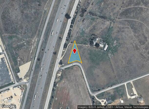
Property Detail
10300 N Interstate 35
Austin-Round Rock-San Marcos, TX
Parson, E. Sur.
R011859
AW0494 AW0494 - PARSON, E. SUR., ACRES 0.594
Agriculturalland
Williamson
X
Texas
48491C0150F
0.59 AC
2024
Georgetown
2025
Austin
021601
NEARBY LISTINGS FOR SALE OR LEASE
DEMOGRAPHICS near 10300 N Interstate 35
1 mile
3 mile
5 mile
2024 Total Population
201
13,683
17,225
2029 Population
263
17,560
22,102
Pop Growth 2024-2029
+ 30.85%
+ 28.33%
+ 28.31%
Average Age
38
34
35
2024 Total Households
68
4,599
5,801
HH Growth 2024-2029
+ 30.88%
+ 28.81%
+ 28.82%
Median Household Inc
$85,937
$83,753
$83,377
Avg Household Size
3.00
2.90
2.90
2024 Avg HH Vehicles
3.00
2.00
2.00
Median Home Value
$388,888
$243,277
$259,037
Median Year Built
2009
2011
2010
Nearby Places
Map Layers
Map Styles
 Street
 Aerial
Transit
 Traffic
 Biking
Places
Listings with unknown addresses are not visible on the map
- Restaurants
- Banks
- Shops
- Fitness
- Groceries
PUBLIC TRANSPORTATION
AIRPORT
Killeen Municipal
Drive
Walk
Distance
Killeen Municipal
39 min
29.4 mi
Robert Gray AAF
Drive
Walk
Distance
Robert Gray AAF
51 min
37.5 mi
Freight Ports
Port of Houston
Drive
Walk
Distance
Port of Houston
226 min
194.1 mi
SALE & LEASE HISTORY
LISTING DATE
SALE/LEASE

Mar 11, 2020
For Sale
Nearby Properties
Address
Land Use
TOTAL SIZE
Lot Size
Zoning
Address
Land Use
TOTAL SIZE
Lot Size
Zoning
253,037 SF
16.36 AC
Address
Land Use
TOTAL SIZE
Lot Size
Zoning
91.32 AC
Address
Land Use
TOTAL SIZE
Lot Size
Zoning
79.09 AC
Address
Land Use
TOTAL SIZE
Lot Size
Zoning
110,565 SF
14.29 AC
Address
Land Use
TOTAL SIZE
Lot Size
Zoning
300,531 SF
15.03 AC
Address
Land Use
TOTAL SIZE
Lot Size
Zoning
132,200 SF
7.92 AC
Address
Land Use
TOTAL SIZE
Lot Size
Zoning
120,837 SF
8.44 AC
Address
Land Use
TOTAL SIZE
Lot Size
Zoning
98,000 SF
74.75 AC
Address
Land Use
TOTAL SIZE
Lot Size
Zoning
29,000 SF
25 AC
Address
Land Use
TOTAL SIZE
Lot Size
Zoning
15.03 AC
Address
Land Use
TOTAL SIZE
Lot Size
Zoning
20,414 SF
8.27 AC
Address
Land Use
TOTAL SIZE
Lot Size
Zoning
39,020 SF
11.65 AC
Address
Land Use
TOTAL SIZE
Lot Size
Zoning
15,615 SF
2.39 AC
Address
Land Use
TOTAL SIZE
Lot Size
Zoning
68,261 SF
4.12 AC
Address
Land Use
TOTAL SIZE
Lot Size
Zoning
28,704 SF
13.05 AC
Address
Land Use
TOTAL SIZE
Lot Size
Zoning
18,001 SF
8.87 AC
Address
Land Use
TOTAL SIZE
Lot Size
Zoning
21,844 SF
3.25 AC
Address
Land Use
TOTAL SIZE
Lot Size
Zoning
30,996 SF
12.02 AC
Address
Land Use
TOTAL SIZE
Lot Size
Zoning
17.89 AC
Address
Land Use
TOTAL SIZE
Lot Size
Zoning
1,600 SF
221.78 AC
Address
Land Use
TOTAL SIZE
Lot Size
Zoning
11,100 SF
10 AC
Address
Land Use
TOTAL SIZE
Lot Size
Zoning
32,220 SF
4 AC
Address
Land Use
TOTAL SIZE
Lot Size
Zoning
16.79 AC
Address
Land Use
TOTAL SIZE
Lot Size
Zoning
25,000 SF
2.99 AC
Address
Land Use
TOTAL SIZE
Lot Size
Zoning
31,850 SF
20 AC
Address
Land Use
TOTAL SIZE
Lot Size
Zoning
24,668 SF
3.41 AC
Address
Land Use
TOTAL SIZE
Lot Size
Zoning
201.67 AC
Address
Land Use
TOTAL SIZE
Lot Size
Zoning
2,096 SF
5 AC
Address
Land Use
TOTAL SIZE
Lot Size
Zoning
17,822 SF
2.07 AC
Address
Land Use
TOTAL SIZE
Lot Size
Zoning
8,216 SF
1.25 AC
The World's #1 Commercial Real Estate Marketplace
Connect with us
© 2026 CoStar Group
The information above has been obtained from sources believed reliable. While we do not doubt its accuracy we have not verified it and make no guarantee, warranty or representation about it. It is your responsibility to independently confirm its accuracy and completeness. Any projections, opinions, assumptions, or estimates used are for example only and do not represent the current or future performance of the property. The value of this transaction to you depends on tax and other factors which should be evaluated by your tax, financial, and legal advisors. You and your advisors should conduct a careful, independent investigation of the property to determine to your satisfaction the suitability of the property for your needs.