Property Record
10501 Denton Dr, Dallas, TX 75220


NEARBY LISTINGS FOR SALE OR LEASE
Property Detail
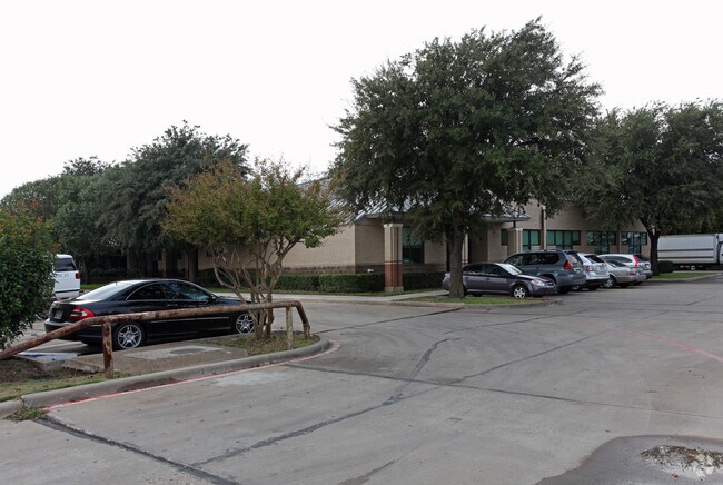
10501 Denton Dr
Dallas-Fort Worth-Arlington, TX
Letot Center 2
006464000004A0000
LETOT CENTER 2 BLK 6464 LT 4A ACS 4.432 INT 200900021471 DD01212009 CO-DC 6464 000 00000 1DA6464 000
Publicschool
Dallas
AE
Texas
48113C0310J
4a
0
4.43 AC
2025
Stemmons Freeway
009804
Dallas/Ft Worth
72,407 SF
DEMOGRAPHICS near 10501 Denton Dr
1 Mile
3 Mile
5 Mile
2024 Total Population
22,025
76,507
243,755
2029 Population
22,062
76,516
244,171
Pop Growth 2024-2029
+ 0.17%
+ 0.01%
+ 0.17%
Average Age
31
35
37
2024 Total Households
7,282
27,393
98,138
HH Growth 2024-2029
(0.08%)
(0.01%)
+ 0.33%
Median Household Inc
$42,088
$65,146
$77,258
Avg Household Size
2.90
2.70
2.40
2024 Avg HH Vehicles
1.00
2.00
2.00
Median Home Value
$252,339
$385,641
$433,565
Median Year Built
1975
1971
1982
Nearby Places
Map Layers
Map Styles
 Street
 Aerial
- Restaurants
- Banks
- Shops
- Fitness
- Groceries
PUBLIC TRANSPORTATION
TRANSIT/SUBWAY
Bachman Station (DART LIGHT RAIL - GREEN LINE - Dallas Area Rapid Transit (DART), DART LIGHT RAIL - ORANGE LINE - Dallas Area Rapid Transit (DART), Green Line - Dallas Area Rapid Transit (DART), Orange Line - Dallas Area Rapid Transit (DART))
DRIVE
WALK
Distance
Bachman Station (DART LIGHT RAIL - GREEN LINE - Dallas Area Rapid Transit (DART), DART LIGHT RAIL - ORANGE LINE - Dallas Area Rapid Transit (DART), Green Line - Dallas Area Rapid Transit (DART), Orange Line - Dallas Area Rapid Transit (DART))
3 min
19 min
1.0 mi
COMMUTER RAIL
Medical/Market Ctr Station (TRINITY RAILWAY - Dallas Area Rapid Transit (DART))
DRIVE
WALK
Distance
Medical/Market Ctr Station (TRINITY RAILWAY - Dallas Area Rapid Transit (DART))
10 min
6.0 mi
Medical/Market Center (Trinity Railway Express - Dallas Area Rapid Transit (DART))
DRIVE
WALK
Distance
Medical/Market Center (Trinity Railway Express - Dallas Area Rapid Transit (DART))
10 min
6.0 mi
AIRPORT
Dallas Love Field
DRIVE
WALK
Distance
Dallas Love Field
11 min
5.0 mi
Dallas-Fort Worth International
DRIVE
WALK
Distance
Dallas-Fort Worth International
21 min
14.0 mi
Freight Ports
Port of Shreveport
DRIVE
WALK
Distance
Port of Shreveport
224 min
206.1 mi
Nearby Properties
Address
Land Use
TOTAL SIZE
Lot Size
Zoning
Address
Land Use
TOTAL SIZE
Lot Size
Zoning
2,476 SF
1,203.03 AC
Z116
Address
Land Use
TOTAL SIZE
Lot Size
Zoning
4,407,366 SF
1,300 AC
IR
Address
Land Use
TOTAL SIZE
Lot Size
Zoning
450,131 SF
39.95 AC
Z296
Address
Land Use
TOTAL SIZE
Lot Size
Zoning
30,000 SF
78.01 AC
Z392
Address
Land Use
TOTAL SIZE
Lot Size
Zoning
1,898,977 SF
42.38 AC
Z239
Address
Land Use
TOTAL SIZE
Lot Size
Zoning
729,266 SF
10.20 AC
Z239
Address
Land Use
TOTAL SIZE
Lot Size
Zoning
654,829 SF
9.78 AC
Z243
Address
Land Use
TOTAL SIZE
Lot Size
Zoning
608,308 SF
7.26 AC
Z198
Address
Land Use
TOTAL SIZE
Lot Size
Zoning
618,535 SF
1,300 AC
IR
Address
Land Use
TOTAL SIZE
Lot Size
Zoning
253,580 SF
188.04 AC
Z393
Address
Land Use
TOTAL SIZE
Lot Size
Zoning
529,640 SF
5.13 AC
Z393
Address
Land Use
TOTAL SIZE
Lot Size
Zoning
558,547 SF
7.39 AC
Z198
Address
Land Use
TOTAL SIZE
Lot Size
Zoning
685,774 SF
7.36 AC
Z198
Address
Land Use
TOTAL SIZE
Lot Size
Zoning
174,728 SF
223.82 AC
Z298
Address
Land Use
TOTAL SIZE
Lot Size
Zoning
205,992 SF
21.48 AC
Z239
Address
Land Use
TOTAL SIZE
Lot Size
Zoning
343,192 SF
14.99 AC
Z151
Address
Land Use
TOTAL SIZE
Lot Size
Zoning
1,102,000 SF
4.98 AC
Z393
Address
Land Use
TOTAL SIZE
Lot Size
Zoning
388,822 SF
19.97 AC
Z116
Address
Land Use
TOTAL SIZE
Lot Size
Zoning
310,154 SF
10.33 AC
Z393
Address
Land Use
TOTAL SIZE
Lot Size
Zoning
165,600 SF
6.78 AC
Z296
Address
Land Use
TOTAL SIZE
Lot Size
Zoning
348,013 SF
11.09 AC
Z243
Address
Land Use
TOTAL SIZE
Lot Size
Zoning
357,100 SF
5.36 AC
Z323
Address
Land Use
TOTAL SIZE
Lot Size
Zoning
320,841 SF
12.64 AC
Z59
Address
Land Use
TOTAL SIZE
Lot Size
Zoning
404,096 SF
12.76 AC
Z239
Address
Land Use
TOTAL SIZE
Lot Size
Zoning
178,900 SF
15.93 AC
Z164
Address
Land Use
TOTAL SIZE
Lot Size
Zoning
184,751 SF
8.92 AC
Z294
Address
Land Use
TOTAL SIZE
Lot Size
Zoning
329,373 SF
14.98 AC
Z125
Address
Land Use
TOTAL SIZE
Lot Size
Zoning
114,386 SF
7.33 AC
Z294
Address
Land Use
TOTAL SIZE
Lot Size
Zoning
134,265 SF
29.20 AC
Z116
Address
Land Use
TOTAL SIZE
Lot Size
Zoning
659,704 SF
11.55 AC
Z393
The World's #1 Commercial Real Estate Marketplace
Connect with us
© 2025 CoStar Group
The information above has been obtained from sources believed reliable. While we do not doubt its accuracy we have not verified it and make no guarantee, warranty or representation about it. It is your responsibility to independently confirm its accuracy and completeness. Any projections, opinions, assumptions, or estimates used are for example only and do not represent the current or future performance of the property. The value of this transaction to you depends on tax and other factors which should be evaluated by your tax, financial, and legal advisors. You and your advisors should conduct a careful, independent investigation of the property to determine to your satisfaction the suitability of the property for your needs.