Property Record
10501 S Fm 1541, Amarillo, TX 79118


Property Detail
10501 S Fm 1541
R-200-1770-0060-0
SECT 177 A B & M BLK 0002, A 300FT N X 740.52FT E TR BEG 548.47FT S OF NW COR OF SECT, 5.1000 ACRES
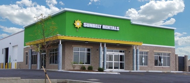
Warehouse
Randall
B and X Area of moderate flood hazard, usually the area between the limits of the 100-year and 500-year floods.
Texas
2024
5.04 AC
2025
Amarillo
021702
Other Market Areas
12,420 SF
Amarillo, TX
NEARBY LISTINGS FOR SALE OR LEASE
-
-
View all Amarillo listings for sale on LoopNet.com
DEMOGRAPHICS near 10501 S Fm 1541
1 mile
3 mile
5 mile
2025 Total Population
526
15,074
71,134
2030 Population
567
16,034
74,829
Pop Growth 2025-2030
+ 7.79%
+ 6.37%
+ 5.19%
Average Age
42
38
39
2025 Total Households
201
5,322
28,357
HH Growth 2025-2030
+ 7.46%
+ 6.54%
+ 5.17%
Median Household Inc
$85,256
$92,688
$76,937
Avg Household Size
2.50
2.70
2.40
2025 Avg HH Vehicles
3.00
2.00
2.00
Median Home Value
$287,930
$251,558
$221,284
Median Year Built
2001
2005
1985
Nearby Places
Map Layers
Map Styles
 Street
 Aerial
Layers
 Traffic
 Biking
Places
Listings with unknown addresses are not visible on the map
- Restaurants
- Banks
- Shops
- Fitness
- Groceries
PUBLIC TRANSPORTATION
AIRPORT
Rick Husband Amarillo International
Drive
Walk
Distance
Rick Husband Amarillo International
24 min
15.0 mi
SALE & LEASE HISTORY
LISTING DATE
SALE/LEASE

Sep 23, 2016
For Sale
Nearby Properties
Address
Land Use
TOTAL SIZE
Lot Size
Zoning
Address
Land Use
TOTAL SIZE
Lot Size
Zoning
362,796 SF
49.98 AC
A
Address
Land Use
TOTAL SIZE
Lot Size
Zoning
228,223 SF
20.83 AC
Address
Land Use
TOTAL SIZE
Lot Size
Zoning
258,757 SF
22.78 AC
A
Address
Land Use
TOTAL SIZE
Lot Size
Zoning
112,261 SF
21.82 AC
Address
Land Use
TOTAL SIZE
Lot Size
Zoning
148,486 SF
20.66 AC
Address
Land Use
TOTAL SIZE
Lot Size
Zoning
189,125 SF
54.69 AC
Address
Land Use
TOTAL SIZE
Lot Size
Zoning
182,242 SF
20.70 AC
Address
Land Use
TOTAL SIZE
Lot Size
Zoning
74,960 SF
7 AC
R2
Address
Land Use
TOTAL SIZE
Lot Size
Zoning
204,468 SF
17.56 AC
Address
Land Use
TOTAL SIZE
Lot Size
Zoning
161,321 SF
31 AC
A
Address
Land Use
TOTAL SIZE
Lot Size
Zoning
68,214 SF
9.06 AC
Address
Land Use
TOTAL SIZE
Lot Size
Zoning
694,915 SF
27.22 AC
Address
Land Use
TOTAL SIZE
Lot Size
Zoning
266,594 SF
15.39 AC
Address
Land Use
TOTAL SIZE
Lot Size
Zoning
663,313 SF
149.32 AC
Address
Land Use
TOTAL SIZE
Lot Size
Zoning
42,332 SF
7.44 AC
Address
Land Use
TOTAL SIZE
Lot Size
Zoning
97,796 SF
4 AC
Address
Land Use
TOTAL SIZE
Lot Size
Zoning
46,335 SF
5.05 AC
Address
Land Use
TOTAL SIZE
Lot Size
Zoning
57,451 SF
7.55 AC
R2
Address
Land Use
TOTAL SIZE
Lot Size
Zoning
181,617 SF
10.97 AC
Address
Land Use
TOTAL SIZE
Lot Size
Zoning
42,450 SF
14.27 AC
Address
Land Use
TOTAL SIZE
Lot Size
Zoning
81,000 SF
7.21 AC
Address
Land Use
TOTAL SIZE
Lot Size
Zoning
100,000 SF
7.35 AC
Address
Land Use
TOTAL SIZE
Lot Size
Zoning
33,528 SF
15 AC
Address
Land Use
TOTAL SIZE
Lot Size
Zoning
71,750 SF
67.02 AC
Address
Land Use
TOTAL SIZE
Lot Size
Zoning
43,700 SF
21.35 AC
Address
Land Use
TOTAL SIZE
Lot Size
Zoning
19,360 SF
14.72 AC
Address
Land Use
TOTAL SIZE
Lot Size
Zoning
64,650 SF
7.07 AC
Address
Land Use
TOTAL SIZE
Lot Size
Zoning
122,012 SF
11.50 AC
Address
Land Use
TOTAL SIZE
Lot Size
Zoning
51,178 SF
48.86 AC
Address
Land Use
TOTAL SIZE
Lot Size
Zoning
23,076 SF
7.27 AC
R2
The World's #1 Commercial Real Estate Marketplace
Connect with us
© 2026 CoStar Group
The information above has been obtained from sources believed reliable. While we do not doubt its accuracy we have not verified it and make no guarantee, warranty or representation about it. It is your responsibility to independently confirm its accuracy and completeness. Any projections, opinions, assumptions, or estimates used are for example only and do not represent the current or future performance of the property. The value of this transaction to you depends on tax and other factors which should be evaluated by your tax, financial, and legal advisors. You and your advisors should conduct a careful, independent investigation of the property to determine to your satisfaction the suitability of the property for your needs.