Property Record
10505 S State Highway 29, Lower Lake, CA 95457


NEARBY LISTINGS FOR SALE OR LEASE
Property Detail
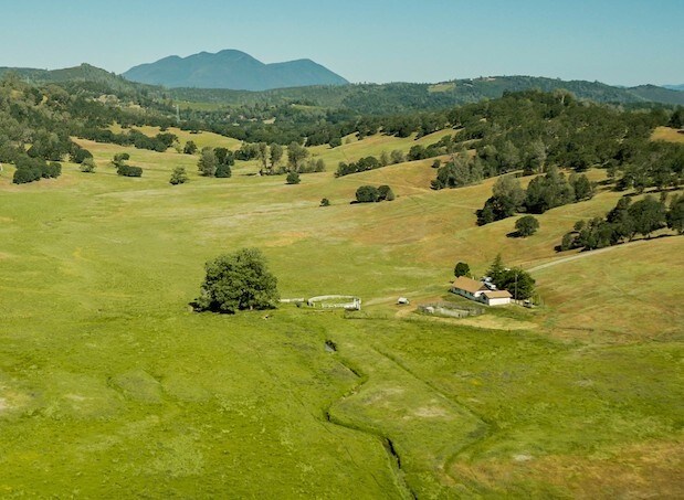
10505 S State Highway 29
Pasture
Lake
X
California
06033C0694E
516.13 AC
2025
Other Market Areas
2025
Clearlake, CA
001200
012-057-030-000
DEMOGRAPHICS near 10505 S State Highway 29
1 Mile
3 Mile
5 Mile
2024 Total Population
358
4,593
15,676
2029 Population
334
4,540
15,531
Pop Growth 2024-2029
(6.70%)
(1.15%)
(0.92%)
Average Age
44
41
41
2024 Total Households
132
1,808
6,023
HH Growth 2024-2029
(6.82%)
(1.16%)
(0.91%)
Median Household Inc
$77,083
$49,999
$47,380
Avg Household Size
2.50
2.50
2.50
2024 Avg HH Vehicles
3.00
2.00
2.00
Median Home Value
$593,750
$268,749
$208,623
Median Year Built
1987
1981
1977
Nearby Places
Map Layers
Map Styles
 Street
 Aerial
- Restaurants
- Banks
- Shops
- Fitness
- Groceries
PUBLIC TRANSPORTATION
AIRPORT
Charles M Schulz - Sonoma County
DRIVE
WALK
Distance
Charles M Schulz - Sonoma County
81 min
48.3 mi
Freight Ports
Port of Richmond
DRIVE
WALK
Distance
Port of Richmond
137 min
94.3 mi
SALE & LEASE HISTORY
LISTING DATE
SALE/LEASE

Sep 24, 2016
For Sale
Sep 13, 2017
For Sale
Oct 11, 2018
For Sale
Jan 05, 2017
For Sale
Nearby Properties
Address
Land Use
TOTAL SIZE
Lot Size
Zoning
Address
Land Use
TOTAL SIZE
Lot Size
Zoning
10.18 AC
Address
Land Use
TOTAL SIZE
Lot Size
Zoning
103,740 SF
13.56 AC
Address
Land Use
TOTAL SIZE
Lot Size
Zoning
4,995 SF
0.60 AC
Address
Land Use
TOTAL SIZE
Lot Size
Zoning
6,000 SF
2.72 AC
C2
Address
Land Use
TOTAL SIZE
Lot Size
Zoning
5,000 SF
159.04 AC
RL
Address
Land Use
TOTAL SIZE
Lot Size
Zoning
405.49 AC
APZ
Address
Land Use
TOTAL SIZE
Lot Size
Zoning
1,043 SF
59.73 AC
RL
Address
Land Use
TOTAL SIZE
Lot Size
Zoning
145 AC
RL
Address
Land Use
TOTAL SIZE
Lot Size
Zoning
Address
Land Use
TOTAL SIZE
Lot Size
Zoning
117.14 AC
A
Address
Land Use
TOTAL SIZE
Lot Size
Zoning
1,971 SF
52.97 AC
RR
Address
Land Use
TOTAL SIZE
Lot Size
Zoning
9,800 SF
3.76 AC
C3
Address
Land Use
TOTAL SIZE
Lot Size
Zoning
2,000 SF
88.92 AC
A
Address
Land Use
TOTAL SIZE
Lot Size
Zoning
117.87 AC
RL
Address
Land Use
TOTAL SIZE
Lot Size
Zoning
2,334 SF
81.85 AC
A
Address
Land Use
TOTAL SIZE
Lot Size
Zoning
1,400 SF
3.83 AC
Address
Land Use
TOTAL SIZE
Lot Size
Zoning
3,050 SF
1.02 AC
Address
Land Use
TOTAL SIZE
Lot Size
Zoning
119.51 AC
APZ
Address
Land Use
TOTAL SIZE
Lot Size
Zoning
2,842 SF
0.94 AC
Address
Land Use
TOTAL SIZE
Lot Size
Zoning
Address
Land Use
TOTAL SIZE
Lot Size
Zoning
117.64 AC
RL
Address
Land Use
TOTAL SIZE
Lot Size
Zoning
3,093 SF
1 AC
Address
Land Use
TOTAL SIZE
Lot Size
Zoning
2,952 SF
0.81 AC
C2
Address
Land Use
TOTAL SIZE
Lot Size
Zoning
5,346 SF
41.67 AC
A
Address
Land Use
TOTAL SIZE
Lot Size
Zoning
116.30 AC
RL
Address
Land Use
TOTAL SIZE
Lot Size
Zoning
Address
Land Use
TOTAL SIZE
Lot Size
Zoning
1,232 SF
0.48 AC
C2
Address
Land Use
TOTAL SIZE
Lot Size
Zoning
67.59 AC
A
Address
Land Use
TOTAL SIZE
Lot Size
Zoning
6,513 SF
166.72 AC
RL
Address
Land Use
TOTAL SIZE
Lot Size
Zoning
122.12 AC
A
The World's #1 Commercial Real Estate Marketplace
Connect with us
© 2025 CoStar Group
The information above has been obtained from sources believed reliable. While we do not doubt its accuracy we have not verified it and make no guarantee, warranty or representation about it. It is your responsibility to independently confirm its accuracy and completeness. Any projections, opinions, assumptions, or estimates used are for example only and do not represent the current or future performance of the property. The value of this transaction to you depends on tax and other factors which should be evaluated by your tax, financial, and legal advisors. You and your advisors should conduct a careful, independent investigation of the property to determine to your satisfaction the suitability of the property for your needs.