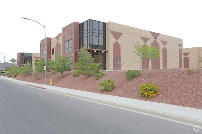
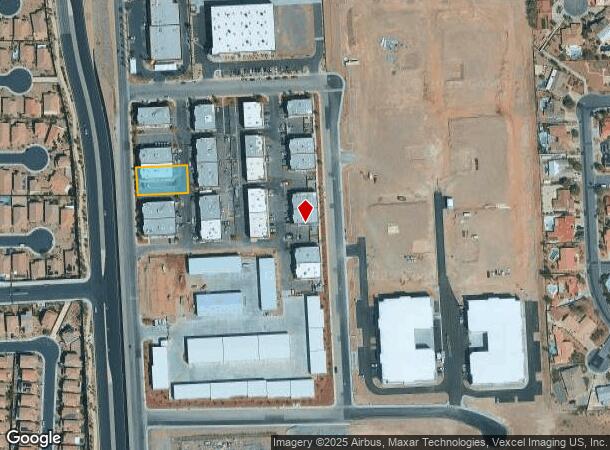
Property Record
1021 Olsen St, Henderson, NV 89011

NEARBY LISTINGS FOR SALE OR LEASE
Property Detail
1021 Olsen St
Las Vegas-Henderson-Paradise, NV
Four Kids Indst Park Amd
160-33-219-027
FOUR KIDS INDUSTRIAL PARK AMD PLAT BOOK 139 PAGE 16 PT LOT 1
Shipyard
Clark
X
Nevada
32003C2605F
1
2024
0.32 AC
2025
SE LV/Henderson
005437
Las Vegas
7,001 SF
DEMOGRAPHICS near 1021 Olsen St
1 Mile
3 Mile
5 Mile
2024 Total Population
7,008
45,023
117,194
2029 Population
7,729
49,688
127,083
Pop Growth 2024-2029
+ 10.29%
+ 10.36%
+ 8.44%
Average Age
44
42
41
2024 Total Households
2,747
17,161
44,866
HH Growth 2024-2029
+ 10.52%
+ 10.62%
+ 8.55%
Median Household Inc
$115,568
$81,413
$70,640
Avg Household Size
2.50
2.60
2.50
2024 Avg HH Vehicles
2.00
2.00
2.00
Median Home Value
$469,129
$423,106
$364,216
Median Year Built
2010
2006
2000
Nearby Places
Map Layers
Map Styles
 Street
 Aerial
- Restaurants
- Banks
- Shops
- Fitness
- Groceries
PUBLIC TRANSPORTATION
AIRPORT
Boulder City Municipal
DRIVE
WALK
Distance
Boulder City Municipal
24 min
14.3 mi
Harry Reid International
DRIVE
WALK
Distance
Harry Reid International
24 min
16.5 mi
Freight Ports
Port of Long Beach
DRIVE
WALK
Distance
Port of Long Beach
322 min
285.1 mi
SALE & LEASE HISTORY
LISTING DATE
SALE/LEASE

Sep 23, 2019
For Sale
Sep 23, 2016
For Sale
Nearby Properties
Address
Land Use
TOTAL SIZE
Lot Size
Zoning
Address
Land Use
TOTAL SIZE
Lot Size
Zoning
31,463 SF
191.46 AC
PS
Address
Land Use
TOTAL SIZE
Lot Size
Zoning
135,690 SF
21.58 AC
CT
Address
Land Use
TOTAL SIZE
Lot Size
Zoning
350.47 AC
PS
Address
Land Use
TOTAL SIZE
Lot Size
Zoning
10.50 AC
Address
Land Use
TOTAL SIZE
Lot Size
Zoning
387,990 SF
22.04 AC
Address
Land Use
TOTAL SIZE
Lot Size
Zoning
1,635 SF
13.84 AC
CT
Address
Land Use
TOTAL SIZE
Lot Size
Zoning
9,493 SF
15.37 AC
Address
Land Use
TOTAL SIZE
Lot Size
Zoning
9,000 SF
96.81 AC
RE
Address
Land Use
TOTAL SIZE
Lot Size
Zoning
40,031 SF
21.25 AC
Address
Land Use
TOTAL SIZE
Lot Size
Zoning
12,621 SF
19.48 AC
Address
Land Use
TOTAL SIZE
Lot Size
Zoning
3,664 SF
16.09 AC
RH20
Address
Land Use
TOTAL SIZE
Lot Size
Zoning
136,465 SF
34.67 AC
Address
Land Use
TOTAL SIZE
Lot Size
Zoning
170,646 SF
18.16 AC
H:IG-RD
Address
Land Use
TOTAL SIZE
Lot Size
Zoning
124,900 SF
5.45 AC
Address
Land Use
TOTAL SIZE
Lot Size
Zoning
83,313 SF
7.79 AC
Address
Land Use
TOTAL SIZE
Lot Size
Zoning
320 AC
DH
Address
Land Use
TOTAL SIZE
Lot Size
Zoning
48,511 SF
13.98 AC
Address
Land Use
TOTAL SIZE
Lot Size
Zoning
123,673 SF
12.23 AC
Address
Land Use
TOTAL SIZE
Lot Size
Zoning
2,540 SF
3.82 AC
CT-G-MP
Address
Land Use
TOTAL SIZE
Lot Size
Zoning
16,240 SF
28.09 AC
Address
Land Use
TOTAL SIZE
Lot Size
Zoning
254,758 SF
10.21 AC
RH36
Address
Land Use
TOTAL SIZE
Lot Size
Zoning
92,070 SF
6.51 AC
Address
Land Use
TOTAL SIZE
Lot Size
Zoning
23.97 AC
Address
Land Use
TOTAL SIZE
Lot Size
Zoning
16,430 SF
1.01 AC
Address
Land Use
TOTAL SIZE
Lot Size
Zoning
2,989 SF
4.98 AC
PS
Address
Land Use
TOTAL SIZE
Lot Size
Zoning
66,420 SF
5.46 AC
Address
Land Use
TOTAL SIZE
Lot Size
Zoning
1,830 SF
3.68 AC
CT-G-MP
Address
Land Use
TOTAL SIZE
Lot Size
Zoning
32,425 SF
5.38 AC
CT
Address
Land Use
TOTAL SIZE
Lot Size
Zoning
24,196 SF
4.84 AC
The World's #1 Commercial Real Estate Marketplace
Connect with us
© 2025 CoStar Group
The information above has been obtained from sources believed reliable. While we do not doubt its accuracy we have not verified it and make no guarantee, warranty or representation about it. It is your responsibility to independently confirm its accuracy and completeness. Any projections, opinions, assumptions, or estimates used are for example only and do not represent the current or future performance of the property. The value of this transaction to you depends on tax and other factors which should be evaluated by your tax, financial, and legal advisors. You and your advisors should conduct a careful, independent investigation of the property to determine to your satisfaction the suitability of the property for your needs.