Property Record
1051 Warrenton Hwy, Thomson, GA 30824
NEARBY LISTINGS FOR SALE OR LEASE
-
-
View all Thomson listings for lease on LoopNet.com
Property Detail
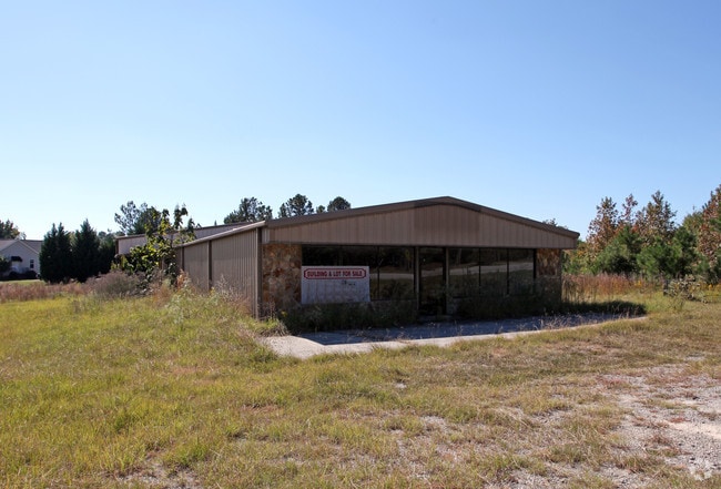
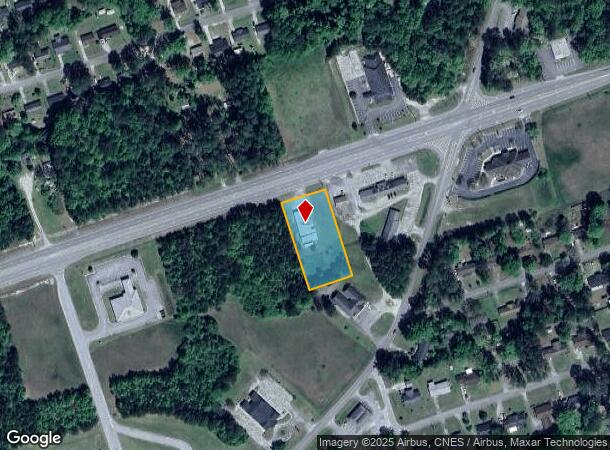
1051 Warrenton Hwy
0T060 00000 007 000
1051 WARRENTON HWY SW
Publicstorage
Mcduffie
X
Georgia
13189C0135B
1.02 AC
2025
McDuffie County
2025
Augusta/Richmond County
950401
Augusta-Richmond County, GA-SC
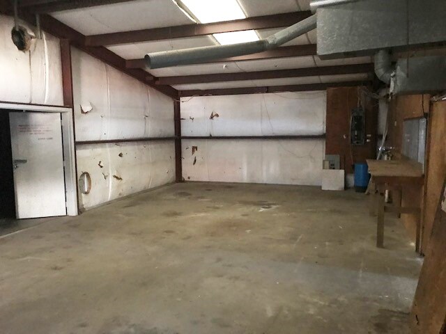
4,080 SF
DEMOGRAPHICS near 1051 Warrenton Hwy
1 Mile
3 Mile
5 Mile
2024 Total Population
2,193
9,944
13,632
2029 Population
2,189
9,909
13,575
Pop Growth 2024-2029
(0.18%)
(0.35%)
(0.42%)
Average Age
42
40
40
2024 Total Households
863
3,950
5,396
HH Growth 2024-2029
(0.58%)
(0.46%)
(0.48%)
Median Household Inc
$51,875
$49,101
$49,179
Avg Household Size
2.40
2.40
2.50
2024 Avg HH Vehicles
2.00
2.00
2.00
Median Home Value
$137,204
$128,623
$133,622
Median Year Built
1976
1979
1981
Nearby Places
Map Layers
Map Styles
 Street
 Aerial
- Restaurants
- Banks
- Shops
- Fitness
- Groceries
PUBLIC TRANSPORTATION
AIRPORT
Augusta Regional at Bush Field
DRIVE
WALK
Distance
Augusta Regional at Bush Field
56 min
39.6 mi
SALE & LEASE HISTORY
LISTING DATE
SALE/LEASE

Sep 24, 2016
For Sale
Mar 27, 2018
For Sale
Jan 13, 2017
For Sale
Jan 11, 2022
For Lease
Dec 15, 2021
For Sale
Nearby Properties
Address
Land Use
TOTAL SIZE
Lot Size
Zoning
Address
Land Use
TOTAL SIZE
Lot Size
Zoning
165,225 SF
32.49 AC
S
Address
Land Use
TOTAL SIZE
Lot Size
Zoning
68,412 SF
10.47 AC
B2
Address
Land Use
TOTAL SIZE
Lot Size
Zoning
19,874 SF
10.54 AC
B2
Address
Land Use
TOTAL SIZE
Lot Size
Zoning
159,233 SF
11.09 AC
B1
Address
Land Use
TOTAL SIZE
Lot Size
Zoning
58,639 SF
41.35 AC
1B
Address
Land Use
TOTAL SIZE
Lot Size
Zoning
92,802 SF
113.71 AC
I2
Address
Land Use
TOTAL SIZE
Lot Size
Zoning
40,168 SF
10 AC
B1
Address
Land Use
TOTAL SIZE
Lot Size
Zoning
94,805 SF
9.05 AC
B1
Address
Land Use
TOTAL SIZE
Lot Size
Zoning
588 SF
13.22 AC
I2
Address
Land Use
TOTAL SIZE
Lot Size
Zoning
63,743 SF
12 AC
1R
Address
Land Use
TOTAL SIZE
Lot Size
Zoning
43,200 SF
4.04 AC
I2
Address
Land Use
TOTAL SIZE
Lot Size
Zoning
143,480 SF
20.91 AC
C2
Address
Land Use
TOTAL SIZE
Lot Size
Zoning
61,540 SF
13.02 AC
I2
Address
Land Use
TOTAL SIZE
Lot Size
Zoning
4,812 SF
5.74 AC
2R
Address
Land Use
TOTAL SIZE
Lot Size
Zoning
35,747 SF
6.69 AC
S
Address
Land Use
TOTAL SIZE
Lot Size
Zoning
25,375 SF
6.33 AC
C2
Address
Land Use
TOTAL SIZE
Lot Size
Zoning
23,839 SF
4.52 AC
B2
Address
Land Use
TOTAL SIZE
Lot Size
Zoning
40,304 SF
5.22 AC
B1
Address
Land Use
TOTAL SIZE
Lot Size
Zoning
40,260 SF
6.02 AC
B1
Address
Land Use
TOTAL SIZE
Lot Size
Zoning
24,382 SF
28.50 AC
I2
Address
Land Use
TOTAL SIZE
Lot Size
Zoning
2,040 SF
5.45 AC
B1
Address
Land Use
TOTAL SIZE
Lot Size
Zoning
75,576 SF
6.91 AC
S
Address
Land Use
TOTAL SIZE
Lot Size
Zoning
40,000 SF
I2
Address
Land Use
TOTAL SIZE
Lot Size
Zoning
53,856 SF
9.38 AC
R3
Address
Land Use
TOTAL SIZE
Lot Size
Zoning
35,938 SF
2.05 AC
B2
Address
Land Use
TOTAL SIZE
Lot Size
Zoning
1,568 SF
6.10 AC
R2
Address
Land Use
TOTAL SIZE
Lot Size
Zoning
148,024 SF
34.12 AC
S
Address
Land Use
TOTAL SIZE
Lot Size
Zoning
38,488 SF
5.36 AC
P
Address
Land Use
TOTAL SIZE
Lot Size
Zoning
36,121 SF
3.79 AC
C2
Address
Land Use
TOTAL SIZE
Lot Size
Zoning
19,000 SF
3.13 AC
S
The World's #1 Commercial Real Estate Marketplace
Connect with us
© 2025 CoStar Group
The information above has been obtained from sources believed reliable. While we do not doubt its accuracy we have not verified it and make no guarantee, warranty or representation about it. It is your responsibility to independently confirm its accuracy and completeness. Any projections, opinions, assumptions, or estimates used are for example only and do not represent the current or future performance of the property. The value of this transaction to you depends on tax and other factors which should be evaluated by your tax, financial, and legal advisors. You and your advisors should conduct a careful, independent investigation of the property to determine to your satisfaction the suitability of the property for your needs.