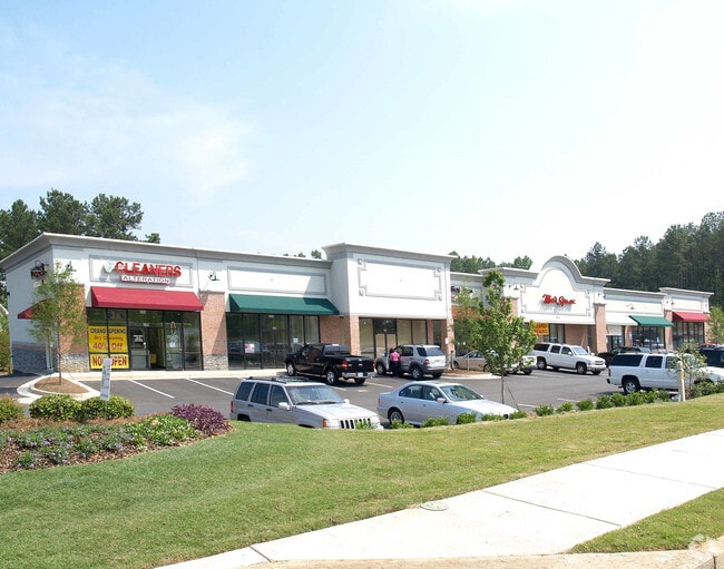
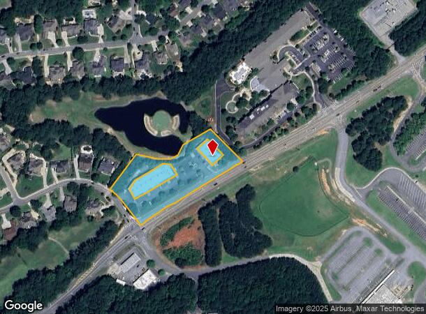
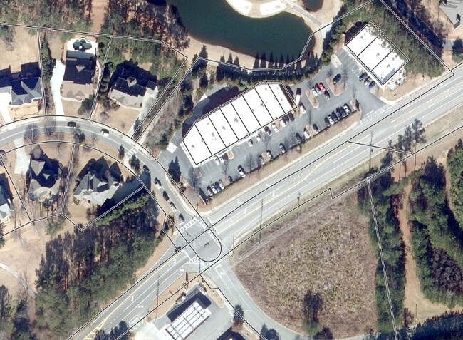
Property Record
10515 Bells Ferry Rd, Canton, GA 30114

NEARBY LISTINGS FOR SALE OR LEASE
Property Detail
10515 Bells Ferry Rd
Atlanta-Sandy Springs-Roswell, GA
Centre/Bridgemill Office Park
015N07-00000-019-00F-0000
LL 136,153; 15THD/TRACT 8 (REFERENCE PARCEL O
Commercialnec
Cherokee
X
Georgia
13057C0233E
136
2025
2.56 AC
2025
Cherokee/Woodstock
090301
Atlanta
DEMOGRAPHICS near 10515 Bells Ferry Rd
1 Mile
3 Mile
5 Mile
2024 Total Population
6,340
38,894
93,234
2029 Population
7,187
44,458
106,482
Pop Growth 2024-2029
+ 13.36%
+ 14.31%
+ 14.21%
Average Age
40
38
39
2024 Total Households
2,243
13,593
32,867
HH Growth 2024-2029
+ 13.46%
+ 14.46%
+ 14.39%
Median Household Inc
$139,517
$113,306
$97,534
Avg Household Size
2.80
2.80
2.80
2024 Avg HH Vehicles
2.00
2.00
2.00
Median Home Value
$410,469
$359,971
$352,463
Median Year Built
2004
2003
2000
Nearby Places
- Restaurants
- Banks
- Shops
- Fitness
- Groceries
SALE & LEASE HISTORY
LISTING DATE
SALE/LEASE

Sep 02, 2025
For Sale
Jan 16, 2024
For Sale
Aug 30, 2021
For Sale
Aug 05, 2017
For Sale
Nearby Properties
Address
Land Use
TOTAL SIZE
Lot Size
Zoning
Address
Land Use
TOTAL SIZE
Lot Size
Zoning
255,483 SF
138.30 AC
LI
Address
Land Use
TOTAL SIZE
Lot Size
Zoning
353,395 SF
29.15 AC
GC
Address
Land Use
TOTAL SIZE
Lot Size
Zoning
79,162 SF
8.54 AC
RM16
Address
Land Use
TOTAL SIZE
Lot Size
Zoning
103,620 SF
19.78 AC
R-5
Address
Land Use
TOTAL SIZE
Lot Size
Zoning
302,757 SF
62.80 AC
PUD
Address
Land Use
TOTAL SIZE
Lot Size
Zoning
177,744 SF
23.73 AC
PUD
Address
Land Use
TOTAL SIZE
Lot Size
Zoning
155,341 SF
14.54 AC
R-5
Address
Land Use
TOTAL SIZE
Lot Size
Zoning
299,408 SF
15 AC
TND
Address
Land Use
TOTAL SIZE
Lot Size
Zoning
43,897 SF
8.45 AC
PUD
Address
Land Use
TOTAL SIZE
Lot Size
Zoning
138,048 SF
21.40 AC
R-40
Address
Land Use
TOTAL SIZE
Lot Size
Zoning
182,067 SF
23.83 AC
GC
Address
Land Use
TOTAL SIZE
Lot Size
Zoning
85,408 SF
37.56 AC
AG
Address
Land Use
TOTAL SIZE
Lot Size
Zoning
94,150 SF
24.74 AC
AG
Address
Land Use
TOTAL SIZE
Lot Size
Zoning
70,397 SF
13.24 AC
R-20
Address
Land Use
TOTAL SIZE
Lot Size
Zoning
44,397 SF
15.84 AC
GC
Address
Land Use
TOTAL SIZE
Lot Size
Zoning
33,071 SF
1.70 AC
TND
Address
Land Use
TOTAL SIZE
Lot Size
Zoning
69,360 SF
5.86 AC
R-80
Address
Land Use
TOTAL SIZE
Lot Size
Zoning
24,984 SF
2.16 AC
GC
Address
Land Use
TOTAL SIZE
Lot Size
Zoning
57,363 SF
19.68 AC
PUD
Address
Land Use
TOTAL SIZE
Lot Size
Zoning
78,503 SF
9.51 AC
PUD
Address
Land Use
TOTAL SIZE
Lot Size
Zoning
158,853 SF
33.73 AC
LI
Address
Land Use
TOTAL SIZE
Lot Size
Zoning
31,232 SF
8.61 AC
LI
Address
Land Use
TOTAL SIZE
Lot Size
Zoning
67,422 SF
8.14 AC
PUD
Address
Land Use
TOTAL SIZE
Lot Size
Zoning
56,484 SF
9.04 AC
GC
Address
Land Use
TOTAL SIZE
Lot Size
Zoning
56,991 SF
5.82 AC
NC
Address
Land Use
TOTAL SIZE
Lot Size
Zoning
41,010 SF
22.25 AC
PUD
Address
Land Use
TOTAL SIZE
Lot Size
Zoning
14,545 SF
1.09 AC
GC
Address
Land Use
TOTAL SIZE
Lot Size
Zoning
30,080 SF
7.31 AC
GC
Address
Land Use
TOTAL SIZE
Lot Size
Zoning
59,690 SF
4.87 AC
GC
Address
Land Use
TOTAL SIZE
Lot Size
Zoning
15,014 SF
210.76 AC
PUD
The World's #1 Commercial Real Estate Marketplace
Connect with us
© 2025 CoStar Group
The information above has been obtained from sources believed reliable. While we do not doubt its accuracy we have not verified it and make no guarantee, warranty or representation about it. It is your responsibility to independently confirm its accuracy and completeness. Any projections, opinions, assumptions, or estimates used are for example only and do not represent the current or future performance of the property. The value of this transaction to you depends on tax and other factors which should be evaluated by your tax, financial, and legal advisors. You and your advisors should conduct a careful, independent investigation of the property to determine to your satisfaction the suitability of the property for your needs.