Property Record
10500 S Vincennes Ave, Chicago, IL 60643


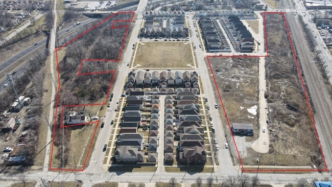
This Property Is For Sale
NEARBY LISTINGS FOR SALE OR LEASE
Property Detail
10500 S Vincennes Ave
Chicago-Naperville-Elgin, IL-IN-WI
Bronsons Resub Of Lts1-4 In Blk12 Of W
25-17-112-023-0000
(BRONSONS) RESUB OF LTS1-4 IN BLK12 OF WASHINGTON HEI GHTS BEING BLKS5-12, THE WH NW SEC17 & EH NE SEC18 WH NW SEC 17-37-14
Commercialbuilding
Cook
X
Illinois
17031C0635J
1-4
2023
0.14 AC
2024
South Chicago
720700
Chicago
2,193 SF
DEMOGRAPHICS near 10500 S Vincennes Ave
1 Mile
3 Mile
5 Mile
2024 Total Population
20,829
197,698
478,411
2029 Population
20,166
191,604
463,579
Pop Growth 2024-2029
(3.18%)
(3.08%)
(3.10%)
Average Age
43
41
41
2024 Total Households
8,033
74,536
182,581
HH Growth 2024-2029
(3.50%)
(3.46%)
(3.48%)
Median Household Inc
$63,072
$60,099
$52,444
Avg Household Size
2.50
2.60
2.50
2024 Avg HH Vehicles
1.00
1.00
1.00
Median Home Value
$191,928
$186,738
$185,512
Median Year Built
1948
1951
1952
Nearby Places
Map Layers
Map Styles
 Street
 Aerial
- Restaurants
- Banks
- Shops
- Fitness
- Groceries
PUBLIC TRANSPORTATION
COMMUTER RAIL
Washington Heights Station (Rock Island District Line - Northeast Illinois Regional Commuter Railroad (Metra))
DRIVE
WALK
Distance
Washington Heights Station (Rock Island District Line - Northeast Illinois Regional Commuter Railroad (Metra))
1 min
9 min
0.4 mi
103Rd Street Station (Rock Island District Line - Northeast Illinois Regional Commuter Railroad (Metra))
DRIVE
WALK
Distance
103Rd Street Station (Rock Island District Line - Northeast Illinois Regional Commuter Railroad (Metra))
2 min
15 min
0.8 mi
AIRPORT
Chicago Midway International
DRIVE
WALK
Distance
Chicago Midway International
19 min
11.1 mi
Chicago O'Hare International
DRIVE
WALK
Distance
Chicago O'Hare International
47 min
31.3 mi
Freight Ports
Port Milwaukee
DRIVE
WALK
Distance
Port Milwaukee
125 min
99.5 mi
Nearby Properties
Address
Land Use
TOTAL SIZE
Lot Size
Zoning
Address
Land Use
TOTAL SIZE
Lot Size
Zoning
8 AC
PD 1168
Address
Land Use
TOTAL SIZE
Lot Size
Zoning
0.51 AC
PD 1168
Address
Land Use
TOTAL SIZE
Lot Size
Zoning
1.08 AC
PD 1168
Address
Land Use
TOTAL SIZE
Lot Size
Zoning
10.73 AC
PD 1243
Address
Land Use
TOTAL SIZE
Lot Size
Zoning
11 AC
PD 1168
Address
Land Use
TOTAL SIZE
Lot Size
Zoning
159,300 SF
13.36 AC
PD 425
Address
Land Use
TOTAL SIZE
Lot Size
Zoning
307,335 SF
24.17 AC
PD 770
Address
Land Use
TOTAL SIZE
Lot Size
Zoning
63,930 SF
3.49 AC
PD 181
Address
Land Use
TOTAL SIZE
Lot Size
Zoning
157,787 SF
12.23 AC
Address
Land Use
TOTAL SIZE
Lot Size
Zoning
162,000 SF
20.94 AC
PD 1167
Address
Land Use
TOTAL SIZE
Lot Size
Zoning
Address
Land Use
TOTAL SIZE
Lot Size
Zoning
223,310 SF
15.67 AC
Address
Land Use
TOTAL SIZE
Lot Size
Zoning
129,837 SF
10.44 AC
PD 770
Address
Land Use
TOTAL SIZE
Lot Size
Zoning
622,934 SF
34.41 AC
M2-3
Address
Land Use
TOTAL SIZE
Lot Size
Zoning
224,089 SF
Address
Land Use
TOTAL SIZE
Lot Size
Zoning
82,000 SF
Address
Land Use
TOTAL SIZE
Lot Size
Zoning
98,506 SF
7.66 AC
Address
Land Use
TOTAL SIZE
Lot Size
Zoning
141,165 SF
7.82 AC
PD 966
Address
Land Use
TOTAL SIZE
Lot Size
Zoning
1 AC
RS-3
Address
Land Use
TOTAL SIZE
Lot Size
Zoning
105,150 SF
4 AC
Address
Land Use
TOTAL SIZE
Lot Size
Zoning
285,672 SF
13.14 AC
Address
Land Use
TOTAL SIZE
Lot Size
Zoning
101,294 SF
8.10 AC
B3-1
Address
Land Use
TOTAL SIZE
Lot Size
Zoning
111,198 SF
10.60 AC
PD 566
Address
Land Use
TOTAL SIZE
Lot Size
Zoning
0.54 AC
RS-3
Address
Land Use
TOTAL SIZE
Lot Size
Zoning
451,400 SF
26.59 AC
M3-3
Address
Land Use
TOTAL SIZE
Lot Size
Zoning
1.71 AC
PD 1168
Address
Land Use
TOTAL SIZE
Lot Size
Zoning
65,186 SF
10.47 AC
PD 566
Address
Land Use
TOTAL SIZE
Lot Size
Zoning
109,213 SF
7.59 AC
Address
Land Use
TOTAL SIZE
Lot Size
Zoning
63,700 SF
0.74 AC
C1-1
Address
Land Use
TOTAL SIZE
Lot Size
Zoning
66,152 SF
5.47 AC
PD 430
The World's #1 Commercial Real Estate Marketplace
Connect with us
© 2025 CoStar Group
The information above has been obtained from sources believed reliable. While we do not doubt its accuracy we have not verified it and make no guarantee, warranty or representation about it. It is your responsibility to independently confirm its accuracy and completeness. Any projections, opinions, assumptions, or estimates used are for example only and do not represent the current or future performance of the property. The value of this transaction to you depends on tax and other factors which should be evaluated by your tax, financial, and legal advisors. You and your advisors should conduct a careful, independent investigation of the property to determine to your satisfaction the suitability of the property for your needs.