Property Record
10515 Browning Rd, Lithia, FL 33547
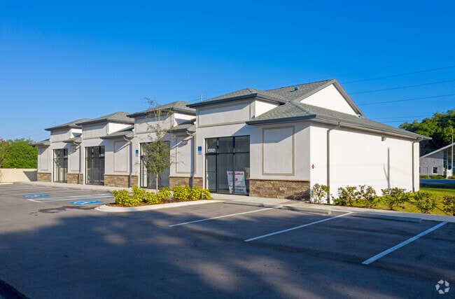


Property Detail
10515 Browning Rd
U-26-30-21-ZZZ-000004-40650.0
A PORTION OF N 645.39 FT OF E 1/2 OF NW 1/4 OF NE 1/4 LESS RD R/W FOR SR 640 AND BROWNING RD DESC AS: COMM AT NW COR OF E 1/2 OF NW 1/4 OF NE 1/4 THN RUN S 00 DEG 33 MIN 59 SEC W 56.37 FT TO A PT OF INTERSECTION WITH SLY R/W LINE OF LITHIA PINECREST
Pasture
HILLSBOROUGH
PD
Florida
B and X Area of moderate flood hazard, usually the area between the limits of the 100-year and 500-year floods.
40650
2024
7.88 AC
2025
Eastern Outlying
013926
Tampa/St Petersburg
4,920 SF
Tampa-St. Petersburg-Clearwater, FL
NEARBY LISTINGS FOR SALE OR LEASE
DEMOGRAPHICS near 10515 Browning Rd
1 mile
3 mile
5 mile
2025 Total Population
2,380
17,578
49,888
2030 Population
2,591
18,870
53,662
Pop Growth 2025-2030
+ 8.87%
+ 7.35%
+ 7.56%
Average Age
38
37
39
2025 Total Households
700
5,276
15,824
HH Growth 2025-2030
+ 9.14%
+ 7.56%
+ 7.72%
Median Household Inc
$152,184
$136,873
$124,147
Avg Household Size
3.20
3.20
3.10
2025 Avg HH Vehicles
2.00
2.00
2.00
Median Home Value
$709,876
$632,806
$532,547
Median Year Built
2007
2007
2003
Nearby Places
Map Layers
Map Styles
 Street
 Aerial
Layers
 Traffic
 Biking
Places
Listings with unknown addresses are not visible on the map
- Restaurants
- Banks
- Shops
- Fitness
- Groceries
PUBLIC TRANSPORTATION
AIRPORT
Tampa International
Drive
Walk
Distance
Tampa International
47 min
29.7 mi
Freight Ports
Port of Tampa Bay
Drive
Walk
Distance
Port of Tampa Bay
35 min
19.7 mi
SALE & LEASE HISTORY
LISTING DATE
SALE/LEASE

Nov 15, 2019
For Lease
Nearby Properties
Address
Land Use
TOTAL SIZE
Lot Size
Zoning
Address
Land Use
TOTAL SIZE
Lot Size
Zoning
421,873 SF
93.26 AC
PD
Address
Land Use
TOTAL SIZE
Lot Size
Zoning
293,939 SF
86.31 AC
AS-1
Address
Land Use
TOTAL SIZE
Lot Size
Zoning
25,210 SF
66.38 AC
AR
Address
Land Use
TOTAL SIZE
Lot Size
Zoning
233.81 AC
AR
Address
Land Use
TOTAL SIZE
Lot Size
Zoning
99,450 SF
13.65 AC
PD
Address
Land Use
TOTAL SIZE
Lot Size
Zoning
1,440 SF
636.64 AC
AR
Address
Land Use
TOTAL SIZE
Lot Size
Zoning
99,384 SF
14.72 AC
PD
Address
Land Use
TOTAL SIZE
Lot Size
Zoning
67,300 SF
10.03 AC
PD
Address
Land Use
TOTAL SIZE
Lot Size
Zoning
607.04 AC
AM
Address
Land Use
TOTAL SIZE
Lot Size
Zoning
322.61 AC
AR
Address
Land Use
TOTAL SIZE
Lot Size
Zoning
60,362 SF
6.47 AC
PD
Address
Land Use
TOTAL SIZE
Lot Size
Zoning
297.24 AC
PD
Address
Land Use
TOTAL SIZE
Lot Size
Zoning
486.13 AC
AR
Address
Land Use
TOTAL SIZE
Lot Size
Zoning
103,714 SF
36.66 AC
AR
Address
Land Use
TOTAL SIZE
Lot Size
Zoning
947 SF
399.15 AC
AR
Address
Land Use
TOTAL SIZE
Lot Size
Zoning
48,315 SF
3.11 AC
PD
Address
Land Use
TOTAL SIZE
Lot Size
Zoning
3,002 SF
230.50 AC
AR
Address
Land Use
TOTAL SIZE
Lot Size
Zoning
25,854 SF
170.94 AC
PD
Address
Land Use
TOTAL SIZE
Lot Size
Zoning
1,826 SF
970.07 AC
AR
Address
Land Use
TOTAL SIZE
Lot Size
Zoning
285.69 AC
AR
Address
Land Use
TOTAL SIZE
Lot Size
Zoning
5,810 SF
128.83 AC
AR
Address
Land Use
TOTAL SIZE
Lot Size
Zoning
104.06 AC
PD
Address
Land Use
TOTAL SIZE
Lot Size
Zoning
952 SF
240.77 AC
AS-1
Address
Land Use
TOTAL SIZE
Lot Size
Zoning
23,352 SF
2.60 AC
CN
Address
Land Use
TOTAL SIZE
Lot Size
Zoning
160.94 AC
AR
Address
Land Use
TOTAL SIZE
Lot Size
Zoning
35,136 SF
0.78 AC
PD
Address
Land Use
TOTAL SIZE
Lot Size
Zoning
199.20 AC
PD
Address
Land Use
TOTAL SIZE
Lot Size
Zoning
5,184 SF
68.07 AC
PD
Address
Land Use
TOTAL SIZE
Lot Size
Zoning
13,800 SF
3.55 AC
PD
Address
Land Use
TOTAL SIZE
Lot Size
Zoning
20,668 SF
18.34 AC
AR
The World's #1 Commercial Real Estate Marketplace
Connect with us
© 2026 CoStar Group
The information above has been obtained from sources believed reliable. While we do not doubt its accuracy we have not verified it and make no guarantee, warranty or representation about it. It is your responsibility to independently confirm its accuracy and completeness. Any projections, opinions, assumptions, or estimates used are for example only and do not represent the current or future performance of the property. The value of this transaction to you depends on tax and other factors which should be evaluated by your tax, financial, and legal advisors. You and your advisors should conduct a careful, independent investigation of the property to determine to your satisfaction the suitability of the property for your needs.