Property Record
10518 Albemarle Rd, Mint Hill, NC 28227


NEARBY LISTINGS FOR SALE OR LEASE
Property Detail
10518 Albemarle Rd
Charlotte-Concord-Gastonia, NC-SC
Carriker Fish & Steak Hse Inc
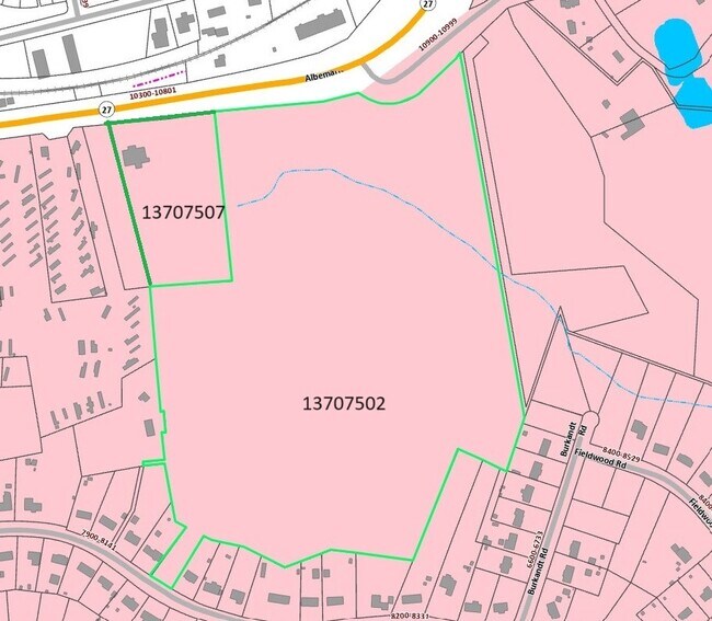
137-075-07
N/A
Commercialnec
Mecklenburg
X
North Carolina
3710550300K
7
2024
5.88 AC
2025
East Charlotte
005719
Charlotte
5,648 SF
DEMOGRAPHICS near 10518 Albemarle Rd
1 Mile
3 Mile
5 Mile
2024 Total Population
6,250
51,340
135,919
2029 Population
6,724
54,508
144,007
Pop Growth 2024-2029
+ 7.58%
+ 6.17%
+ 5.95%
Average Age
38
38
38
2024 Total Households
2,049
17,921
48,880
HH Growth 2024-2029
+ 7.42%
+ 6.11%
+ 5.91%
Median Household Inc
$63,972
$67,991
$65,018
Avg Household Size
2.90
2.80
2.70
2024 Avg HH Vehicles
2.00
2.00
2.00
Median Home Value
$254,060
$271,247
$271,390
Median Year Built
1989
1993
1989
Nearby Places
Map Layers
Map Styles
 Street
 Aerial
- Restaurants
- Banks
- Shops
- Fitness
- Groceries
PUBLIC TRANSPORTATION
AIRPORT
Concord-Padgett Regional
DRIVE
WALK
Distance
Concord-Padgett Regional
22 min
16.3 mi
Charlotte/Douglas International
DRIVE
WALK
Distance
Charlotte/Douglas International
34 min
19.3 mi
SALE & LEASE HISTORY
LISTING DATE
SALE/LEASE

Apr 18, 2024
For Sale
Nearby Properties
Address
Land Use
TOTAL SIZE
Lot Size
Zoning
Address
Land Use
TOTAL SIZE
Lot Size
Zoning
261,708 SF
34.03 AC
Address
Land Use
TOTAL SIZE
Lot Size
Zoning
539,702 SF
83.70 AC
I
Address
Land Use
TOTAL SIZE
Lot Size
Zoning
315,436 SF
23.89 AC
R3
Address
Land Use
TOTAL SIZE
Lot Size
Zoning
290,268 SF
19.96 AC
R17MFCD
Address
Land Use
TOTAL SIZE
Lot Size
Zoning
187,371 SF
7.31 AC
Address
Land Use
TOTAL SIZE
Lot Size
Zoning
333,774 SF
64.04 AC
I
Address
Land Use
TOTAL SIZE
Lot Size
Zoning
148,190 SF
14.50 AC
R17MF
Address
Land Use
TOTAL SIZE
Lot Size
Zoning
96,071 SF
7.44 AC
Address
Land Use
TOTAL SIZE
Lot Size
Zoning
239,983 SF
21.41 AC
I-G(CD)
Address
Land Use
TOTAL SIZE
Lot Size
Zoning
78,372 SF
14.08 AC
IGCUD
Address
Land Use
TOTAL SIZE
Lot Size
Zoning
126,174 SF
12.13 AC
R9MFCD
Address
Land Use
TOTAL SIZE
Lot Size
Zoning
58,134 SF
5.08 AC
IGCUD
Address
Land Use
TOTAL SIZE
Lot Size
Zoning
104,386 SF
13 AC
R4
Address
Land Use
TOTAL SIZE
Lot Size
Zoning
86,432 SF
20.01 AC
I
Address
Land Use
TOTAL SIZE
Lot Size
Zoning
40,890 SF
2.92 AC
O-A DO-B(C
Address
Land Use
TOTAL SIZE
Lot Size
Zoning
80,888 SF
8.20 AC
Address
Land Use
TOTAL SIZE
Lot Size
Zoning
67,080 SF
7.99 AC
Address
Land Use
TOTAL SIZE
Lot Size
Zoning
146,650 SF
15.45 AC
CC
Address
Land Use
TOTAL SIZE
Lot Size
Zoning
124,191 SF
13.86 AC
CC
Address
Land Use
TOTAL SIZE
Lot Size
Zoning
104,214 SF
1.69 AC
MUDD-O
Address
Land Use
TOTAL SIZE
Lot Size
Zoning
120,944 SF
16.40 AC
R-15(CD)
Address
Land Use
TOTAL SIZE
Lot Size
Zoning
62,619 SF
11.93 AC
I-G(CD)
Address
Land Use
TOTAL SIZE
Lot Size
Zoning
108,786 SF
9.95 AC
I1
Address
Land Use
TOTAL SIZE
Lot Size
Zoning
49,878 SF
6.11 AC
Address
Land Use
TOTAL SIZE
Lot Size
Zoning
77,876 SF
26.47 AC
R
Address
Land Use
TOTAL SIZE
Lot Size
Zoning
108,250 SF
10.07 AC
CC
Address
Land Use
TOTAL SIZE
Lot Size
Zoning
45,974 SF
9.85 AC
O-A DO-B(C
Address
Land Use
TOTAL SIZE
Lot Size
Zoning
73,255 SF
13.35 AC
R
Address
Land Use
TOTAL SIZE
Lot Size
Zoning
55,576 SF
10.80 AC
CC
Address
Land Use
TOTAL SIZE
Lot Size
Zoning
60,402 SF
10.46 AC
BP
The World's #1 Commercial Real Estate Marketplace
Connect with us
© 2025 CoStar Group
The information above has been obtained from sources believed reliable. While we do not doubt its accuracy we have not verified it and make no guarantee, warranty or representation about it. It is your responsibility to independently confirm its accuracy and completeness. Any projections, opinions, assumptions, or estimates used are for example only and do not represent the current or future performance of the property. The value of this transaction to you depends on tax and other factors which should be evaluated by your tax, financial, and legal advisors. You and your advisors should conduct a careful, independent investigation of the property to determine to your satisfaction the suitability of the property for your needs.