Property Record
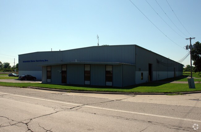
1052 Matzinger Rd, Toledo, OH 43612


Property Detail
1052 Matzinger Rd
23-22501
DUNBARS NORTHEAST INDUSTRI AL PK PL 1 LOT 1 & 2 & THTPT LOT 2 8-9-18 LYIN
Storemultistory
LUCAS
10-IG
Ohio
B and X Area of moderate flood hazard, usually the area between the limits of the 100-year and 500-year floods.
1,2
0
3 AC
2025
North Toledo
005602
Toledo
40,200 SF
Toledo, OH
NEARBY LISTINGS FOR SALE OR LEASE
DEMOGRAPHICS near 1052 Matzinger Rd
1 mile
3 mile
5 mile
2025 Total Population
554
61,799
163,916
2030 Population
566
62,029
164,515
Pop Growth 2025-2030
+ 2.17%
+ 0.37%
+ 0.37%
Average Age
40
39
39
2025 Total Households
236
25,418
69,368
HH Growth 2025-2030
+ 2.12%
+ 0.26%
+ 0.31%
Median Household Inc
$54,827
$44,981
$47,211
Avg Household Size
2.30
2.30
2.20
2025 Avg HH Vehicles
2.00
2.00
2.00
Median Home Value
$129,166
$90,010
$107,806
Median Year Built
1967
1951
1952
Nearby Places
Map Layers
Map Styles
 Street
 Aerial
Layers
 Traffic
 Biking
Places
Listings with unknown addresses are not visible on the map
- Restaurants
- Banks
- Shops
- Fitness
- Groceries
PUBLIC TRANSPORTATION
COMMUTER RAIL
Toledo (Capitol Limited - Amtrak, Lake Shore Limited - Amtrak)
Drive
Walk
Distance
Toledo (Capitol Limited - Amtrak, Lake Shore Limited - Amtrak)
12 min
5.8 mi
AIRPORT
Eugene F Kranz Toledo Express
Drive
Walk
Distance
Eugene F Kranz Toledo Express
41 min
25.3 mi
Freight Ports
Port of Toledo
Drive
Walk
Distance
Port of Toledo
17 min
8.1 mi
Nearby Properties
Address
Land Use
TOTAL SIZE
Lot Size
Zoning
Address
Land Use
TOTAL SIZE
Lot Size
Zoning
1,046,727 SF
0.41 AC
10-IC
Address
Land Use
TOTAL SIZE
Lot Size
Zoning
569,999 SF
45.25 AC
10-MX
Address
Land Use
TOTAL SIZE
Lot Size
Zoning
286,525 SF
105.33 AC
10-RS6
Address
Land Use
TOTAL SIZE
Lot Size
Zoning
169.42 AC
10-IG
Address
Land Use
TOTAL SIZE
Lot Size
Zoning
171,946 SF
0.17 AC
10-IC
Address
Land Use
TOTAL SIZE
Lot Size
Zoning
Address
Land Use
TOTAL SIZE
Lot Size
Zoning
169.42 AC
10-IG
Address
Land Use
TOTAL SIZE
Lot Size
Zoning
375,323 SF
10-IC
Address
Land Use
TOTAL SIZE
Lot Size
Zoning
172,044 SF
12.78 AC
10-MX
Address
Land Use
TOTAL SIZE
Lot Size
Zoning
28.51 AC
10-IG
Address
Land Use
TOTAL SIZE
Lot Size
Zoning
230,400 SF
18 AC
10-CR
Address
Land Use
TOTAL SIZE
Lot Size
Zoning
34.13 AC
10-IG
Address
Land Use
TOTAL SIZE
Lot Size
Zoning
90,113 SF
8.12 AC
21-PO
Address
Land Use
TOTAL SIZE
Lot Size
Zoning
20.67 AC
10-MX
Address
Land Use
TOTAL SIZE
Lot Size
Zoning
84,527 SF
7.79 AC
10-RS6
Address
Land Use
TOTAL SIZE
Lot Size
Zoning
175,978 SF
10.02 AC
10-IL
Address
Land Use
TOTAL SIZE
Lot Size
Zoning
282,124 SF
9.71 AC
10-IC
Address
Land Use
TOTAL SIZE
Lot Size
Zoning
71,918 SF
7 AC
10-RS6
Address
Land Use
TOTAL SIZE
Lot Size
Zoning
328,898 SF
13.67 AC
10-IG
Address
Land Use
TOTAL SIZE
Lot Size
Zoning
90,507 SF
9 AC
10-CRSO
Address
Land Use
TOTAL SIZE
Lot Size
Zoning
106.75 AC
AC = AG
Address
Land Use
TOTAL SIZE
Lot Size
Zoning
22.97 AC
10-IG
Address
Land Use
TOTAL SIZE
Lot Size
Zoning
92,888 SF
20.24 AC
10-IL
Address
Land Use
TOTAL SIZE
Lot Size
Zoning
159,798 SF
8.32 AC
10-IL
Address
Land Use
TOTAL SIZE
Lot Size
Zoning
123,258 SF
23.59 AC
Address
Land Use
TOTAL SIZE
Lot Size
Zoning
50,895 SF
3 AC
10-RD6
Address
Land Use
TOTAL SIZE
Lot Size
Zoning
86.45 AC
10-IG
Address
Land Use
TOTAL SIZE
Lot Size
Zoning
52,343 SF
2 AC
10-RD6
Address
Land Use
TOTAL SIZE
Lot Size
Zoning
132,601 SF
14.41 AC
10-MX
Address
Land Use
TOTAL SIZE
Lot Size
Zoning
191,297 SF
28.74 AC
10-CRSO
The World's #1 Commercial Real Estate Marketplace
Connect with us
© 2026 CoStar Group
The information above has been obtained from sources believed reliable. While we do not doubt its accuracy we have not verified it and make no guarantee, warranty or representation about it. It is your responsibility to independently confirm its accuracy and completeness. Any projections, opinions, assumptions, or estimates used are for example only and do not represent the current or future performance of the property. The value of this transaction to you depends on tax and other factors which should be evaluated by your tax, financial, and legal advisors. You and your advisors should conduct a careful, independent investigation of the property to determine to your satisfaction the suitability of the property for your needs.