Property Record
1053 Broad St, Bloomfield, NJ 07003


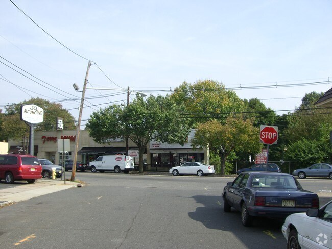
Property Detail
1053 Broad St
Newark, NJ
169 X 111
02-00961-0000-00020
Essex
Storemultistory
New Jersey
B-2
20
B and X Area of moderate flood hazard, usually the area between the limits of the 100-year and 500-year floods.
0.43 AC
2024
Bloomfield/GSP
2025
Northern New Jersey
015000
NEARBY LISTINGS FOR SALE OR LEASE
DEMOGRAPHICS near 1053 Broad St
1 mile
3 mile
5 mile
2025 Total Population
22,258
210,535
691,384
2030 Population
23,214
219,146
712,511
Pop Growth 2025-2030
+ 4.30%
+ 4.09%
+ 3.06%
Average Age
41
41
40
2025 Total Households
7,750
80,357
252,237
HH Growth 2025-2030
+ 4.26%
+ 4.24%
+ 3.24%
Median Household Inc
$179,305
$121,148
$90,789
Avg Household Size
2.80
2.50
2.60
2025 Avg HH Vehicles
2.00
2.00
2.00
Median Home Value
$628,670
$530,153
$491,428
Median Year Built
1948
1952
1953
Nearby Places
Map Layers
Map Styles
 Street
 Aerial
Layers
 Traffic
 Biking
Places
Listings with unknown addresses are not visible on the map
- Restaurants
- Banks
- Shops
- Fitness
- Groceries
PUBLIC TRANSPORTATION
COMMUTER RAIL
Watchung Avenue (Montclair-Boonton Line - NJ Transit Commuter Rail (NJ Transit))
Drive
Walk
Distance
Watchung Avenue (Montclair-Boonton Line - NJ Transit Commuter Rail (NJ Transit))
2 min
1.2 mi
Walnut Street (Montclair-Boonton Line - NJ Transit Commuter Rail (NJ Transit))
Drive
Walk
Distance
Walnut Street (Montclair-Boonton Line - NJ Transit Commuter Rail (NJ Transit))
5 min
2.0 mi
AIRPORT
Newark Liberty International
Drive
Walk
Distance
Newark Liberty International
20 min
16.4 mi
LaGuardia
Drive
Walk
Distance
LaGuardia
40 min
23.0 mi
John F Kennedy International
Drive
Walk
Distance
John F Kennedy International
48 min
31.0 mi
Freight Ports
Port Newark Container Terminal
Drive
Walk
Distance
Port Newark Container Terminal
24 min
12.8 mi
SALE & LEASE HISTORY
LISTING DATE
SALE/LEASE

Sep 24, 2016
For Sale
Mar 21, 2017
For Lease
Nearby Properties
Address
Land Use
TOTAL SIZE
Lot Size
Zoning
Address
Land Use
TOTAL SIZE
Lot Size
Zoning
5 AC
H
Address
Land Use
TOTAL SIZE
Lot Size
Zoning
28.33 AC
Address
Land Use
TOTAL SIZE
Lot Size
Zoning
1,589 SF
0.22 AC
R4
Address
Land Use
TOTAL SIZE
Lot Size
Zoning
12.54 AC
OPRP
Address
Land Use
TOTAL SIZE
Lot Size
Zoning
0.24 AC
R4
Address
Land Use
TOTAL SIZE
Lot Size
Zoning
1.12 AC
M-O
Address
Land Use
TOTAL SIZE
Lot Size
Zoning
Address
Land Use
TOTAL SIZE
Lot Size
Zoning
3.26 AC
PR
Address
Land Use
TOTAL SIZE
Lot Size
Zoning
0.17 AC
BCR1
Address
Land Use
TOTAL SIZE
Lot Size
Zoning
1.67 AC
BCR1
Address
Land Use
TOTAL SIZE
Lot Size
Zoning
3.20 AC
BSRD
Address
Land Use
TOTAL SIZE
Lot Size
Zoning
224 SF
0.94 AC
BCR1
Address
Land Use
TOTAL SIZE
Lot Size
Zoning
1.50 AC
RA
Address
Land Use
TOTAL SIZE
Lot Size
Zoning
1.95 AC
RA
Address
Land Use
TOTAL SIZE
Lot Size
Zoning
3.55 AC
Address
Land Use
TOTAL SIZE
Lot Size
Zoning
9.98 AC
R-1
Address
Land Use
TOTAL SIZE
Lot Size
Zoning
3.20 AC
Address
Land Use
TOTAL SIZE
Lot Size
Zoning
7.22 AC
M-3
Address
Land Use
TOTAL SIZE
Lot Size
Zoning
9.38 AC
B-A
Address
Land Use
TOTAL SIZE
Lot Size
Zoning
25.80 AC
P
Address
Land Use
TOTAL SIZE
Lot Size
Zoning
4.09 AC
M-O
Address
Land Use
TOTAL SIZE
Lot Size
Zoning
17.90 AC
R-G
Address
Land Use
TOTAL SIZE
Lot Size
Zoning
12.52 AC
Address
Land Use
TOTAL SIZE
Lot Size
Zoning
17.50 AC
Address
Land Use
TOTAL SIZE
Lot Size
Zoning
73,436 SF
189.03 AC
R-2
Address
Land Use
TOTAL SIZE
Lot Size
Zoning
486 SF
22.07 AC
Address
Land Use
TOTAL SIZE
Lot Size
Zoning
129,312 SF
11.80 AC
M-0
Address
Land Use
TOTAL SIZE
Lot Size
Zoning
Address
Land Use
TOTAL SIZE
Lot Size
Zoning
5.20 AC
R-H
Address
Land Use
TOTAL SIZE
Lot Size
Zoning
5.25 AC
M-1
The World's #1 Commercial Real Estate Marketplace
Connect with us
© 2026 CoStar Group
The information above has been obtained from sources believed reliable. While we do not doubt its accuracy we have not verified it and make no guarantee, warranty or representation about it. It is your responsibility to independently confirm its accuracy and completeness. Any projections, opinions, assumptions, or estimates used are for example only and do not represent the current or future performance of the property. The value of this transaction to you depends on tax and other factors which should be evaluated by your tax, financial, and legal advisors. You and your advisors should conduct a careful, independent investigation of the property to determine to your satisfaction the suitability of the property for your needs.